
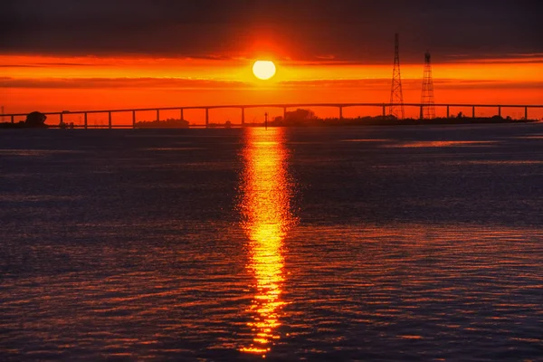
The San Francisco Bay Area stands as one of the world’s most spectacular showcases for bridge engineering. From the world-famous Golden Gate to lesser-known gems tucked away in quieter corners of the region, these magnificent structures tell the story of human ambition meeting natural challenges. Each bridge serves as both a functional necessity and an architectural masterpiece, connecting communities while defining the Bay Area’s distinctive skyline.
Whether you’re crossing them daily for work or visiting as a tourist, these bridges offer something far beyond simple transportation. They’re viewing platforms for stunning vistas, monuments to engineering prowess, and symbols of the region’s innovative spirit.
Here is a list of 12 iconic Bay Area bridges that showcase the engineering marvels spanning these historic waters.
Golden Gate Bridge

The Golden Gate Bridge stands as perhaps the most photographed bridge in the country, stretching 1.7 miles across the Golden Gate Strait. Its distinctive International Orange color was specifically chosen to provide maximum visibility in San Francisco’s notorious foggy conditions while complementing the natural beauty of the surrounding landscape.
Completed in 1937 at a cost of $33 million and at the cost of 10 workers’ lives, this engineering marvel features twin towers reaching 750 feet skyward, which were once taller than any building in San Francisco. An estimated 2.35 billion vehicles have crossed the bridge since its opening, with about 110,000 vehicles making the journey daily.
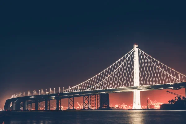
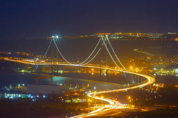
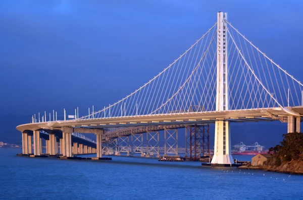
San Francisco-Oakland Bay Bridge

The San Francisco-Oakland Bay Bridge serves as the most heavily-traveled bridge in the Bay Area, accounting for nearly 40% of all daily bridge trips in the region. This workhorse carries more than 270,000 vehicles daily, making it the third-busiest bridge in the entire country.
Despite being an incredible engineering achievement and the terminus of transcontinental Interstate 80, it has long lived in the shadow of its famous sister across the bay. The bridge includes a fascinating piece of history – regularly spaced refuge bays called ‘deadman alcoves’ along the tunnel that remain visible to eastbound motorists today.
Like Travel Pug’s content? Follow us on MSN.
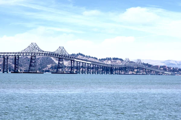
Richmond-San Rafael Bridge
The Richmond-San Rafael Bridge spans 5.5 miles, making it one of California’s longest bridges, though it’s often overlooked for its less glamorous aesthetics compared to other Bay Area spans. This cantilever-truss structure stretches across the northern end of the bay and has earned the dubious distinction of being struck by passing ships on several occasions, including a World War II vessel and a Navy radar ship.
Despite its utilitarian appearance, the bridge efficiently serves 78,750 vehicles daily while offering scenic views of San Francisco Bay. Local residents once dubbed it the ‘roller coaster bridge’ upon its completion, though it gracefully connects travelers to Marin County’s hills and the wine-growing regions of Sonoma and Napa Valley.
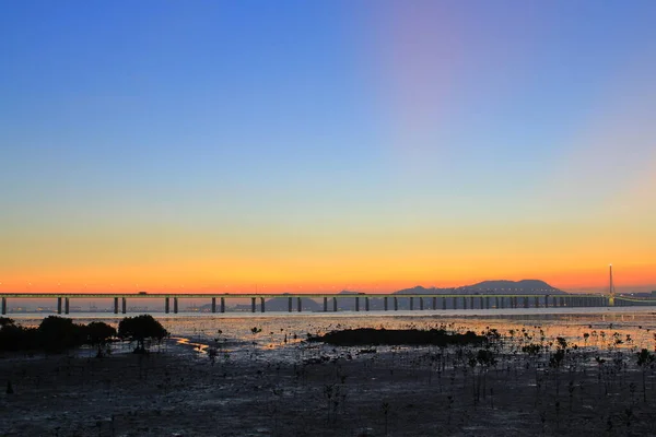
San Mateo-Hayward Bridge
Spanning 7 miles, the San Mateo-Hayward Bridge holds the title as the longest bridge in California and ranks as the fourth-longest bridge in the entire United States. What this bridge lacks in dramatic design, it more than makes up for in sheer scale, stretching like a silver ribbon across the southern portion of the bay.
The bridge features a long, graceful design without the dramatic towers found on suspension bridges, instead relying on a continuous span that seems to float effortlessly above the water. This impressive structure provides travelers with exceptional combinations of grace and strength while offering stunning views of the surrounding bay waters.
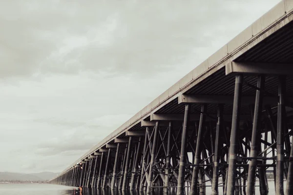
Dumbarton Bridge
The original Dumbarton Bridge, which opened in 1927, holds the historic distinction of being the first vehicular crossing over San Francisco Bay proper. The current structure replaced the original in 1984 with an earthquake-retrofitted design that efficiently moves traffic while maintaining aesthetic appeal.
Like the San Mateo-Hayward Bridge, it features a long, ribbon-like design without dramatic towers, instead showcasing the elegance of functional engineering. The bridge now provides three lanes in each direction along with a bicycle and pedestrian path, serving as a crucial link between the Peninsula and the East Bay.
Like Travel Pug’s content? Follow us on MSN.
Carquinez Bridge
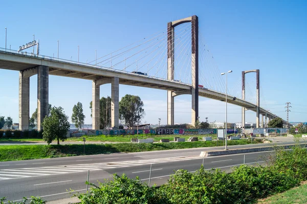
The name Carquinez Bridge actually refers to a pair of parallel bridges spanning the Carquinez Strait, with the original cantilever bridge built in 1927 as part of the direct route between San Francisco and Sacramento. A second parallel cantilever bridge was completed in 1958 to handle increased traffic, but seismic concerns about the 1927 span led to its replacement with a stunning suspension bridge in 2003.
This newer span, officially named the Alfred Zampa Memorial Bridge, honors ironworker Al Zampa who helped construct numerous Bay Area bridges, including the Golden Gate Bridge and the original Carquinez span. The bridge represents both historical significance and modern engineering excellence in one remarkable location.
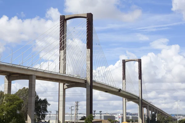
Alfred Zampa Memorial Bridge
The Alfred Zampa Memorial Bridge across the Carquinez Strait stands as the first new suspension bridge built in the United States since 1973, opening in October 2003. The bridge features a north tower standing 420 feet high and a south tower at 404 feet, with a main span of 2,388 feet between the towers.
This bridge holds the unique distinction of being the only bridge in the United States named for a blue-collar worker, representing all the men and women in building and construction trades who create these monumental structures. The bridge includes a pedestrian and bicycle path as part of a larger vision to eventually create a bike trail circling the entire Bay Area.
Benicia-Martinez Bridge
The Benicia-Martinez Bridge actually consists of three parallel structures crossing the Carquinez Strait west of Suisun Bay, linking Benicia on the north side with Martinez on the south. Built to replace ferries that once carried passengers across the Carquinez Strait, this bustling span became the first bridge in Northern California to feature an open road tolling system.
The newer 2007 span, officially called the Congressman George Miller Benicia-Martinez Bridge, carries northbound Interstate 680 traffic alongside the 1962 southbound span. Between these automotive bridges sits a remarkable 1930 vertical-lift railroad drawbridge that serves both freight and Amtrak passenger trains.
Like Travel Pug’s content? Follow us on MSN.
Benicia-Martinez Railroad Bridge
The Union Pacific Railroad Bridge, also known as the Benicia-Martinez Rail Drawbridge, began construction in 1928 and was completed in 1930 as a massive cantilever project. This railway bridge holds multiple records: it remains the only train bridge with tracks crossing the bay in California, stands as the second-longest railway bridge on the continent, and claims the title of longest railway bridge west of the Mississippi River.
Today, long freight trains and Amtrak trains including the Capitol Corridor and long-distance California Zephyr and Coast Starlight regularly cross this historic span. Passengers riding Amtrak get spectacular views of the Carquinez Strait during their crossing, making the train journey worthwhile for this experience alone.
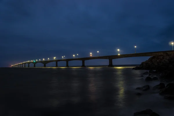
Antioch Bridge
The Antioch Bridge officially bears the name Senator John A. Nejedly Bridge, honoring the state senator who authored legislation authorizing its construction. Unlike other toll bridges in California, this 1.8-mile span features only a single lane of traffic in each direction, making it unique among major Bay Area crossings.
The bridge spans the San Joaquin River, connecting northeastern Contra Costa County to Sacramento County, and holds the distinction of being the only bridge to reach outside the nine-county Bay Area. This quiet span sees only about 10,000 vehicles daily, compared to 270,000 on the Bay Bridge, making it so peaceful that during foggy nights, a half-hour can pass between vehicles.
Original Antioch Bridge
The original Antioch Bridge, built in 1926, measured 4,640 feet long and held the distinction of being the largest highway bridge ever constructed in California at that time. This pioneering structure contained 2,000 tons of structural steel and 500 tons of reinforcing steel, featuring two navigation openings that were 320 feet wide with a maximum vertical clearance of 70 feet above high tide.
The bridge featured a lift span section that could be raised for ships, but was plagued with problems throughout its lifetime, including speed restrictions of just 15 miles per hour and multiple ship collisions. It opened on January 1, 1926, as a connecting link on the coast-to-coast Victory Highway, representing an important milestone in California’s transportation network.
Like Travel Pug’s content? Follow us on MSN.
Bay Area Bridge Trail Connections
The Bay Area’s bridge network extends beyond vehicular transportation to encompass an impressive pedestrian and cycling infrastructure. These bridge crossings offer not-to-be-missed experiences as part of trail systems like the Carquinez Strait Scenic Loop Trail, providing paved routes perfect for cycling adventures. Multiple bridges now feature bicycle and pedestrian access, including the Antioch Bridge, creating opportunities for active transportation across the bay waters.
Cyclists and walkers should prepare for high winds, especially when crossing the taller spans, but the spectacular views and unique perspective make these journeys unforgettable. The Vista Point near the Benicia-Martinez Bridge complex offers an excellent spot for picnicking and sightseeing, providing scenic views of multiple bridges, the Carquinez Strait, and distant Mount Diablo.
How these steel giants connect past and present

These five major bridges represented impossible-to-build dreams when they were first conceived, yet today they allow travelers to visit San Francisco, the peninsula, and the East Bay easily, quickly, and safely. What started with ferries crossing the Carquinez Strait in the mid-1800s has evolved into a sophisticated network of engineering marvels that define the Bay Area’s landscape.
These bridges changed the economic engine of California as the West Coast population exploded in the early 20th century, making it hard to downplay their value when considering how much time they save compared to driving around San Francisco Bay.
While many of these aging structures now require repairs and seismic retrofitting, they continue serving as both functional transportation links and beloved symbols of human achievement. The Bay Area’s bridges have modernized with electronic toll collection systems, representing how these historic structures adapt to serve future generations while honoring their remarkable past.
More from Travel Pug

- 20 Best Beach Towns in the Carolinas
- 13 Destinations Where Tourists Regularly Regret Their Trip
- 20 Things You Actually Get in First Class
- 20 Small Airports With Aviation Museums
- 20 Places in the U.S. That Are Perfect for a Reset Trip
Like Travel Pug’s content? Follow us on MSN.