
Throughout human history, civilization has flourished alongside waterways that provide transportation, sustenance, and protection. Some cities take this relationship further, integrating rivers into their very fabric to create unique urban landscapes where water and land intertwine.
These distinctive places blur the boundary between street and stream, transforming what could be barriers into central features of urban identity and daily life. Here is a list of 15 remarkable cities worldwide where rivers don’t just pass through but fundamentally define the street pattern, transportation systems, and cultural character of the urban environment.
Venice
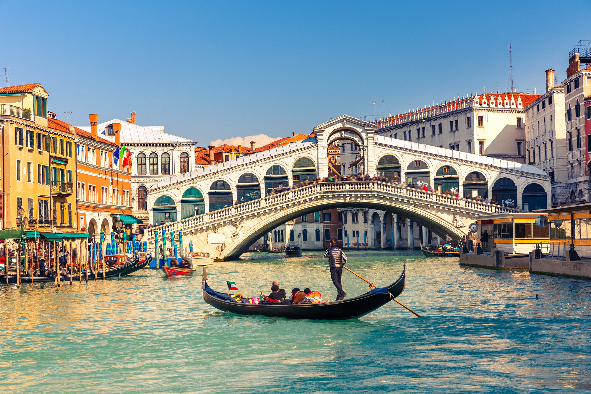
This Italian masterpiece consists of 118 islands laced together by 150 canals and over 400 bridges, creating a floating metropolis unlike any other. The Grand Canal serves as the city’s main thoroughfare, lined with palaces showcasing 500 years of architectural evolution.
Venetian addresses reflect this aquatic reality, with many buildings accessible only by water and having their “front doors” opening directly onto canals.
Amsterdam
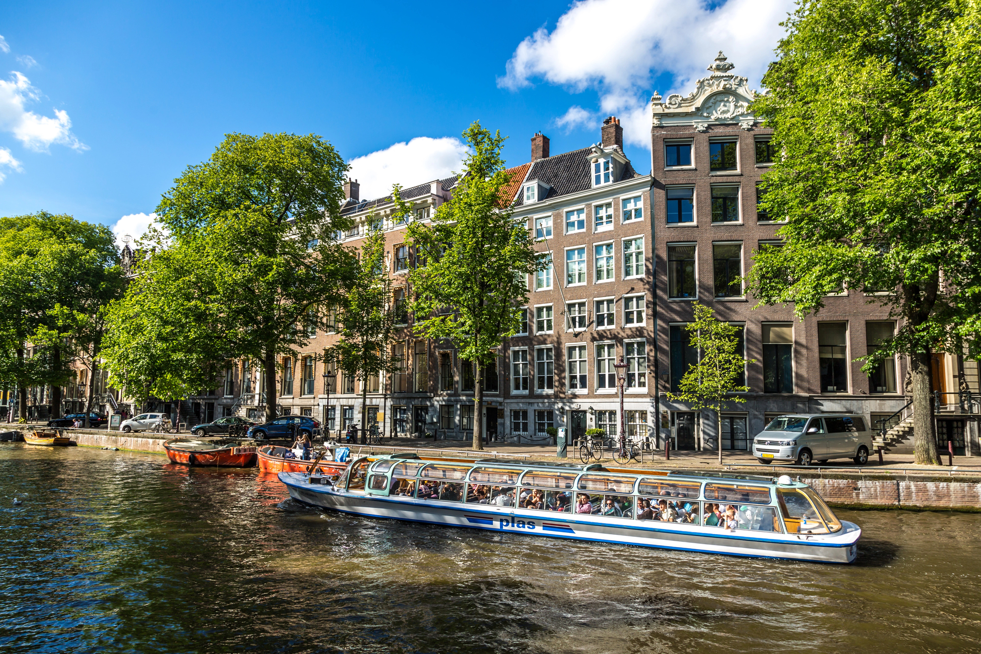
The Dutch capital features 165 canals totaling over 60 miles in length, forming an unusual ring pattern that defines the shape of the city’s expansion and formation. Waterways, in the past, were critical infrastructure facilitating the delivery of cargo into the city during the Dutch Golden Age of trade.
Modern Amsterdam maintains this watery heritage with floating homes, houseboats, and waterbuses as part of the critical transport network.
Bangkok

The ‘Venice of the East’ evolved around the Chao Phraya River and its many tributaries that branch through the city like veins. The city once had so many canals that most residents traveled primarily by boat, earning Bangkok the nickname again.
Despite modernization, thousands of people still live in waterside communities where longtail boats serve as the primary mode of transportation.
Like Travel Pug’s content? Follow us on MSN.
Suzhou
This ancient Chinese city incorporated water into its urban planning over 2,500 years ago, creating a network of canals that parallel nearly every street. The city’s waterways served both practical transportation needs and aesthetic purposes in classical Chinese garden design.
Inhabitants still use distinctive flat-bottomed boats to transport goods through narrow canals passing under nearly 60 ornate stone bridges.
Giethoorn
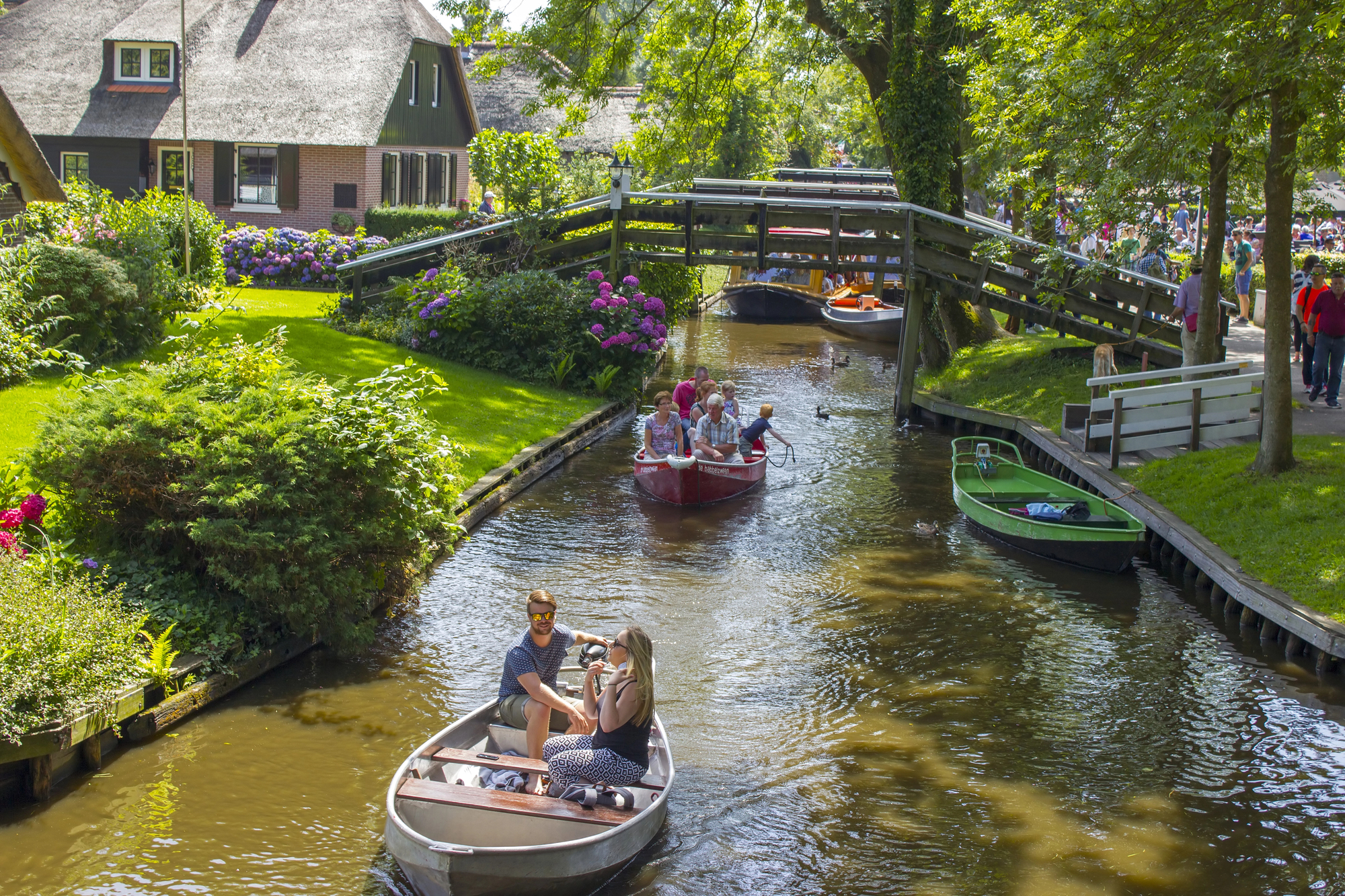
This Dutch town took water-based planning to an extreme by eliminating streets altogether in favor of canals. The town consists of small islands with over a hundred wooden footbridges and minimal or no roads connecting to the interior parts.
Mail is delivered by boat to the inhabitants, and farmers developed special shallow-draft boats to transport hay and livestock through the narrow canals.
Stockholm
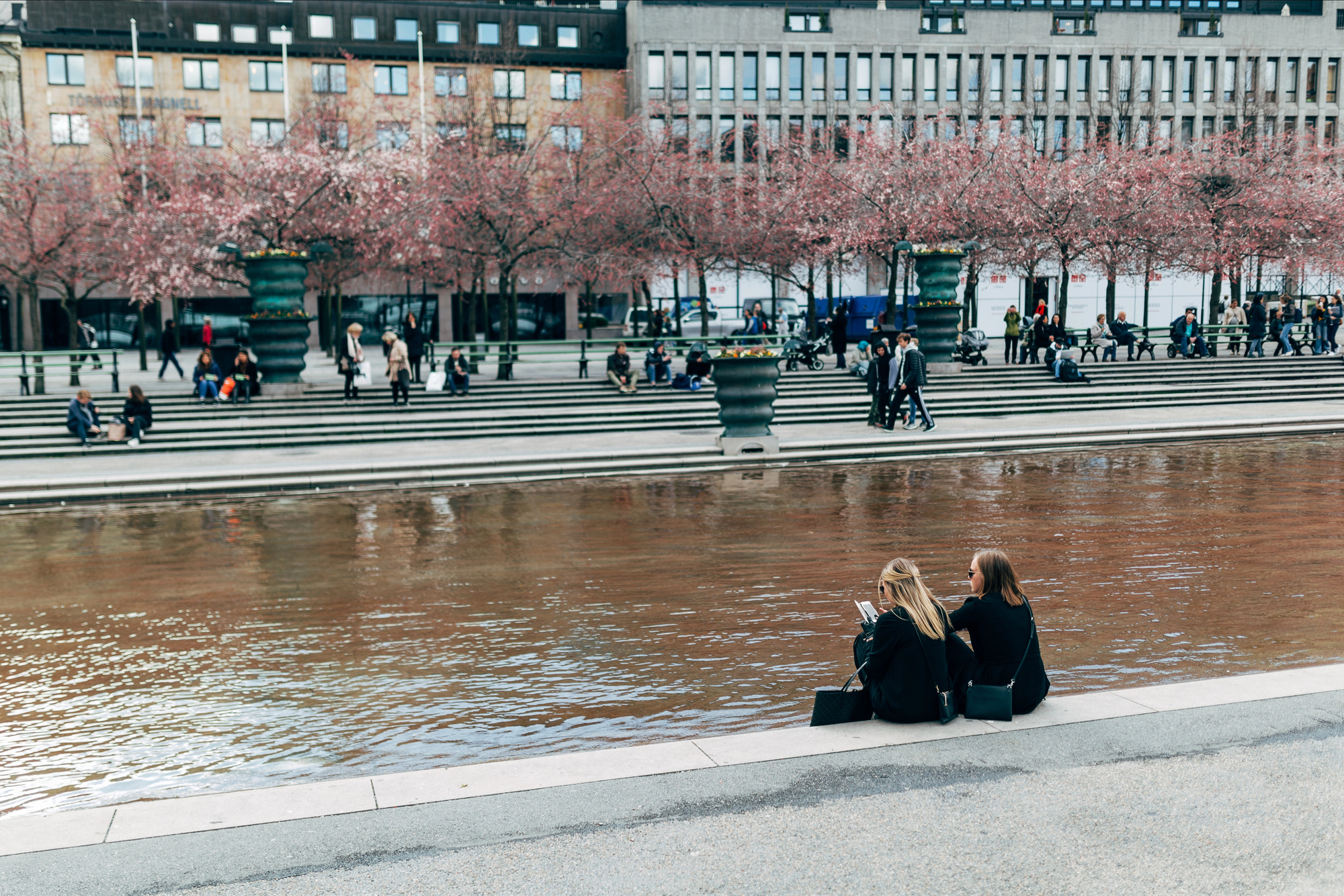
Sweden’s capital spreads across 14 islands where freshwater Lake Mälaren meets the Baltic Sea – creating a metropolis where water comprises one-third of the total area. The historical Gamla Stan district occupies its own island, requiring bridges and ferries as critical links in urban transit systems.
Winter transforms Stockholm’s relationship with its waterways; frozen canals become impromptu skating routes connecting neighborhoods when temperatures drop low enough to create natural ice pathways.
Like Travel Pug’s content? Follow us on MSN.
Bruges
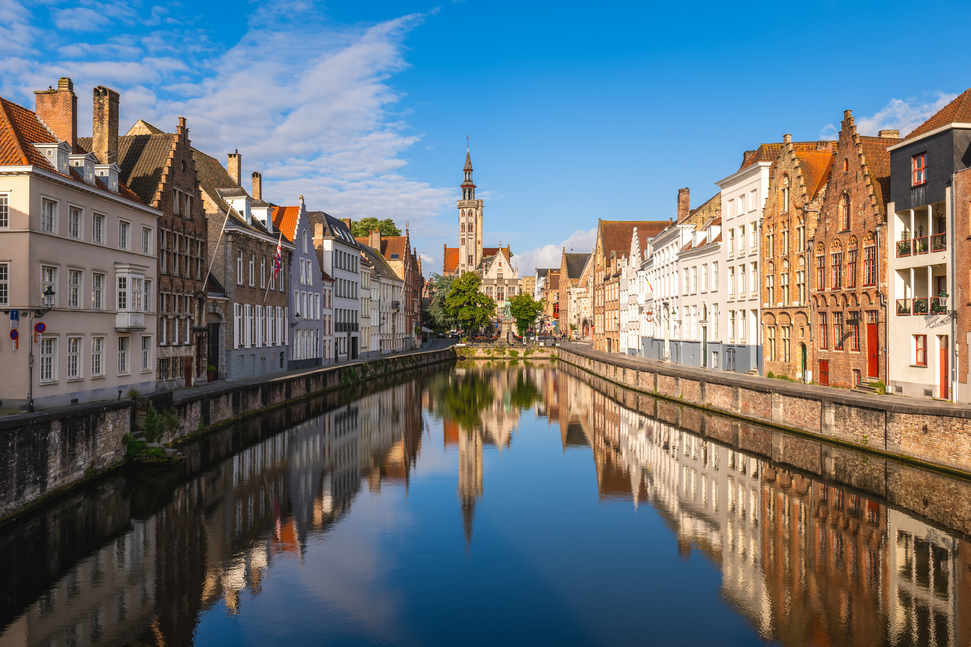
This preserved medieval Belgian city features a circular canal system that once functioned simultaneously as a defensive moat and commercial transportation network – blending security with trade efficiency. The historic center contains numerous small bridges and water gates through which goods could enter the protected city by boat.
Buildings showcase their waterfront facades with special hoisting beams and ‘loading doors’ positioned strategically for goods to be lifted directly from canal boats to storage rooms.
Alleppey

This Indian city in Kerala contains a vast network of backwater canals, lagoons, and lakes that serve as the primary transportation infrastructure for many residents. The region’s famous houseboats evolved from traditional rice barges into floating accommodations that navigate the extensive canal system.
School buses in this region often take the form of long wooden boats that collect children from waterside homes.
Fort Lauderdale
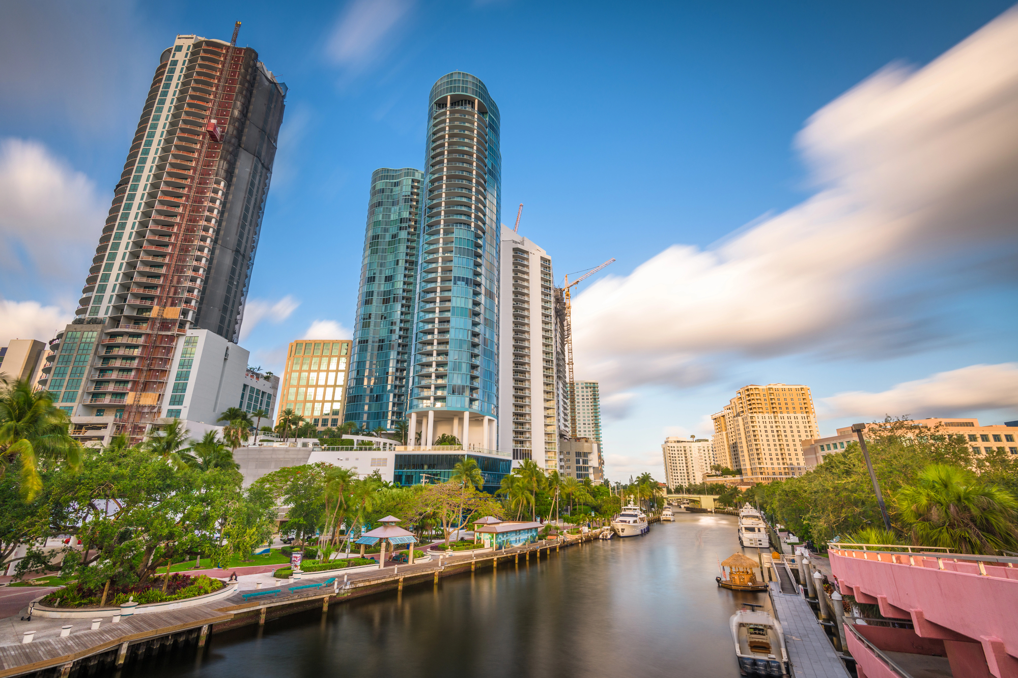
This Florida city embraces its ‘American Venice’ nickname with over 165 miles of waterways that wind through residential neighborhoods and commercial districts. Many homes feature private docks instead of driveways, with boats serving as essential transportation rather than just recreational vessels.
The city contains more than 12 percent water by area, with property values directly correlating to water access and canal width.
Like Travel Pug’s content? Follow us on MSN.
Tigre
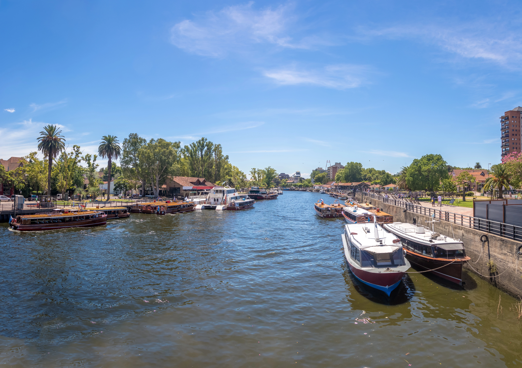
This Argentine city near Buenos Aires centers around a vast delta where hundreds of islands are accessible only by watercraft navigating a complex network of rivers and streams. The community adapted to its watery environment by developing floating services, including grocery stores, libraries, and even a floating church that moves between islands.
Children learn to pilot boats before they can ride bicycles, with watercraft serving as both school buses and family cars.
Birmingham
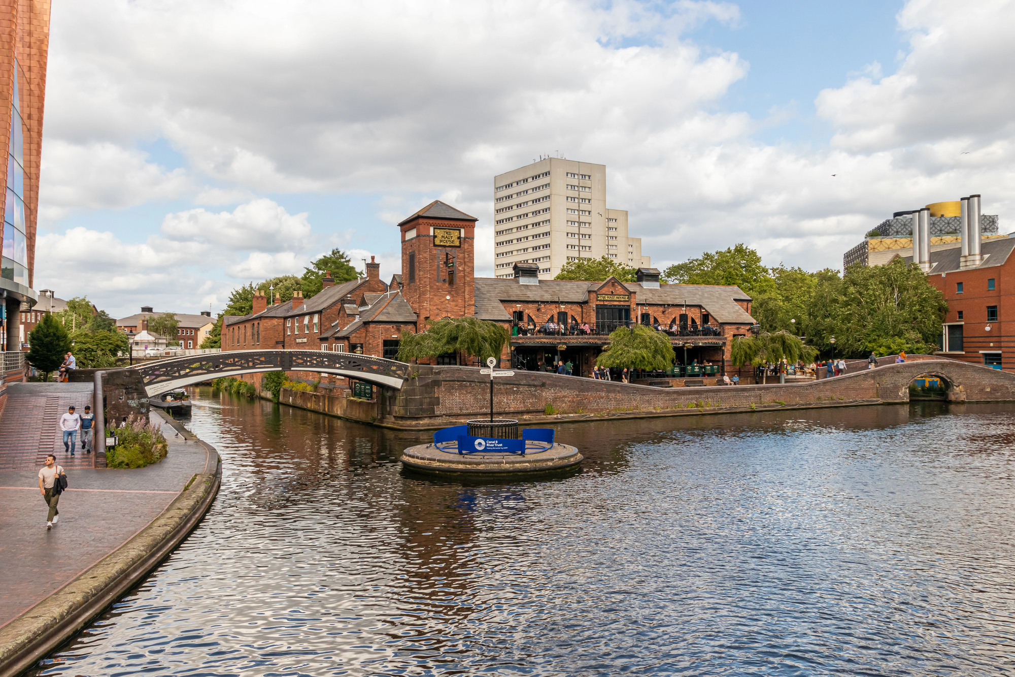
This English city boasts more miles of canals than Venice, with industrial waterways that once transported coal, iron, and manufactured goods during the Industrial Revolution. The city’s canal network connected factories to markets and remains the densest concentration of navigable waterways in England.
Former warehouses and factories along these urban canals have transformed into apartments and restaurants while maintaining their distinctive waterfront character.
Xochimilco
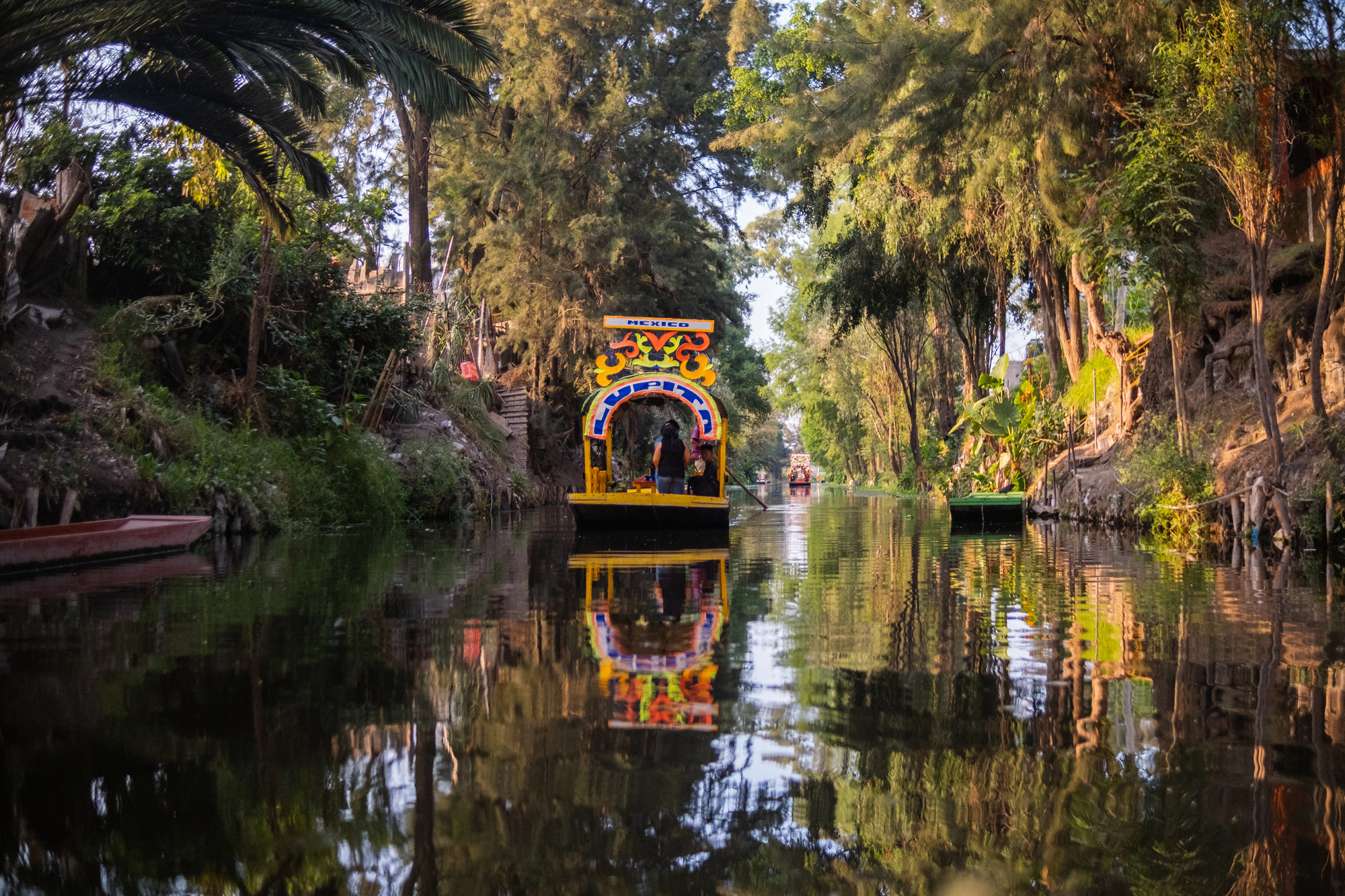
This district of Mexico City preserves ancient Aztec agricultural canals that create a floating garden system dating back to pre-Columbian times. The interconnected waterways support traditional farming on artificial islands called chinampas, created from layers of lake mud and aquatic vegetation.
Colorful flat-bottomed boats called trajineras navigate the canals, serving both agricultural transport and tourism purposes.
Like Travel Pug’s content? Follow us on MSN.
Zhouzhuang
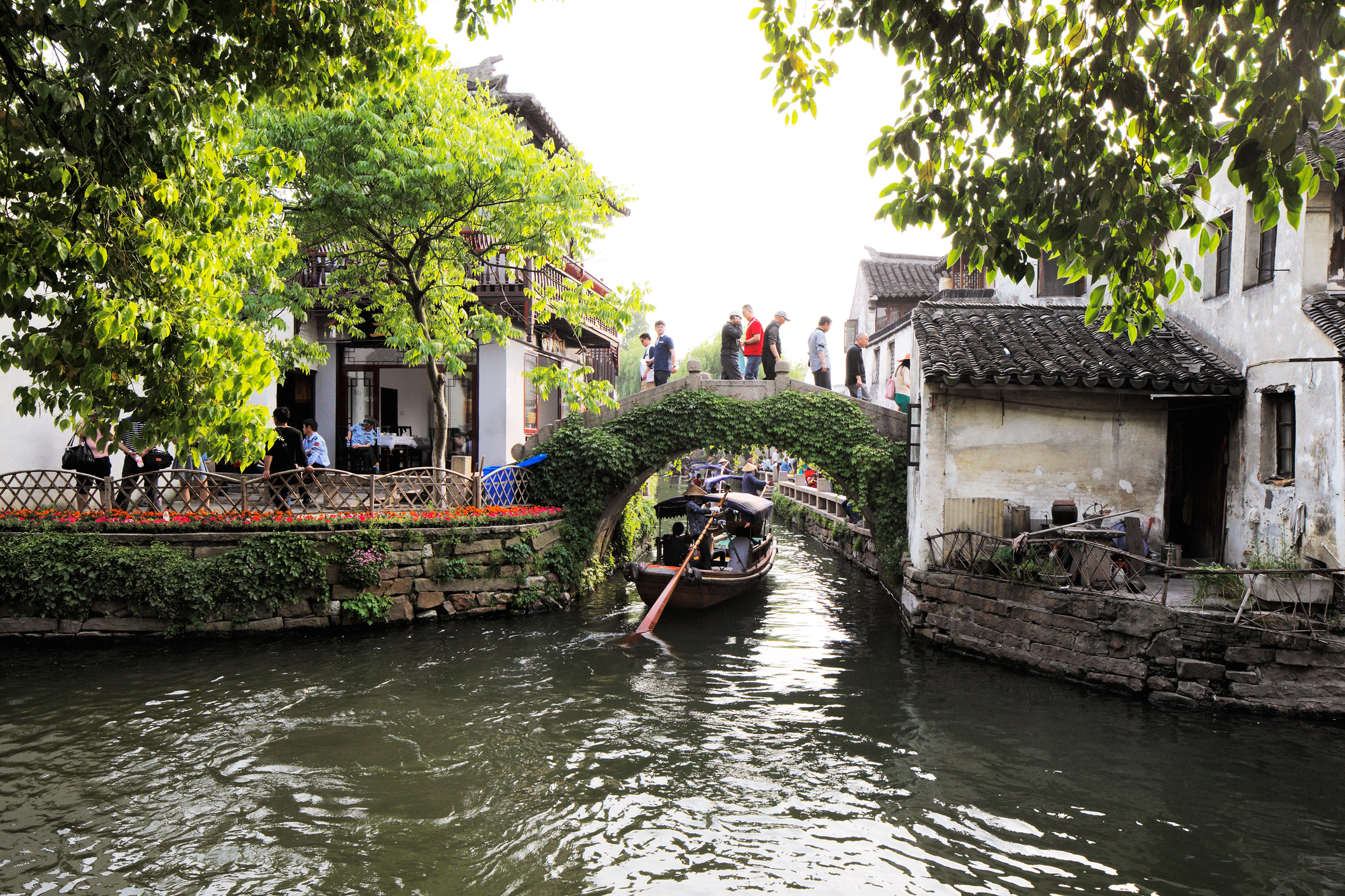
This ancient Chinese water town near Shanghai built its entire street plan around a cruciform system of canals that divide the settlement into distinct quarters. Over 60 percent of structures in the historic core date to the Ming and Qing dynasties, with distinctive stone bridges connecting the canal-separated sections.
Residents maintain traditions of raising ducks along canal edges and using specialized narrow cleaning tools for keeping waterfront steps algae-free.
Utrecht
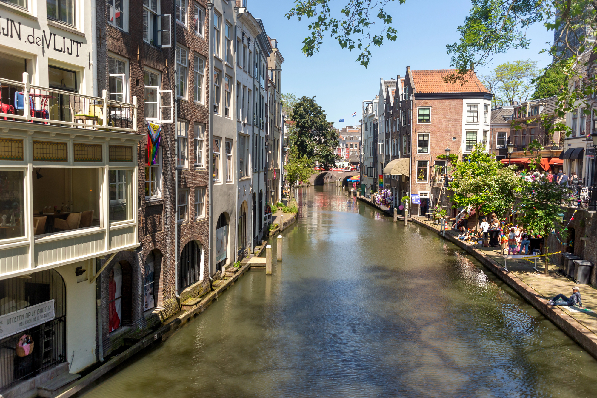
This Dutch university city features distinctive two-level canals with wharves and warehouses below street level, connected to upper streets by staircases. The unusual design creates waterside public spaces where restaurants and shops now operate in former commercial loading zones.
Canal-level homes feature unique ‘flood doors’ that can be quickly sealed during high water, reflecting generations of Dutch water management expertise.
Tenochtitlan
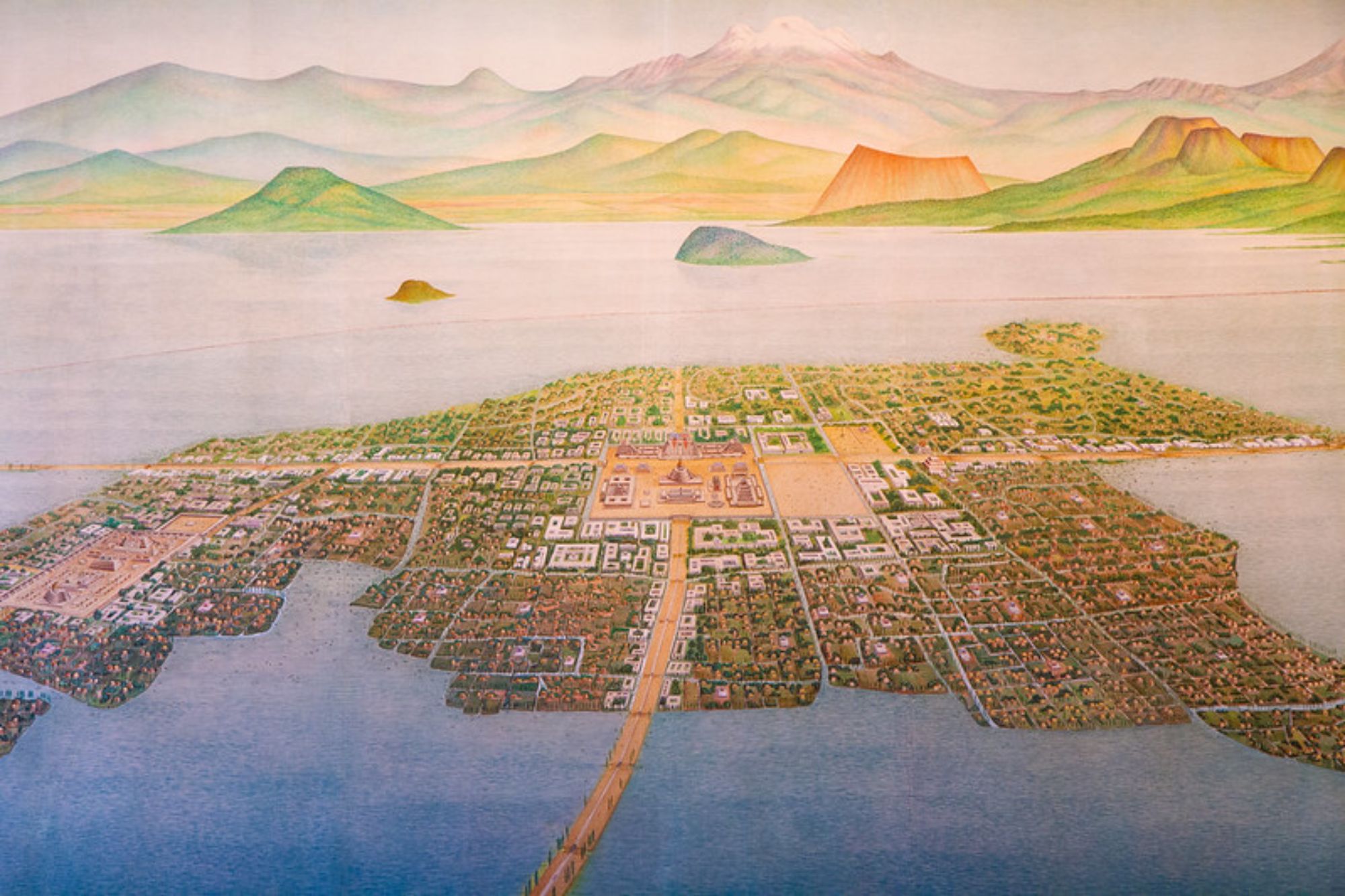
Modern Mexico City sits atop the ruins of this Aztec capital that once housed up to 200,000 people on an engineered system of canals and artificial islands. The pre-Columbian city featured sophisticated urban planning with a grid of canals supporting aquatic transportation and floating gardens.
Though most canals were filled in during colonial times, the ancient water-based pattern still influences neighborhood boundaries and street alignments in the modern metropolis.
Like Travel Pug’s content? Follow us on MSN.
Flowing Foundations
These urban waterscapes demonstrate how rivers and canals become more than geographic features—they transform into frameworks around which cities organize themselves. Rather than seeing water as an obstacle, these communities embraced their aquatic settings to develop distinctive identities and innovative approaches to urban living.
As climate change brings new water-related challenges to cities worldwide, these river-defined communities offer valuable lessons in adaptation and coexistence with natural water systems.
More from Travel Pug

- Cities Growing so Fast You Won’t Recognize Them in 10 Years
- 13 Destinations Where Tourists Regularly Regret Their Trip
- 16 U.S. Cities That Are Quietly Becoming Travel Hotspots
- Where to Travel If You Love Long Bus Rides and Daydreams
- 20 Cities Perfect for Solo Travelers Who Crave Adventure & Culture
Like Travel Pug’s content? Follow us on MSN.