
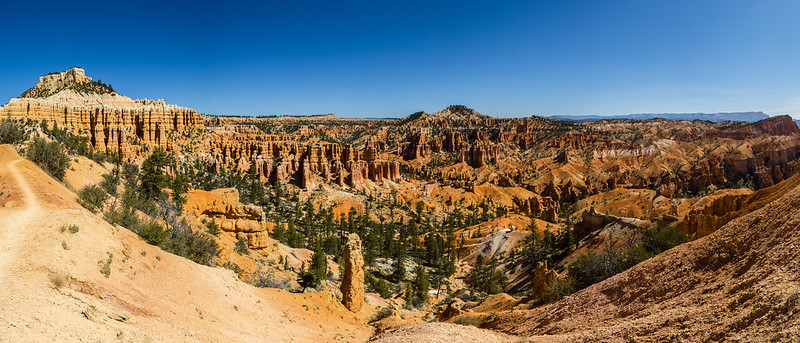
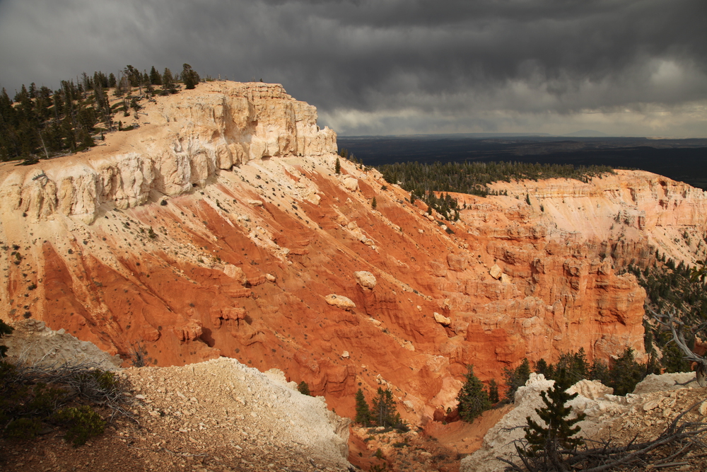
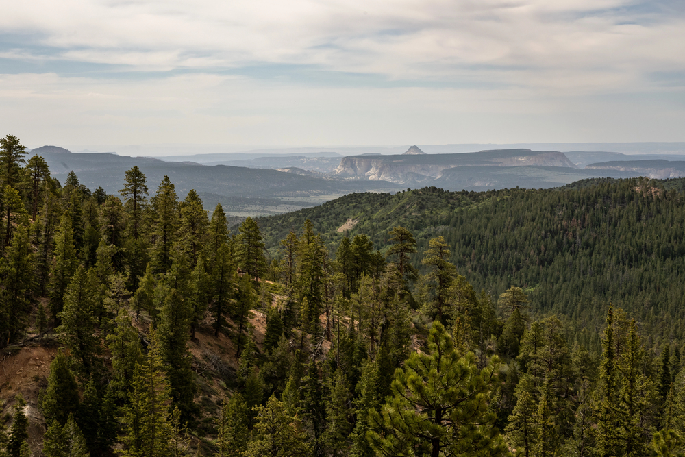
Bryce Canyon National Park doesn’t actually contain a canyon at all. Instead, it’s home to a series of natural amphitheaters carved into the cliffs of the Paunsaugunt Plateau, where thousands of red, orange, and white rock spires called hoodoos create one of the most spectacular landscapes in the American Southwest. These towering stone pillars, some reaching heights of 150 feet, were sculpted over millions of years by frost, root wedging, and chemical weathering.
The park’s unique geology makes it a hiker’s paradise, with trails that wind through slot canyons, climb along rim edges, and descend into the heart of the hoodoo formations. From easy strolls suitable for families to challenging backcountry adventures, each trail offers a different perspective on these geological wonders.
Here is a list of 19 Bryce Canyon hikes that showcase the magnificent hoodoos from every angle imaginable.
Sunrise Point
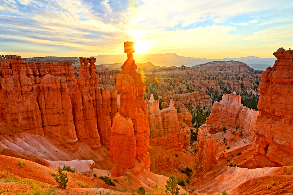
The paved walkway at Sunrise Point provides an accessible introduction to Bryce Canyon’s hoodoo landscape without requiring any strenuous hiking. This viewpoint sits at 8,100 feet elevation and offers sweeping views across the main amphitheater, where thousands of hoodoos create a maze of red and orange spires. The early morning light transforms the rock formations into a glowing tapestry, making this spot particularly magical during the first hour after dawn. Wheelchair accessible and just a short walk from the parking area, this trail works perfectly for visitors of all ages and mobility levels.
Sunset Point
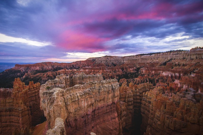
Located about a mile south of Sunrise Point, this viewpoint delivers on its promise with spectacular evening displays when the hoodoos catch the golden hour light. The short, paved trail leads to multiple viewing areas where you can watch the rock formations shift from bright orange to deep red as the sun sets behind the plateau. During peak season, this spot can get crowded, but the wide viewing area provides plenty of space to find your own perfect vantage point. The trail also connects to the Rim Trail, making it easy to combine multiple viewpoints in a single visit.
Inspiration Point
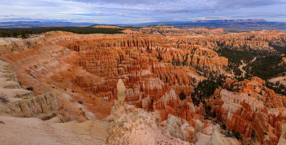
A moderate uphill walk of about 0.75 miles takes you to Inspiration Point, which sits higher than the other rim viewpoints and provides a broader perspective of the entire Bryce amphitheater. The trail gains about 200 feet in elevation, but the paved path makes the climb manageable for most visitors. From this vantage point, you can see how the hoodoos are arranged in distinct layers and formations, with the Silent City formation particularly visible to the north. The elevated position also offers views of the Pink Cliffs and the distant Aquarius Plateau on clear days.
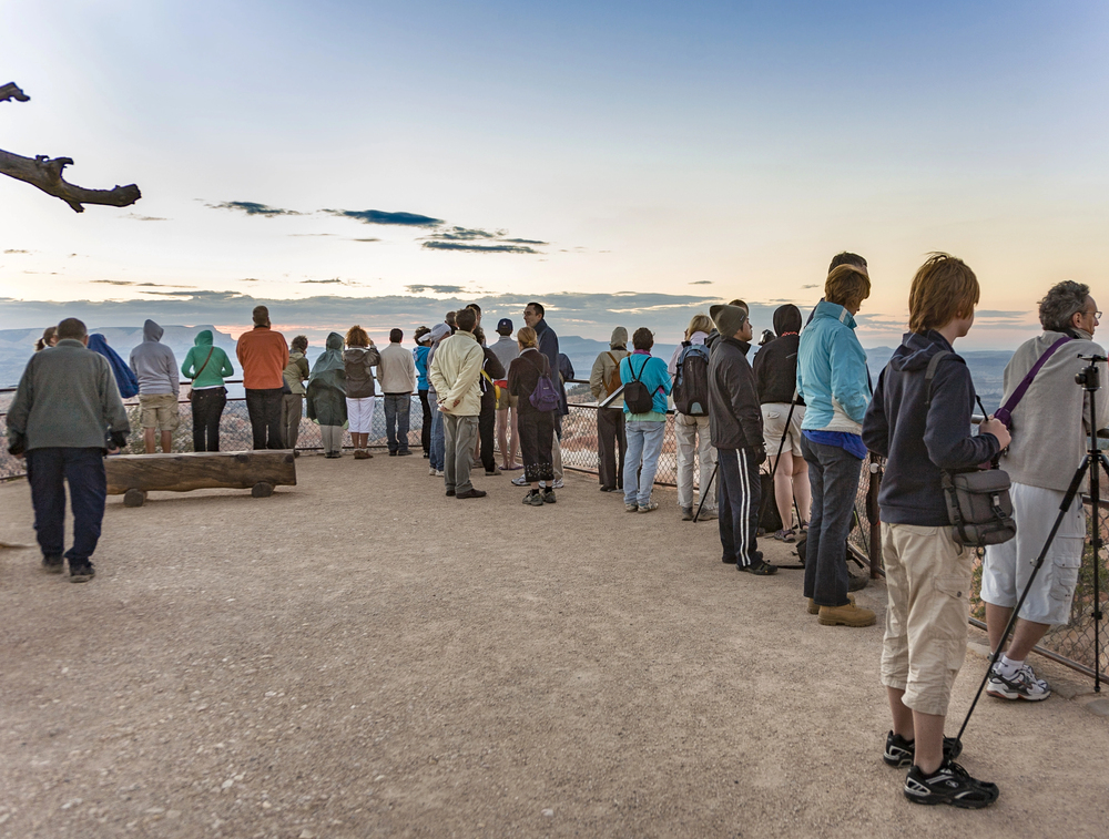
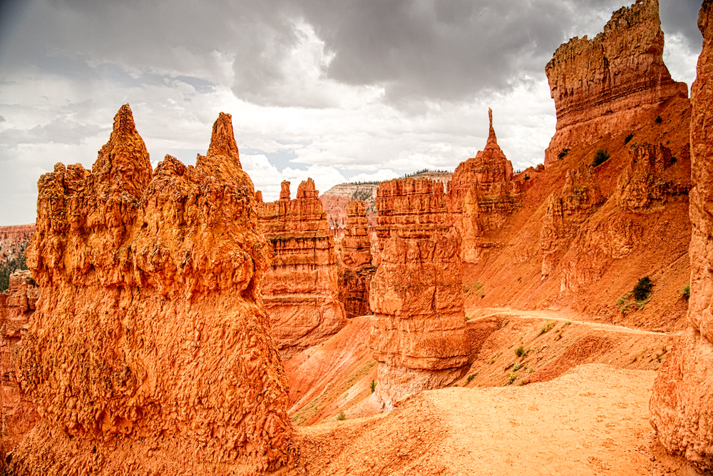
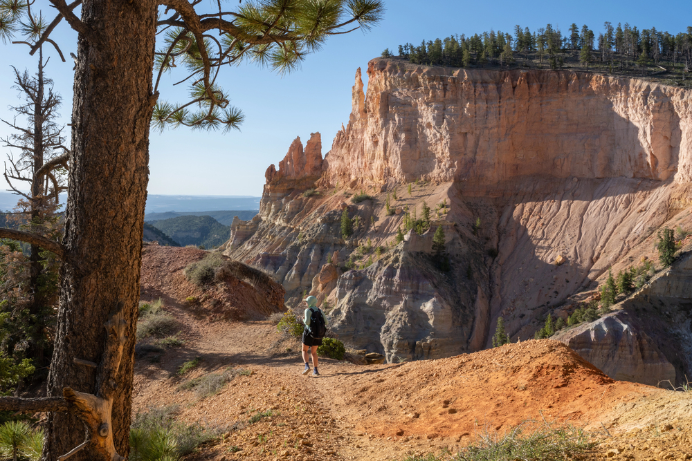
Bryce Point
— Photo by Hackman
This viewpoint requires a short walk from the parking area but rewards visitors with some of the most dramatic hoodoo views in the park. The trail leads to several overlooks where you can peer down into the amphitheater and see individual hoodoos up close, including some of the park’s most famous formations. The perspective here shows how water and ice have carved intricate patterns into the rock over thousands of years. Early morning visits often provide the best lighting and fewer crowds, though the formations look spectacular throughout the day.
Rim Trail
The Rim Trail connects all the major viewpoints along an 11-mile route, but most visitors tackle shorter sections between specific overlooks. The trail stays relatively flat and paved for most of its length, making it one of the most accessible ways to see multiple hoodoo formations in a single hike. You can walk from Sunrise Point to Sunset Point in about 30 minutes, enjoying constantly changing views of the amphitheater below. The trail also provides access to less crowded viewpoints between the main stops, where you can often find solitude among the spectacular scenery.
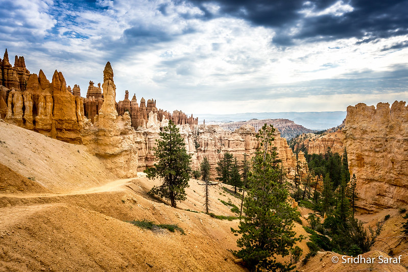
Fairyland Loop Trail
This 8-mile loop trail descends from Fairyland Point into the heart of the hoodoo formations, offering an immersive experience among the rock spires. The trail drops about 900 feet into the amphitheater, winding through narrow passages between towering hoodoos and across small meadows dotted with wildflowers. Hikers pass through the aptly named Fairyland, where the rock formations create almost magical landscapes that seem too fantastical to be real. The loop can be challenging due to its length and elevation changes, but the close-up views of the hoodoos make every step worthwhile.
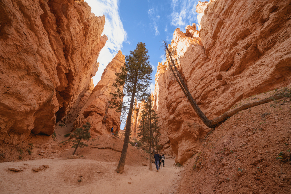
Navajo Loop Trail
Perhaps the most popular trail in Bryce Canyon, the Navajo Loop descends 550 feet into the amphitheater through a series of switchbacks that provide constantly changing perspectives on the surrounding hoodoos. The trail passes through narrow slot canyons where the rock walls tower overhead, creating cool microclimates even on hot summer days. Wall Street, a particularly narrow section of the trail, showcases some of the park’s most impressive hoodoo formations up close. The 1.5-mile loop takes most hikers about an hour to complete, making it perfect for visitors with limited time who want to experience the hoodoos from ground level.
Queen’s Garden Trail
Considered the easiest descent into the amphitheater, the Queen’s Garden Trail drops 320 feet over 0.9 miles to reach the park’s most famous hoodoo formation. The trail winds through a landscape of red and white rock spires, with the Queen Victoria formation serving as the destination centerpiece. This hoodoo earned its name from its resemblance to a regal figure wearing a crown, though different visitors often see different shapes in the weathered rock. The relatively gentle grade makes this trail accessible to families with children, while still providing an authentic hoodoo hiking experience.
Navajo-Queen’s Garden Combination
Combining the Navajo Loop and Queen’s Garden trails creates a 2.9-mile figure-eight route that many consider the best introduction to Bryce Canyon’s hoodoo landscape. The combination allows hikers to experience both the dramatic descent through Wall Street and the gentler approach to the Queen Victoria formation. Starting at Sunset Point and ending at Sunrise Point, this route provides diverse perspectives on the rock formations while keeping the difficulty level manageable for most visitors. The trail can get busy during peak season, but the variety of scenery keeps the experience engaging throughout.
Peek-a-Boo Loop Trail
This 5.5-mile loop trail offers a more challenging hoodoo experience, with steeper grades and more varied terrain than the shorter amphitheater trails. The trail descends about 800 feet into the formations, passing through narrow canyons and climbing over small ridges between hoodoo clusters. Peek-a-Boo gets its name from the way the rock formations seem to appear and disappear as you wind through the maze-like landscape. The trail provides excellent opportunities for photography, with unique angles on the hoodoos that aren’t visible from the rim viewpoints.
Tower Bridge Trail
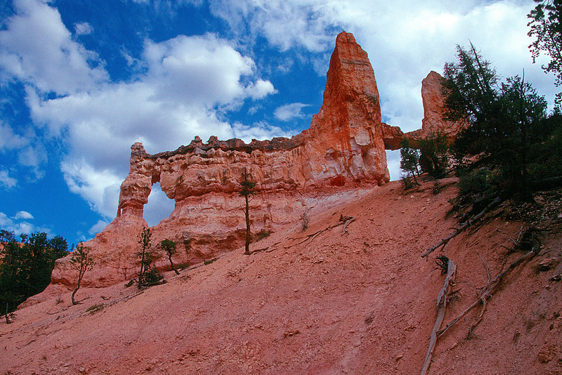
A moderate 3-mile round-trip hike leads to one of Bryce Canyon’s most distinctive hoodoo formations, a natural bridge carved from the same red rock that forms the park’s famous spires. The trail descends about 400 feet through a landscape of scattered hoodoos and juniper trees, providing a different perspective on the park’s geology. Tower Bridge itself resembles a massive stone archway, created when softer rock eroded away beneath a harder caprock layer. The formation demonstrates how the same forces that create hoodoos can also carve bridges and arches in the right conditions.
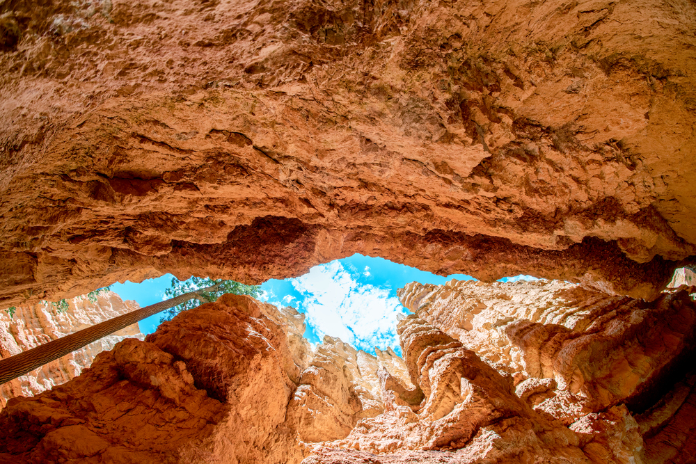
Mossy Cave Trail
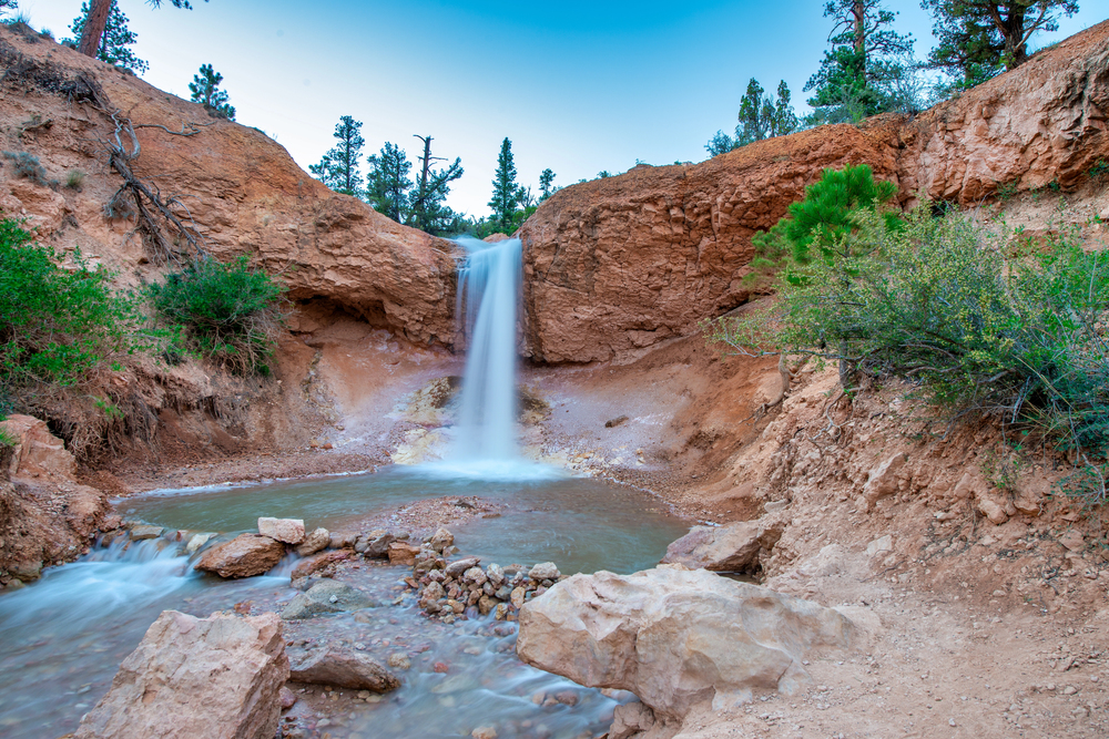
This easy 0.8-mile trail leads to a small waterfall and cave formation, showcasing how water continues to shape the landscape around Bryce Canyon. The trail follows a small stream through a narrow canyon, where seeping water has created moss-covered walls and a year-round spring. While not technically within the main amphitheater, this trail demonstrates the ongoing geological processes that create and modify hoodoo formations. The cave itself is more of a shallow alcove, but the cool microclimate and flowing water provide a refreshing contrast to the dry desert environment of most park trails.
Bristlecone Loop Trail
Located at Rainbow Point, this easy 1-mile loop trail combines hoodoo views with ancient bristlecone pine trees, some of which are over 1,000 years old. The trail stays near the rim at about 9,100 feet elevation, providing distant views of the Pink Cliffs and the hoodoo formations below. The bristlecone pines add a unique element to the landscape, their gnarled branches creating interesting foreground elements for photos of the rock formations. This trail works well for visitors who want to see hoodoos from a different perspective while exploring the park’s diverse ecosystems.
Agua Canyon Trail
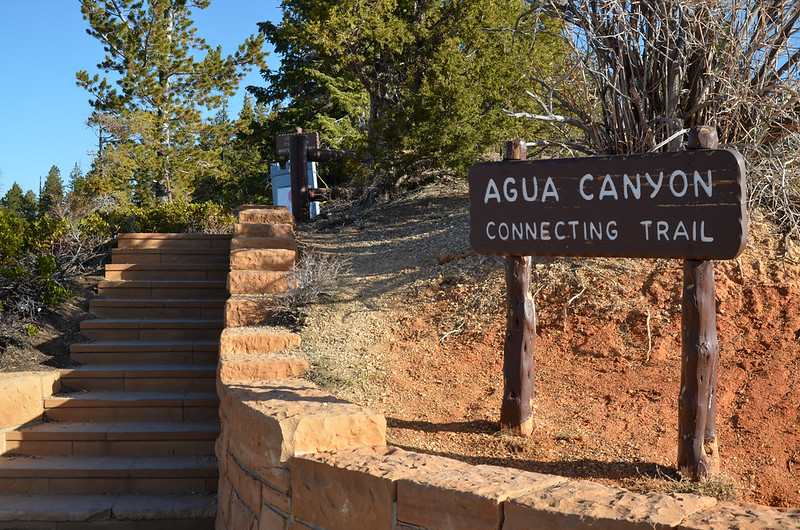
A short 1.6-mile round-trip hike leads to an overlook of some of Bryce Canyon’s most colorful hoodoo formations, where the rock displays particularly vibrant reds and oranges. The trail gains about 200 feet in elevation but remains relatively easy for most hikers. The viewpoint showcases a section of the amphitheater where the hoodoos are densely packed, creating an almost urban skyline effect in the rock formations. The late afternoon light brings out the most intense colors in these formations, making this trail particularly rewarding for evening visits.
Swamp Canyon Trail
This 4.2-mile round-trip trail descends into a side canyon where water has carved a different type of landscape, with fewer traditional hoodoos but more diverse rock formations. The trail follows a seasonal stream through a narrow canyon, where the walls show layers of different rock types and colors. Small alcoves and side canyons provide opportunities to explore off the main trail, though hikers should be cautious of loose rock and flash flood potential. The trail offers a quieter alternative to the busy amphitheater hikes while still showcasing the park’s geological diversity.
Whiteman Connecting Trail
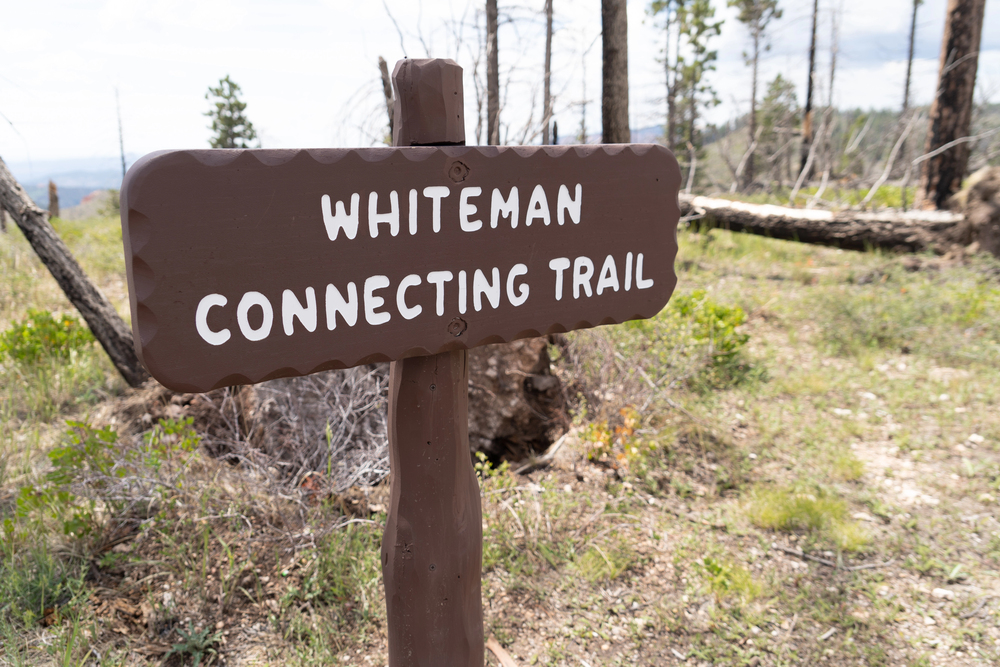
This 0.9-mile connector trail links the main amphitheater area with the southern viewpoints, passing through a landscape of scattered hoodoos and high desert vegetation. The trail provides a different perspective on how hoodoos form in isolation rather than in the dense clusters seen in the main amphitheater. Hikers can observe various stages of hoodoo development, from freshly carved spires to weathered remnants that are slowly disappearing. The trail also offers views of the Paunsaugunt Plateau and distant mountain ranges beyond the park boundaries.
Riggs Spring Loop Trail
This challenging 8.7-mile loop trail explores the park’s backcountry, where hoodoos are scattered among meadows and forests at higher elevations. The trail descends about 1,600 feet from the rim to Riggs Spring, passing through diverse ecosystems that showcase how elevation affects plant and animal life. While the hoodoo formations are less dense than in the main amphitheater, the trail provides opportunities to see these rock spires in a more natural, less visited setting. The spring itself creates a small oasis in the desert landscape, supporting vegetation and wildlife not found elsewhere in the park.
Under-the-Rim Trail
This 23-mile backpacking trail traverses the full length of the park, passing through numerous hoodoo formations and providing the most comprehensive tour of Bryce Canyon’s geological wonders. The trail can be hiked in sections as day hikes, with each segment offering different perspectives on the rock formations and surrounding landscape. Backpackers who complete the entire trail experience the full range of hoodoo environments, from the dense spires of the main amphitheater to the scattered formations in the park’s remote southern sections. The trail demonstrates how the same geological processes have created varied landscapes across the plateau.
Hat Shop Trail
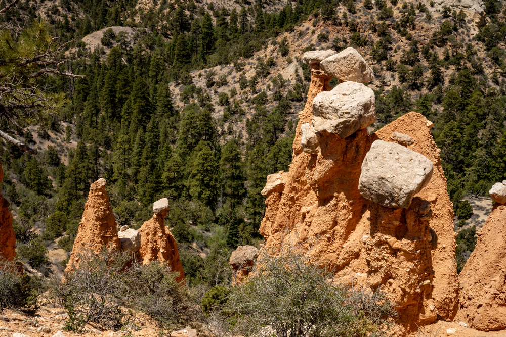
This 3.8-mile round-trip trail leads to a collection of hoodoos that are topped with distinctive caprock formations, creating the appearance of stone hats balanced on pedestals. The trail descends about 900 feet from the rim, winding through a landscape where erosion has created some of the park’s most unusual rock formations. The Hat Shop formations demonstrate how harder rock layers protect softer material beneath, creating the classic hoodoo shape that makes Bryce Canyon famous. The trail provides excellent examples of how different rock types weather at different rates, creating the park’s diverse geological features.
Timeless Stone Sentinels
These hoodoo formations have stood guard over the Colorado Plateau for millions of years, yet they continue to evolve with each freeze-thaw cycle and summer storm. The same forces that carved these magnificent spires from solid rock continue their work today, slowly reshaping the landscape grain by grain. Modern visitors can witness this ancient process in action, observing fresh rockfall and newly exposed rock faces that reveal the ongoing dance between stone and weather. Each trail through this remarkable landscape offers a chance to connect with geological time scales that dwarf human history. The hoodoos remind us that even the most solid-seeming features of our world are constantly changing, creating beauty through the patient work of natural forces.
More from Travel Pug

- 20 Best Beach Towns in the Carolinas
- 13 Destinations Where Tourists Regularly Regret Their Trip
- 20 Things You Actually Get in First Class
- 20 Small Airports With Aviation Museums
- 20 Places in the U.S. That Are Perfect for a Reset Trip
Like Travel Pug’s content? Follow us on MSN.