
Portugal’s seafaring heritage doesn’t stop at its land borders—it’s spread out across the huge Atlantic Ocean in a scatter of islands that boast tales of discovery, colonization, and, on occasion, absolute abandonment. These Atlantic colonies have seen centuries of human drama, from daring discoveries to peaceful withdrawals from society.
Many of these Portuguese islands have faded from common knowledge. Their stories lie buried beneath waves of time and shifting political tides. Here is a list of 19 Portuguese islands lost in the Atlantic that reveal forgotten chapters of maritime history.
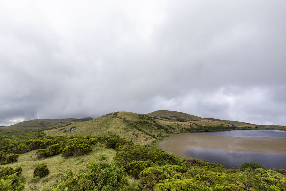
Corvo Island, Azores

The smallest inhabited island in the Azores archipelago sits about 1,200 miles west of mainland Portugal—like a tiny emerald dot in endless blue. Corvo’s population has dwindled to fewer than 400 residents, which makes it feel almost forgotten by the modern world.
The island’s volcanic crater lake, Caldeirão, remains one of Europe’s most isolated natural wonders.
Vila Islet, Azores
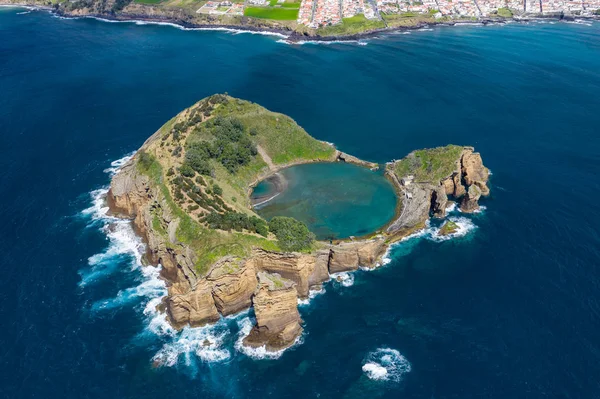
This tiny rocky outcrop near Corvo Island barely registers on most maps, sitting in the Azores’ westernmost waters. Vila Islet once housed a small fishing community, though harsh Atlantic storms eventually drove the last residents back to larger islands.
Today, only seabirds call this remote speck of land home.
Like Travel Pug’s content? Follow us on MSN.
Formigas Rocks, Azores

These jagged rocks emerge from the Atlantic about 25 miles northeast of Santa Maria Island, like the spine of some sleeping sea monster. Portuguese sailors discovered these treacherous formations during the early days of Atlantic exploration, yet countless ships met their fate on these hidden reefs.
The rocks remain uninhabited and largely inaccessible, earning their reputation as the Azores’ most dangerous ‘lost’ islands.
Dollabarat Rock, Azores

At high tide, this isolated rock structure, about 35 miles south of Terceira Island, hardly breaches the ocean surface. Dollabarat was noted by early Portuguese navigators as a crucial waypoint for crossing the Atlantic, but it is no longer relevant due to modern GPS technology.
The rock reminds us of the changes in navigation since Portugal’s discovery era.
Princess Alice Bank, Azores

This underwater mountain peak rises from the Atlantic depths about 50 miles southwest of Pico Island, occasionally breaking the surface during extremely low tides. Portuguese fishermen once knew every detail of this submerged island, using it as a rich fishing ground for centuries.
Climate change and shifting ocean patterns have made Princess Alice Bank even more elusive than before.
Like Travel Pug’s content? Follow us on MSN.
Selvagem Pequena, Madeira

This smaller sibling to Selvagem Grande lies just a few miles to the northeast, equally uninhabitable and remote. Early Portuguese settlers attempted to establish communities here multiple times, though the island’s unforgiving landscape defeated every effort.
The island remains one of the Atlantic’s most pristine environments, virtually untouched by human development.
Ilhéu de Fora, Madeira
Sitting about 12 miles northeast of Porto Santo Island, this rocky islet represents one of Madeira’s most isolated outposts. Portuguese records show brief attempts at settlement during the 16th century, yet Atlantic storms and isolation proved too challenging.
Ilhéu de Fora now serves as a crucial nesting site for endangered seabirds.
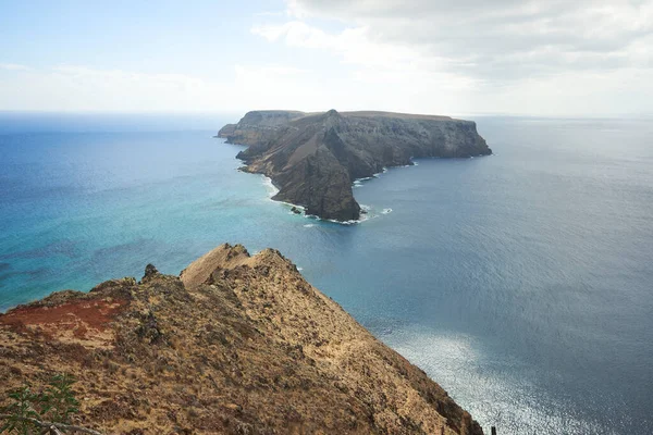
Deserta Grande, Madeira
The largest of the Desertas Islands lies about 15 miles southeast of Madeira’s main island—living up to its name with stark, desert-like conditions. Portuguese colonists established small communities here during the early settlement period, though drought and soil erosion gradually forced abandonment.
The island’s unique ecosystem now attracts scientists studying Atlantic island evolution.
Like Travel Pug’s content? Follow us on MSN.
Bugio Island, Madeira

This southernmost island in the Desertas chain sits in splendid isolation about 20 miles from Madeira proper—a testament to nature’s harsh beauty. Bugio’s name translates to ‘monkey’ in Portuguese, though no primates ever lived on this barren rock.
The island’s lighthouse, built in the 19th century, remains its only permanent human structure.
Chão Islet, Madeira
Located between Desertas Grande and Bugio, this tiny islet barely qualifies as land during rough Atlantic weather. Portuguese sailors used Chão as a navigation marker for centuries, yet its small size made any settlement attempts futile.
The islet’s unique position creates unusual ocean currents that marine biologists still study today.
Ilhéu da Cal, Porto Santo
This limestone islet sits just off Porto Santo’s eastern coast. It once served as a quarry for Portuguese construction projects while workers lived there for decades, extracting lime for buildings across the Madeira archipelago.
When synthetic materials replaced natural lime, the islet was abandoned, leaving behind crumbling stone structures.
Like Travel Pug’s content? Follow us on MSN.
Baixo da Barca, Atlantic

This shallow reef system lies about 60 miles northeast of the Azores, marked by a single navigation beacon. Portuguese merchant ships frequently ran aground on Baixo da Barca during the colonial period, which gave it a reputation as a ship graveyard.
Modern sonar mapping has revealed dozens of wrecks scattered across the reef’s perimeter.
Banco D. João de Castro, Azores

Named after a Portuguese viceroy, this underwater volcano occasionally surfaces between Terceira and São Miguel islands. The bank last emerged above water in 1941, creating a temporary island that disappeared within months.
Portuguese scientists monitor this geological curiosity while waiting for its next dramatic appearance.
Terra Que Nunca Houve, Atlantic Legend

Portuguese explorers reported discovering this mysterious island about 200 miles west of Madeira during the 16th century. Multiple expeditions searched for ‘The Land That Never Was,’ though modern oceanography confirms no such island exists in those coordinates.
The legend persists in Portuguese maritime folklore as a symbol of the uncertain nature of exploration.
Like Travel Pug’s content? Follow us on MSN.
Rochedo da Agulha, Atlantic

This needle-like rock formation pierces the Atlantic surface about 80 miles northwest of the Azores archipelago. Portuguese whalers used Rochedo da Agulha as a landmark during their hunting expeditions, yet the rock’s tiny size made landing impossible.
Storm damage over the centuries has reduced this ‘needle’ to a barely visible point.
Ilhéu Mole, Azores Waters

Sitting in the channel between Faial and Pico islands, this soft-rock islet gradually erodes with each Atlantic storm. Portuguese farmers once grazed sheep on Ilhéu Mole during calmer seasons while ferrying animals back and forth by boat.
The islet’s shrinking size makes such activities impossible today, leaving it to the gulls and cormorants.
Pedra Branca, Mid-Atlantic

This white limestone outcrop emerges from deep Atlantic waters about 150 miles south of the Azores chain. Portuguese navigators used Pedra Branca as a crucial waypoint during transatlantic voyages, though its remote location kept it uninhabited.
Modern satellite tracking has largely eliminated the need for such physical navigation markers.
Like Travel Pug’s content? Follow us on MSN.
Recife Oculto, Azores Region

Hidden beneath the Atlantic surface near Santa Maria Island, this coral formation only reveals itself during exceptionally low tides. Portuguese pearl divers discovered Recife Oculto in the 17th century while harvesting its marine treasures for European markets.
Overharvesting and environmental changes have left the reef largely barren of valuable species.
Último Rochedo, Atlantic Frontier

On the farthest edge of the Portuguese claim in the Atlantic, this little rock lies just outside the exclusive economic zone. Early explorers sent flag-planting expeditions to Último Rochedo to establish territorial rights, but with its extreme isolation, any practical application was impossible.
It is a symbolic reminder of the distant maritime aspirations of the Portuguese.
Echoes Across the Centuries
These forgotten Atlantic outposts tell the story of Portuguese maritime courage and the harsh realities of ocean colonization. From ambitious settlement attempts to strategic navigation points, each island played a role in shaping Portugal’s relationship with the Atlantic Ocean.
While modern technology has made many of these remote locations less crucial for navigation or survival, they remain important pieces of the puzzle that is Portugal’s maritime heritage, scattered across the Atlantic like breadcrumbs leading back to an age when the ocean represented both opportunity and peril.
Like Travel Pug’s content? Follow us on MSN.
More from Travel Pug

- 20 Best Beach Towns in the Carolinas
- 13 Destinations Where Tourists Regularly Regret Their Trip
- 20 Destinations That Are More Magical Without an Itinerary
- 20 Underrated Adventures That Belong on Your Travel List
- 20 Cities Where You Should Just Wing It, No Planning Required
Like Travel Pug’s content? Follow us on MSN.N.