
Nestled in the heart of the Blue Ridge Mountains, Asheville serves as an ideal gateway to some of the most spectacular hiking terrain in the eastern United States. From gentle woodland strolls to challenging mountain ascents, the surrounding region offers an impressive diversity of trails catering to every experience level and interest.
Here is a list of 20 exceptional hikes within easy reach of Asheville, each offering distinctive landscapes, natural features, and opportunities to connect with the renowned biodiversity of the Southern Appalachians.
Looking Glass Rock Trail
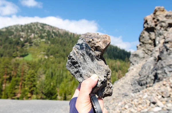
This iconic 6.5-mile round-trip journey leads to one of the most recognizable geological features in western North Carolina, a massive plutonic monolith rising dramatically from the surrounding forest. The moderately strenuous trail gains approximately 1,700 feet of elevation through a series of switchbacks in Pisgah National Forest, culminating in a breathtaking summit offering panoramic views of the Blue Ridge Mountains.
The exposed rock face near the top provides excellent opportunities for photography, particularly in early morning when fog often settles in the valleys below.
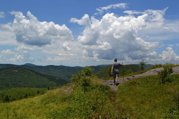
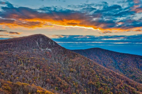
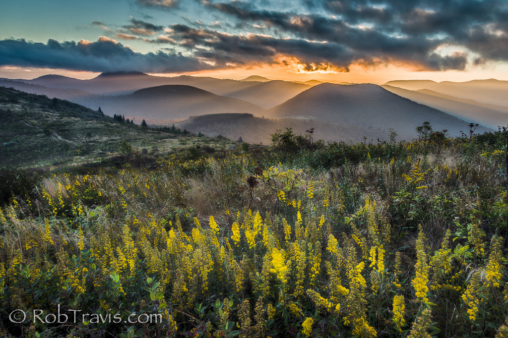
Max Patch
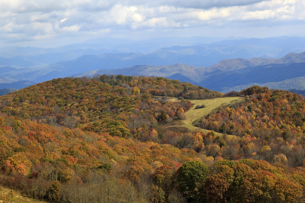
This relatively easy 1.4-mile loop traverses a stunning high-elevation bald, offering 360-degree mountain vistas that rival those of much more strenuous hikes. Located about 40 miles northwest of Asheville on the Tennessee border, this section of the Appalachian Trail crosses an expansive summit meadow renowned for its spectacular wildflower displays in spring and summer.
The wide-open terrain creates perfect conditions for sunset viewing, picnicking, and stargazing, making this accessible trail popular with families and photographers seeking dramatic landscapes without demanding terrain.
Like Travel Pug’s content? Follow us on MSN.
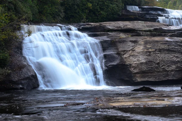
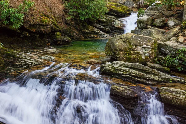
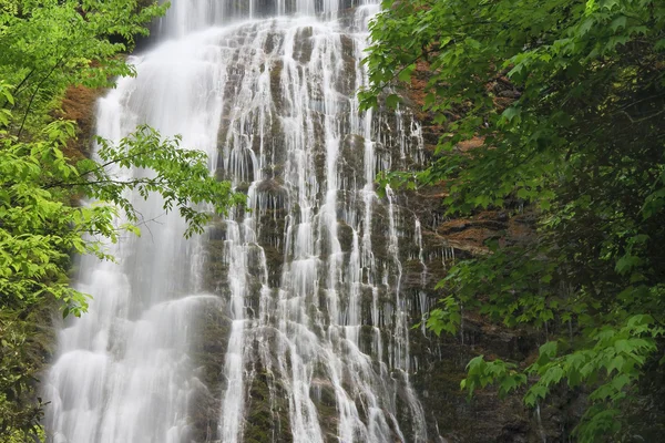
Catawba Falls
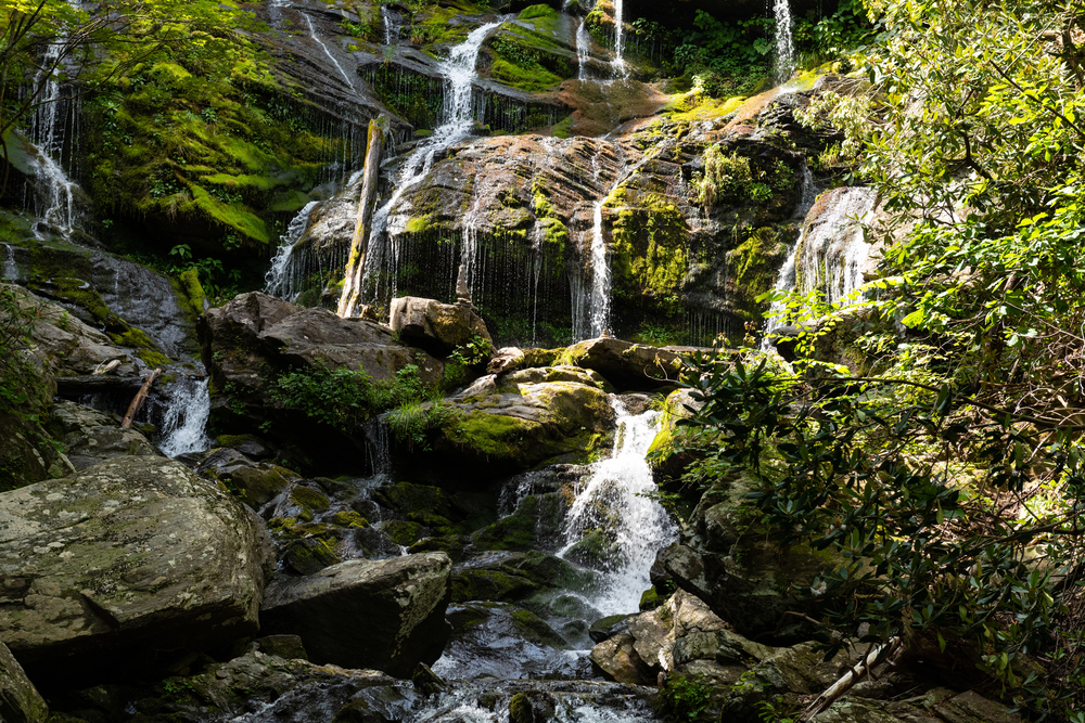
This moderate 3-mile round-trip adventure follows an old roadbed alongside the Catawba River to a stunning 100-foot multi-tiered waterfall in the Pisgah National Forest. Located just 25 miles east of Asheville, the trail crosses several small tributary streams before reaching the base of the impressive cascade, where hikers can enjoy the cooling mist and natural pool beneath the falls.
The path’s gentle grade and short distance make it accessible to most hikers, offering a photogenic waterfall without requiring an all-day excursion.
Graveyard Fields Loop
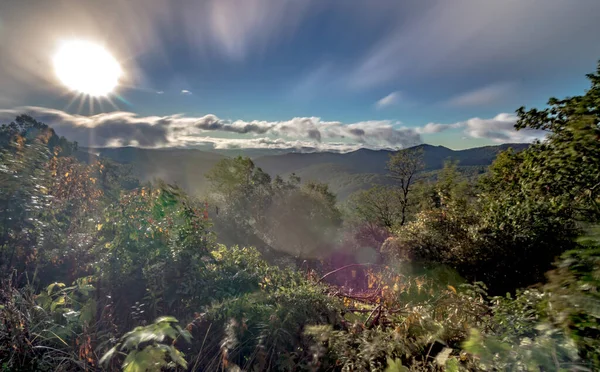
This moderately easy 3.2-mile circuit explores a distinctive high-elevation valley on the Blue Ridge Parkway where two picturesque waterfalls frame a landscape unlike any other in the region. Named for the tree stumps resembling gravestones that once dotted the valley floor, this unique area features open meadows filled with wildflowers, dense thickets of rhododendron and blueberry bushes, and expansive views of surrounding peaks.
The trail passes both Upper and Lower Falls, offering excellent swimming pools during summer months and spectacular autumn colors when the valley’s vegetation transforms into brilliant hues of red and orange.
Craggy Gardens Trail

This accessible 1.9-mile round-trip journey traverses a subalpine environment more characteristic of Canada than North Carolina, featuring twisted birch trees and dense rhododendron gardens that explode with pink and purple blooms in mid-June. Located just 24 miles northeast of Asheville on the Blue Ridge Parkway, the trail climbs gently to a sheltered garden area before continuing to a panoramic overlook offering stunning views of the surrounding mountain ranges.
The relatively high elevation of 5,500 feet provides a naturally air-conditioned environment during summer months, making this an excellent option during the hottest days.
Like Travel Pug’s content? Follow us on MSN.
Black Balsam Knob and Tennent Mountain Loop
This moderate 5-mile circuit traverses multiple treeless summits along the Art Loeb Trail, offering some of the most expansive views in the region with relatively modest effort. Located about 40 miles southwest of Asheville, this nearly 6,000-foot-elevation trail, these grassy balds provide unobstructed 360-degree vistas across the Shining Rock Wilderness and beyond to the Great Smoky Mountains.
The trail passes through diverse ecosystems, including mountain meadows filled with wildflowers, dense stands of balsam fir, and rocky outcrops perfect for taking in the scenery.
Triple Falls Trail
This 2.3-mile round-trip adventure in DuPont State Recreational Forest leads to a spectacular triple-tiered waterfall featured in scenes from ‘The Hunger Games’ film. Located about 40 miles southwest of Asheville, the well-maintained path provides access to three distinct cascades within a short distance, offering excellent photography opportunities from multiple vantage points.
The relatively flat terrain makes this trail accessible for most visitors. At the same time, the proximity to several other impressive waterfalls in the forest allows hikers to extend their expedition if energy permits.
Mount Mitchell Summit Trail
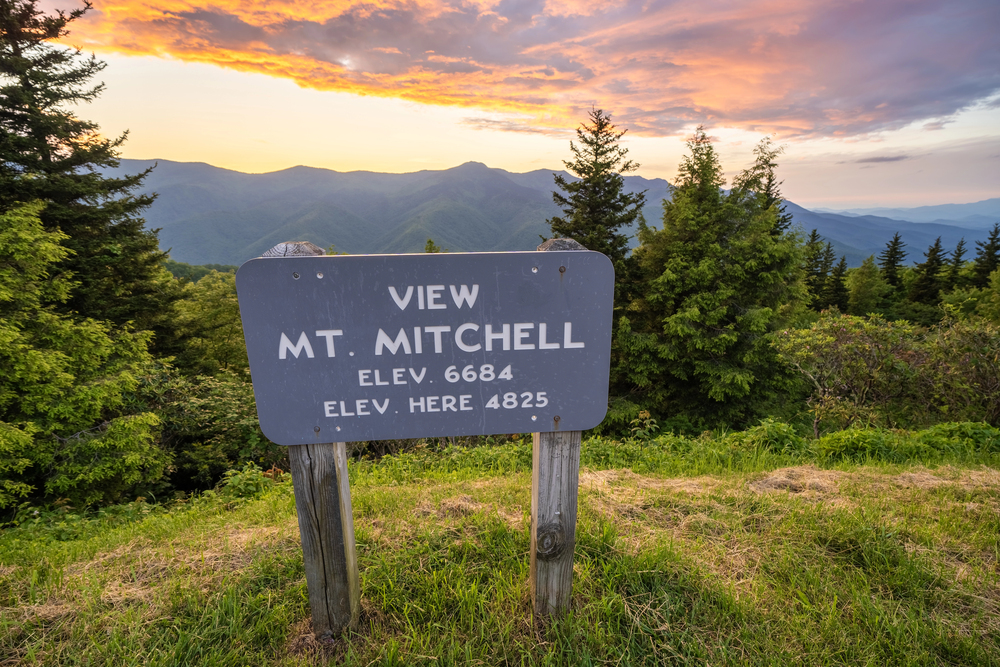
This surprisingly manageable 0.3-mile paved path leads to the highest point east of the Mississippi River at 6,684 feet, offering unparalleled panoramic views from an observation platform. Located about 35 miles northeast of Asheville, the short trail begins at the summit parking area, making this extraordinary vista accessible even to those with limited hiking experience.
The dramatic elevation creates a unique ecosystem reminiscent of Canadian forests, with Fraser firs, red spruce, and cool temperatures even during summer months, while interpretive signs explain the distinctive ecology and geology of this remarkable environment.
Like Travel Pug’s content? Follow us on MSN.
Crabtree Falls Loop
This moderate 2.5-mile circuit features one of the most photogenic waterfalls in the region, a 70-foot cascade that gracefully fans out over a series of rocky ledges. Located about 45 miles northeast of Asheville off the Blue Ridge Parkway, the trail descends through a lush hardwood forest to the base of the falls before looping back via a higher route that offers different perspectives of the surrounding landscape.
The trail’s design allows hikers to experience varying forest environments and stream crossings, creating a satisfying journey beyond just the waterfall destination.
Hawksbill Mountain Trail
This moderate 1.5-mile round-trip hike leads to a distinctive rock outcropping providing spectacular 360-degree views of Linville Gorge, often called ‘the Grand Canyon of the East.’ Located about a 70-mile drive northeast of Asheville, this relatively short trail delivers remarkable scenery for modest effort, with the final approach traversing exposed rock faces to a summit that towers over the surrounding landscape.
The panoramic vista encompasses Table Rock, the deep canyon carved by the Linville River, and on clear days, views extending to the Piedmont region far to the east.
Skinny Dip Falls
This family-friendly, one-mile round-trip adventure leads to a multi-tiered waterfall and pristine swimming pool, popular during summer months. Located at Mile Marker 417 on the Blue Ridge Parkway, about 25 miles southwest of Asheville, the well-maintained trail descends gradually through a lush forest to a crystal-clear pool at the base of the cascades.
The natural swimming area features various jumping rocks for the adventurous, shallow areas for younger visitors, and peaceful spots for those simply wishing to enjoy the mountain scenery and refreshing waters.
Like Travel Pug’s content? Follow us on MSN.
Lovers Leap Loop
This moderate 1.6-mile circuit in Hot Springs offers exceptional views of the French Broad River and the historic mountain town from a dramatic rock outcropping. Located about 40 miles northwest of Asheville, the trail follows a section of the famous Appalachian Trail, ascending steeply before leveling out along a ridgeline with excellent vistas.
The unique perspective allows hikers to appreciate the natural passage created by the river cutting through the mountains, a geological feature that has made this area significant for transportation and human settlement for thousands of years.
Rainbow Falls Trail
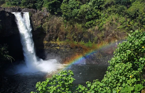
This moderate 3-mile round-trip journey in Gorges State Park leads to a powerful 150-foot waterfall that creates frequent rainbows in its mist on sunny days. Located about a 60-mile drive southwest of Asheville, the well-maintained path descends through temperate rainforest to the base of the spectacular cascade on the Horsepasture River.
The trail offers several excellent vantage points for viewing and photographing the falls, while the river above and below the cascade provides perfect spots for cooling off during warmer months.
Rattlesnake Lodge Trail
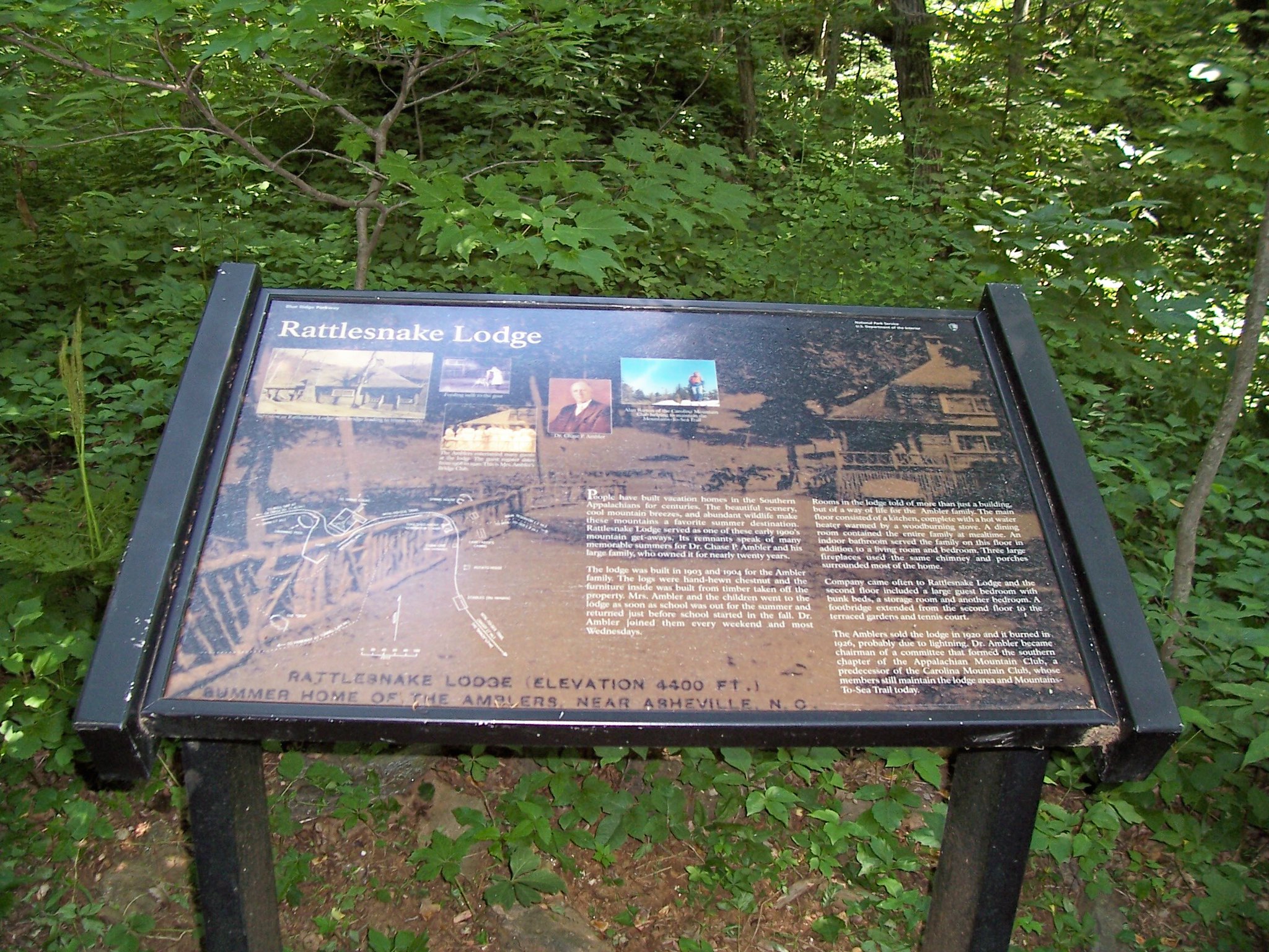
This moderate 3.7-mile round-trip adventure explores the atmospheric ruins of an early 20th-century mountain retreat built by a prominent Asheville physician. Located just 15 minutes from downtown on the Mountains-to-Sea Trail, the path climbs steadily through hardwood forest to the abandoned stone foundations, chimneys, and a spring-fed swimming pool that remain from the once-grand lodge destroyed by fire in 1926.
The trail offers a fascinating blend of natural beauty and historical interest, with informational signs detailing the story of the lodge and its former occupants.
Like Travel Pug’s content? Follow us on MSN.
Clingmans Dome Observation Tower Trail
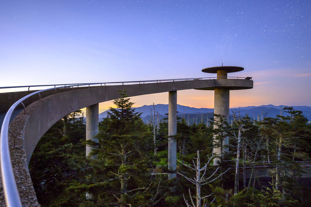
This short but steep 1-mile round-trip paved path leads to the highest point in the Great Smoky Mountains National Park at 6,643 feet, offering extraordinary panoramic views from a distinctive spiral observation tower. Located about 80 miles southwest of Asheville, the trail climbs approximately 330 feet through a fascinating spruce-fir forest that represents a relict ecosystem typically found much further north.
The observation tower provides exceptional 360-degree views across the national park and beyond, potentially encompassing seven states on the clearest days.
Linville Falls Trail
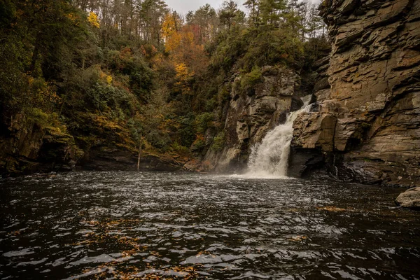
This moderate 1.6-mile round-trip journey leads to multiple overlooks of a powerful two-tiered waterfall plunging into the rugged Linville Gorge. Located about 60 miles northeast of Asheville off the Blue Ridge Parkway, the main trail offers three increasingly dramatic vantage points that showcase different aspects of the falls and the surrounding canyon.
The final overlook at Erwin’s View provides a spectacular perspective of the entire waterfall and gorge system, illustrating why this has been one of the region’s most popular natural attractions for generations.
Daniel Ridge Loop Trail
This moderate 4-mile circuit in Pisgah National Forest features multiple cascading waterfalls, crystal-clear streams, and lush forest environments without the crowds found at more famous destinations. Located about 40 miles southwest of Asheville, the trail follows Daniel Ridge Creek through a variety of mountain ecosystems, passing both the impressive 150-foot Jackson Falls and numerous smaller cascades along the route.
The relatively consistent elevation gain makes this a comfortable half-day adventure that rewards hikers with abundant water features and peaceful forest scenery.
Like Travel Pug’s content? Follow us on MSN.
Mingo Falls Trail
This short but steep 0.4-mile journey leads to one of the tallest and most spectacular waterfalls in the southern Appalachians, cascading over 120 feet down a series of rocky ledges. Located on the Cherokee Indian Reservation about 60 miles west of Asheville, the trail consists primarily of 161 wooden steps and a short path leading to a viewing bridge at the base of the impressive cataract.
The relatively short distance from the parking to the waterfall makes this exceptional natural feature accessible to visitors with limited time or hiking experience. However, the steps provide a genuine cardio workout.
Pink Beds Loop

This family-friendly 5-mile circuit explores a rare mountain valley ecosystem featuring a wetland environment unusual for the region. Located in Pisgah National Forest about an hour from Asheville, the relatively flat trail traverses meadows, bogs, and forests, crossing numerous wooden boardwalks and footbridges over streams and marshy areas.
The loop offers excellent wildlife viewing opportunities, particularly for birds and butterflies attracted to the diverse plant life. At the same time, interpretive signs explain the unique ecology and conservation efforts in this special mountain environment.
Sam Knob Trail
This moderate 2.5-mile round-trip adventure climbs to the summit of a distinctive dual-peaked mountain offering expansive views of surrounding wilderness areas. Located about 45 miles southwest of Asheville at the end of Black Balsam Road, the trail traverses high-elevation meadows filled with wildflowers before climbing more steeply to the 6,050-foot summit.
The exposed grassy areas around the peak provide excellent opportunities for photography, picnicking, and viewing the impressive mountains of the Middle Prong and Shining Rock Wilderness Areas stretching to the horizon.
Like Travel Pug’s content? Follow us on MSN.
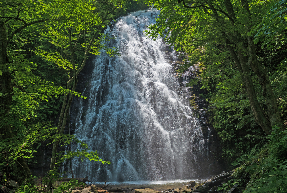
Natural Diversity on Display

These trails showcase the remarkable environmental diversity that makes the Asheville region a world-class hiking destination. From the Canadian-like spruce-fir forests of Mount Mitchell to the almost tropical atmosphere of waterfall basins in Pisgah National Forest, the area offers ecological variety typically found across thousands of miles compressed into a compact, accessible region.
This natural wealth, combined with the cultural heritage of the Southern Appalachians, creates hiking experiences that satisfy both the desire for physical challenge and the deeper human need to connect with wild, beautiful, and inherently restorative landscapes.
More from Travel Pug

- Cities Growing so Fast You Won’t Recognize Them in 10 Years
- 13 Destinations Where Tourists Regularly Regret Their Trip
- 16 U.S. Cities That Are Quietly Becoming Travel Hotspots
- Where to Travel If You Love Long Bus Rides and Daydreams
- 20 Cities Perfect for Solo Travelers Who Crave Adventure & Culture
Like Travel Pug’s content? Follow us on MSN.