
The Great Lakes region offers some of the most spectacular coastal scenery in North America. Ancient geological forces carved dramatic bluffs and cliffs that rise majestically from the water’s edge. These elevated perches became natural settling spots for communities that needed both protection from harsh lake storms and strategic vantage points for navigation and trade.
From Lake Superior’s rugged northern shores to Lake Ontario’s gentler southern bluffs, each community tells a unique story of adaptation and survival. Here’s a list of 20 remarkable cliffside towns that showcase the diverse beauty and character of America’s inland seas.
Duluth, Minnesota
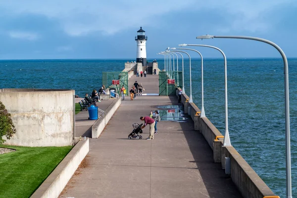
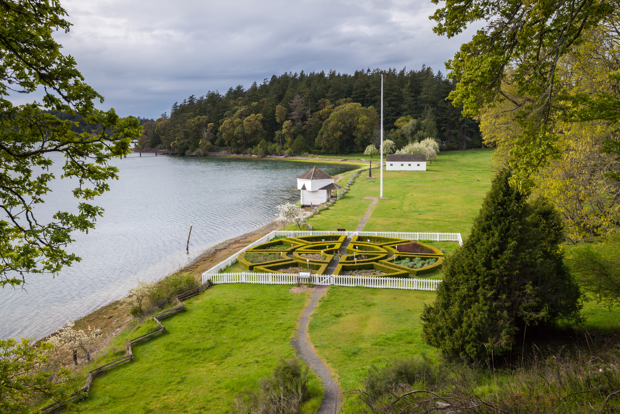
Duluth sits dramatically on a series of steep hills and bluffs overlooking Lake Superior, with some neighborhoods perched more than 600 feet above the water. The city’s Skyline Parkway winds along these heights, offering spectacular views of the Aerial Lift Bridge and the vast expanse of the world’s largest freshwater lake.
This elevation made Duluth a natural hub for the iron ore trade, as massive ships could be spotted from miles away as they approached the harbor.
Grand Marais, Minnesota
This charming artists’ colony clings to rocky bluffs along Lake Superior’s North Shore, where the Sawtooth Mountains meet the water in dramatic fashion. Grand Marais sits at the base of towering cliffs that rise over 1,000 feet within just a few miles inland, creating a stunning backdrop for the town’s colorful harbor.
The combination of lighthouse views and cliff-top hiking trails makes this one of Minnesota’s most photographed destinations.
Like Travel Pug’s content? Follow us on MSN.
Bayfield, Wisconsin

Bayfield occupies a natural amphitheater of bluffs overlooking the Apostle Islands, with Victorian homes cascading down the hillsides toward Lake Superior’s shore. The town’s elevated position provides commanding views of the 22 islands scattered across the lake, many of which feature their dramatic cliffs and sea caves.
Apple orchards thrive on these south-facing slopes, taking advantage of the lake’s moderating influence on the local climate.
Munising, Michigan
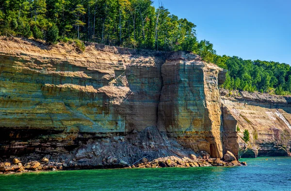
Munising serves as the gateway to Pictured Rocks National Lakeshore, where multicolored sandstone cliffs tower up to 200 feet above Lake Superior. The town itself sits in a protected bay surrounded by forested bluffs, offering visitors easy access to some of the most spectacular cliff formations in the Great Lakes region.
These ancient cliffs tell the story of millions of years of geological history, with iron oxide creating the famous rainbow streaks that give Pictured Rocks its name.
Mackinac Island, Michigan

The entire island of Mackinac rises dramatically from Lake Huron, with limestone bluffs reaching heights of over 300 feet above the water. Fort Mackinac sits strategically on these commanding heights, where British and American forces once controlled the vital straits between Lakes Huron and Michigan.
Today, visitors can take horse-drawn carriages up the bluff roads to enjoy panoramic views that stretch for dozens of miles across the sparkling waters.
Like Travel Pug’s content? Follow us on MSN.
Frankfort, Michigan
Frankfort perches on sandy bluffs along Lake Michigan’s eastern shore, where the Betsie River cuts through towering dunes to reach the lake. The town’s lighthouse sits atop a 40-foot bluff, guiding vessels through the narrow channel that connects Betsie Lake to Lake Michigan.
These elevated dunes provide perfect vantage points for watching spectacular sunsets over the water, especially during the autumn months when the surrounding forests burst into color.
Leland, Michigan

Leland’s historic Fishtown district sits at the base of dramatic bluffs along the Leelanau Peninsula, where the Leland River tumbles over a series of small waterfalls before reaching Lake Michigan. The surrounding hills rise over 400 feet above the lake, covered in cherry orchards and vineyards that benefit from the elevated terrain’s excellent drainage.
This combination of water access and elevated growing conditions has made Leland a center for both fishing and agriculture for over a century.
Glen Arbor, Michigan
Glen Arbor nestles in a valley between the towering Sleeping Bear Dunes, which rise an impressive 450 feet above Lake Michigan’s surface. These massive sand bluffs create one of the most recognizable landmarks on the Great Lakes, visible from more than 30 miles offshore.
The town serves as a base camp for exploring both the dunes and the historic farms that dot the elevated plateaus behind the coastal bluffs.
Like Travel Pug’s content? Follow us on MSN.
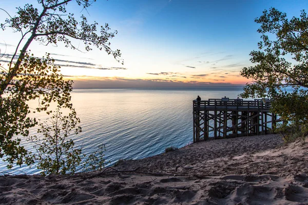
St. Joseph, Michigan
St. Joseph spreads across a series of bluffs overlooking Lake Michigan, with the downtown area perched about 100 feet above the lake’s surface. The famous Silver Beach stretches below these bluffs, accessible by a network of staircases that wind down through the sandy cliffs.
Historic homes line the bluff tops, taking advantage of cooling lake breezes and spectacular water views that extend to the Chicago skyline on clear days.
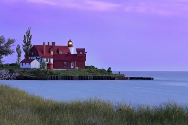
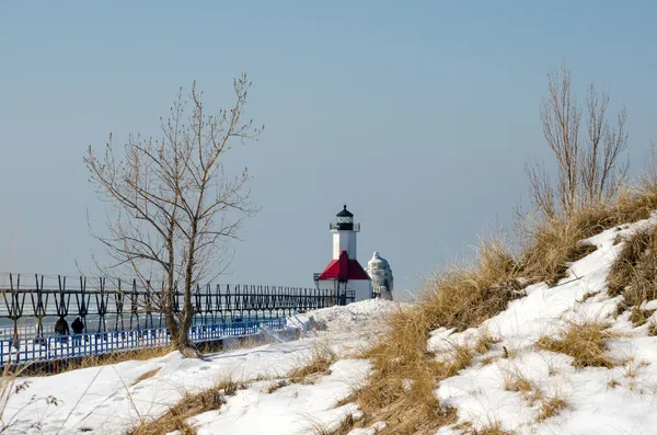
South Haven, Michigan
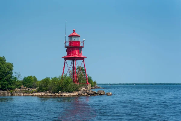
South Haven’s residential areas climb the wooded bluffs that overlook Lake Michigan, offering residents and visitors elevated views of the lake’s eastern shore. The town’s iconic red lighthouse sits at the end of a pier below these bluffs, creating picture-perfect scenes that attract photographers from across the Midwest.
Beach stairs carved into the sandy cliffs provide access to miles of pristine shoreline, while the elevated downtown area stays cool even on the hottest summer days.
Fish Creek, Wisconsin
Fish Creek occupies a natural harbor surrounded by limestone bluffs in Wisconsin’s Door County peninsula. The town’s historic buildings seem to spill down the hillsides toward Green Bay waters. These Niagara Escarpment cliffs rise over 200 feet above the lake, creating dramatic backdrops for the area’s famous fish boils and summer theater productions.
The combination of protected waters and elevated terrain made this an ideal location for early settlers who needed both safe harbor and defensible positions.
Like Travel Pug’s content? Follow us on MSN.
Ephraim, Wisconsin

Ephraim’s white clapboard buildings climb the bluffs overlooking Eagle Harbor on Green Bay, creating one of Door County’s most picturesque scenes. The town sits on terraced levels carved into the limestone cliffs, with narrow streets winding between buildings that seem to defy gravity as they cling to the steep slopes.
These elevated perches provide spectacular views across the bay to Michigan’s Upper Peninsula, especially during the area’s famous autumn color displays.
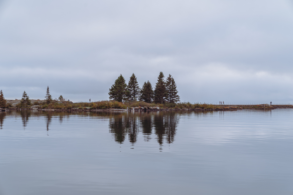
Washington Island, Wisconsin
Washington Island rises from the waters north of the Door County peninsula, with limestone bluffs and rolling hills that reach elevations of over 200 feet above Lake Michigan. The island’s dramatic Rock Island State Park features some of the most spectacular cliff formations in the Great Lakes, where ancient coral reefs now tower above crashing waves.
Scandinavian settlers were drawn to these elevated locations, which reminded them of their Norwegian and Icelandic homelands.
Alpena, Michigan
Alpena sits on elevated ground along Thunder Bay on Lake Huron, where limestone quarries have carved dramatic cliffs and terraces into the landscape for over a century. The town’s position on these natural heights provides excellent views of Thunder Bay’s numerous shipwrecks, which lie preserved in the cold, clear waters below.
Alpena’s maritime museum takes advantage of this elevated vantage point to help visitors understand the treacherous navigation challenges that claimed so many vessels in these waters.
Like Travel Pug’s content? Follow us on MSN.
Oscoda, Michigan
Oscoda spreads along high sandy bluffs where the Au Sable River meets Lake Huron, creating a natural elevated platform that overlooks miles of pristine shoreline. These ancient dune formations rise over 100 feet above the lake, supporting rare plants and providing crucial nesting sites for migrating birds.
The town’s position on these heights made it a natural choice for early loggers who needed clear views of log drives coming down the Au Sable River.
Port Austin, Michigan
Port Austin occupies the tip of Michigan’s Thumb region, where limestone bluffs and sandy cliffs create a diverse coastal landscape along Lake Huron’s Saginaw Bay. The town sits on elevated ground that provides 360-degree water views, making it feel more like an island community than a mainland settlement.
These natural heights offer protection from the severe storms that can sweep across the bay, while providing spectacular vantage points for watching both sunrise and sunset over the water.
Sandusky, Ohio
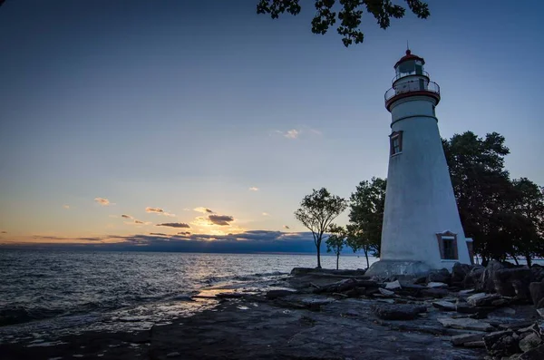
Sandusky spreads across limestone bluffs overlooking Sandusky Bay and the Lake Erie islands, with many neighborhoods perched 50 to 100 feet above the water’s surface. The city’s elevated position made it a natural transportation hub, where travelers could spot approaching ships from miles away across the lake’s relatively shallow waters.
Today, these same heights provide perfect views of Cedar Point’s famous roller coasters and the ferries that carry visitors to Put-in-Bay and Kelley’s Island.
Like Travel Pug’s content? Follow us on MSN.
Put-in-Bay, Ohio
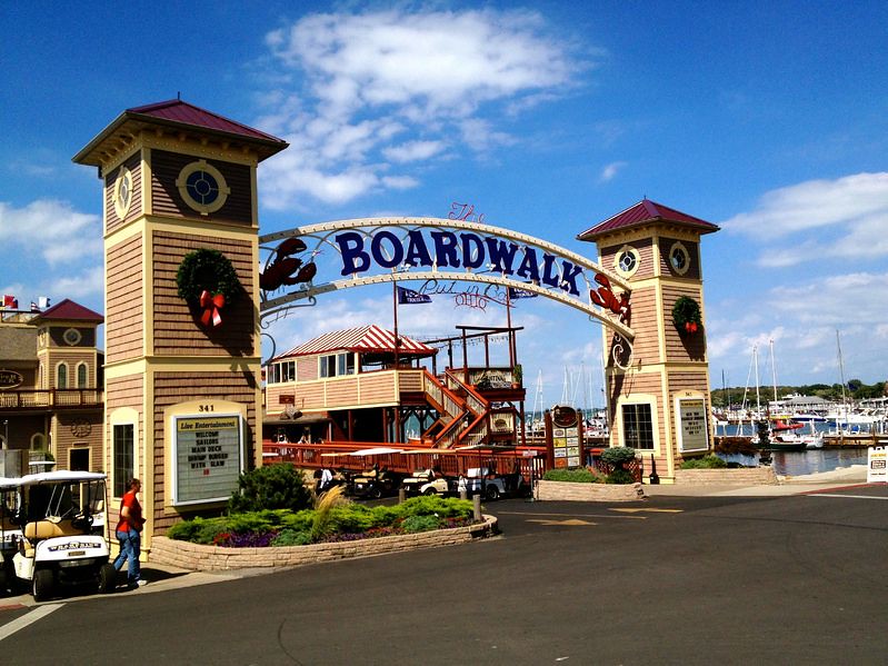
Put-in-Bay covers South Bass Island in Lake Erie, where limestone cliffs and elevated terrain create natural amphitheaters overlooking some of the lake’s most protected waters. The island’s highest point rises over 200 feet above Lake Erie, topped by the famous Perry’s Victory Memorial, which commemorates the War of 1812 naval battle fought in these waters.
These commanding heights made the island strategically important during various conflicts, while today, they provide spectacular views of the Canadian shoreline just 25 miles away.
Niagara-on-the-Lake, Ontario

Niagara-on-the-Lake sits on a series of gentle bluffs where the Niagara River meets Lake Ontario, creating elevated vineyard sites that produce some of Canada’s finest wines. The town’s historic district occupies these natural terraces, with tree-lined streets that offer glimpses of both the lake and the famous Niagara River.
These heights provided perfect defensive positions during the War of 1812, and today they offer visitors elevated views of the river mouth and Toronto’s distant skyline.
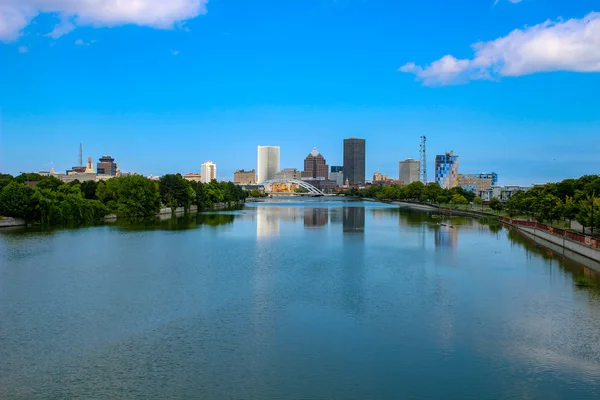
Rochester, New York

Rochester’s lakefront Durand-Eastman Park stretches along dramatic bluffs that rise over 100 feet above Lake Ontario’s southern shore, creating a natural barrier between the city and the lake. These ancient beach ridges and coastal bluffs support rare plants and provide crucial stopover habitat for migrating birds following the Great Lakes flyway.
The combination of elevated terrain and lake access made Rochester a natural choice for early mills and industries that needed both water power and commanding views of approaching ships.
Like Travel Pug’s content? Follow us on MSN.
Where Water Meets Sky
These 20 cliffside communities represent more than just scenic beauty—they embody the story of human adaptation to one of North America’s most dramatic landscapes. Each town developed its unique character by working with, rather than against, the natural advantages that elevation provides along these massive freshwater seas. From Duluth’s iron ore ports to Niagara-on-the-Lake’s terraced vineyards, these communities show how geography shapes destiny.
Today, as climate change and development pressure threaten many coastal areas, these elevated Great Lakes towns offer valuable lessons about sustainable living in harmony with dramatic natural landscapes. Their enduring appeal proves that sometimes the best view comes from taking the high ground.
More from Travel Pug

- 20 Best Beach Towns in the Carolinas
- 13 Destinations Where Tourists Regularly Regret Their Trip
- 20 Destinations That Are More Magical Without an Itinerary
- 20 Underrated Adventures That Belong on Your Travel List
- 20 Cities Where You Should Just Wing It, No Planning Required
Like Travel Pug’s content? Follow us on MSN.