
The Hudson River flows 315 miles from the Adirondack Mountains to New York Harbor, creating one of America’s most historically significant and scenically diverse waterways. While many experience its majesty from shoreline parks or riverside trails, paddling directly on its surface reveals perspectives impossible to appreciate from land.
Here is a list of 20 remarkable Hudson River vistas best experienced from the intimate vantage point of a kayak, where water-level immersion transforms familiar landmarks and reveals hidden treasures inaccessible to land-bound observers.
Palisades Cliffs from River Level
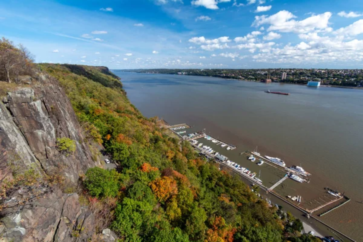
These dramatic basalt formations rise 300–500 feet directly from the water, creating imposing vertical walls visible for miles when viewed from shore. Paddling directly beneath these cliffs reveals intricate textures of the columnar basalt, mineral streaks, and nesting locations of peregrine falcons that are otherwise invisible from distant viewpoints.
Morning paddlers experience dramatic lighting as sunrise illuminates the east-facing cliffs with golden light, accentuating every crevice and outcropping.
Bear Mountain Bridge Underpass
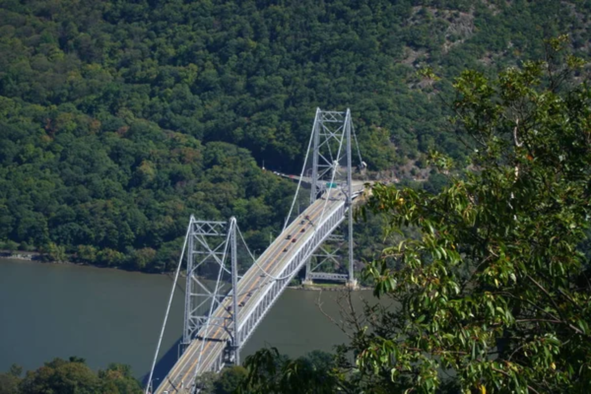
This historic span connects Bear Mountain and Anthony’s Nose across one of the river’s narrowest points, creating a cathedral-like space beneath its structure. Paddlers passing underneath experience the bridge from a perspective few ever witness, where massive concrete piers rise directly from the water amid swirling currents.
The acoustics beneath the span amplify river sounds while framing views both upstream and downstream through the geometric patterns of its supporting trusses.
Like Travel Pug’s content? Follow us on MSN.
Constitution Marsh Audubon Sanctuary
This tidal wetland south of Cold Spring allows kayakers to penetrate deep into areas unreachable by larger craft, revealing intimate glimpses of marsh ecology in action. Narrow channels wind through dense vegetation where herons stalk prey and osprey circle overhead searching for fish swimming just inches beneath your hull.
The restored habitat demonstrates successful conservation efforts, creating crucial wildlife corridors in surprisingly close proximity to urban development.
West Point Waterfront
The historic military academy presents an imposing granite facade when viewed from water level, with parade grounds and Gothic-inspired architecture perched dramatically above the river. Paddlers navigate past former artillery emplacements where massive chain booms once stretched across the river to block British warships during the Revolutionary War.
Evening paddlers witness sunset illuminating the academy’s stone buildings with amber light while enjoying perspectives far different from typical tourist viewpoints.
Bannerman Castle
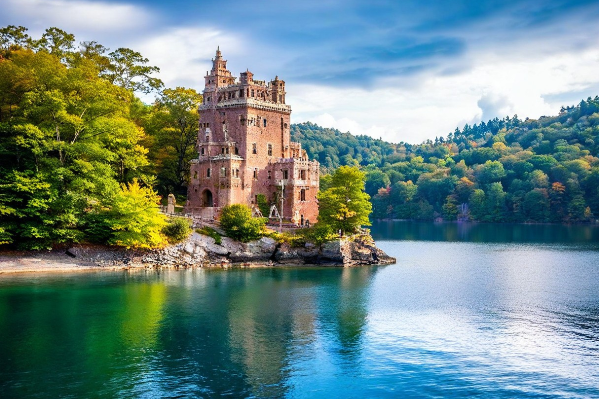
This crumbling island fortress rises from Pollepel Island like something from a fairy tale, its partially collapsed Scottish-inspired battlements creating a hauntingly beautiful silhouette. Kayakers can circle the entire island, viewing the deteriorating structure from angles impossible to appreciate from tour boats restricted to deeper waters.
Morning fog frequently shrouds the lower sections of the ruins as upper towers emerge dramatically from the mist in a scene worthy of romantic painters.
Like Travel Pug’s content? Follow us on MSN.
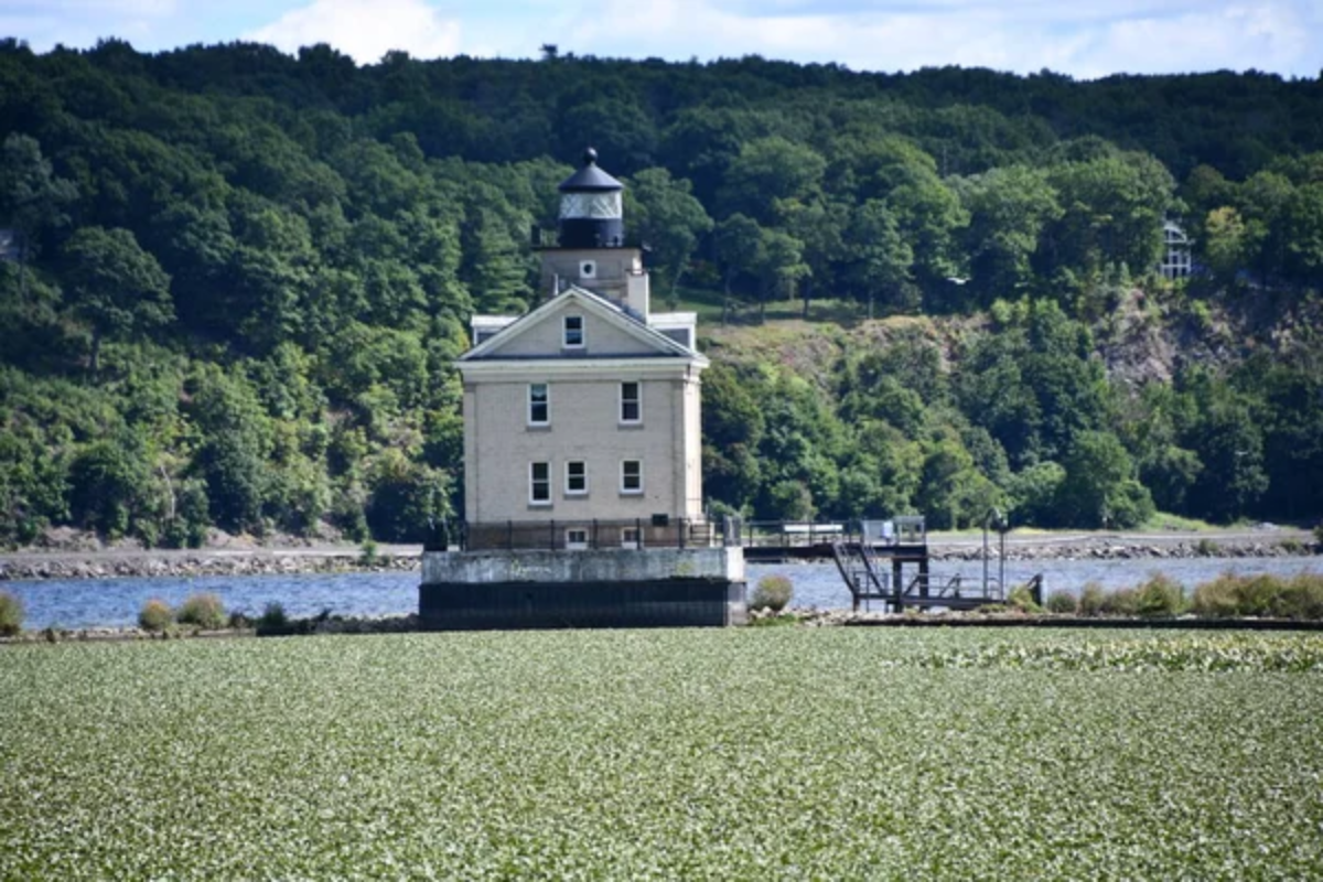
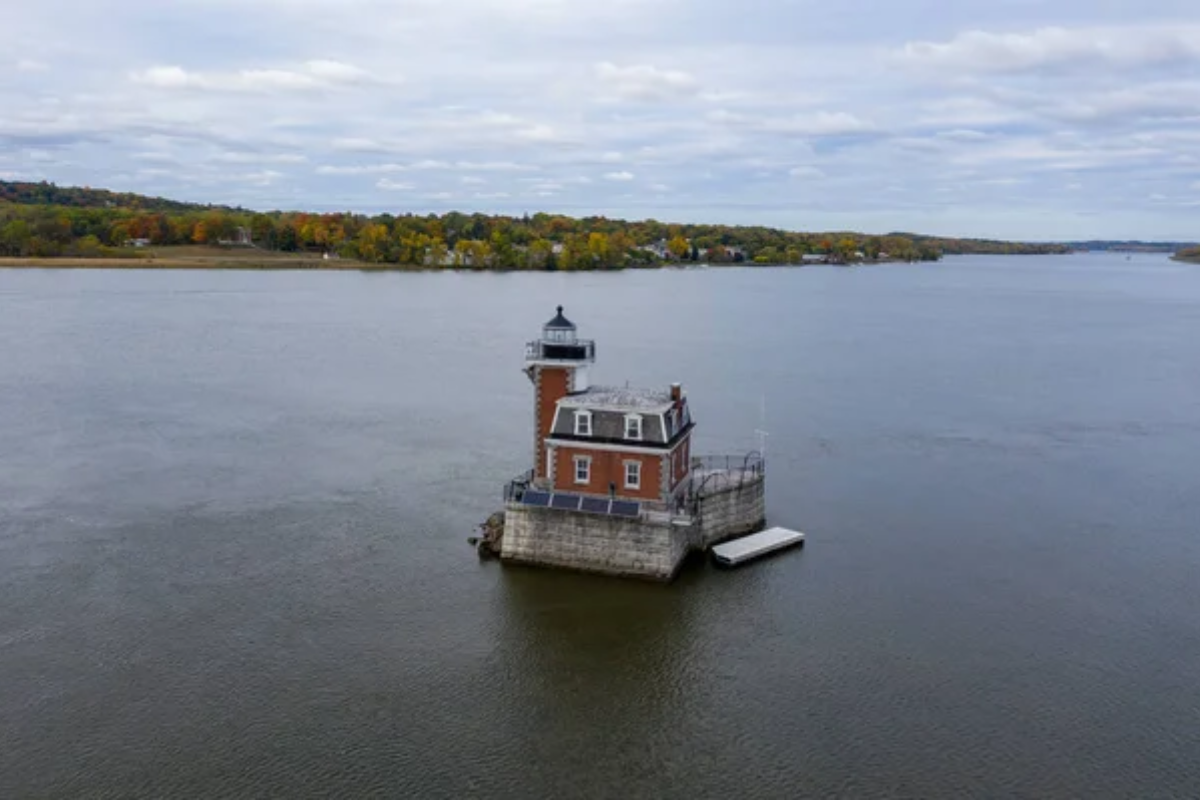
Esopus Meadows Lighthouse
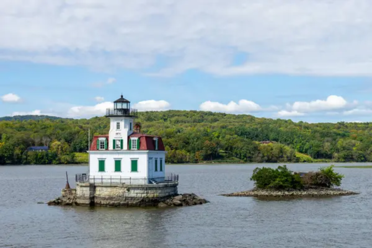
This restored 1871 lighthouse stands directly in the river atop a shallow, rocky reef marking a navigational hazard for larger vessels. Paddlers can approach remarkably close to its hexagonal wooden structure while waterbirds rest on surrounding shoals exposed during low tide.
The lighthouse keeper’s dwelling remains furnished with period pieces visible through windows, providing glimpses into the daily life of those who once maintained this isolated outpost.
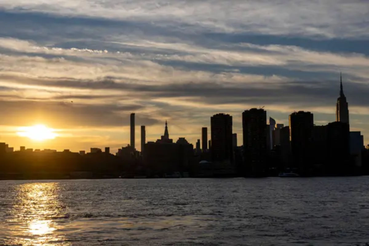
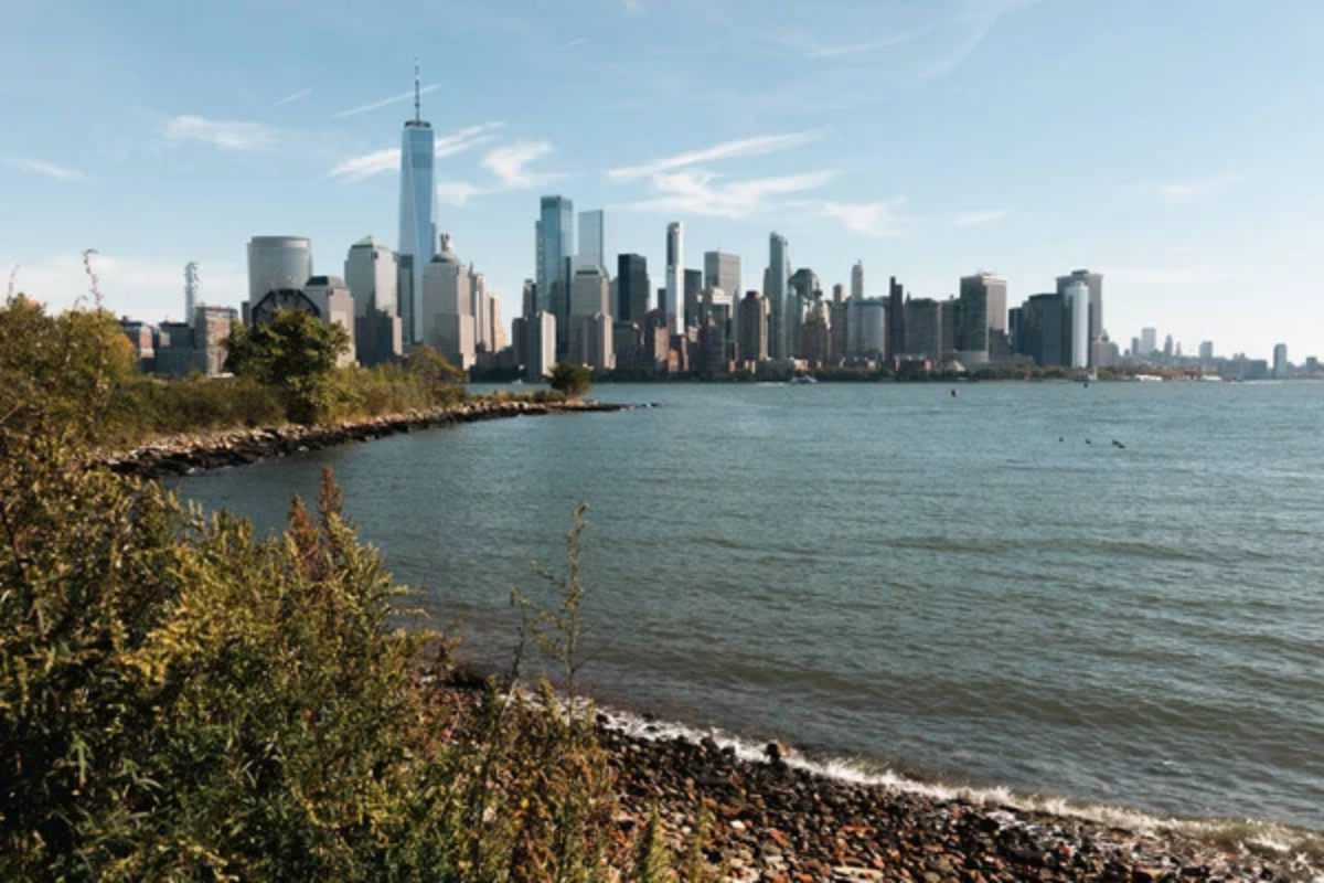
Manhattan Skyline from Hoboken Cove
This protected paddling area offers breathtaking views of the entire Manhattan skyline rising dramatically across the water without the intimidating currents of mid-river channels. Sunset transforms the glass-and-steel towers into gold-and-copper monuments as windows reflect the changing light across the water’s surface.
Night paddling (with appropriate safety gear) reveals the illuminated cityscape in its full glory, mirrored in the water surrounding your kayak.
Croton Point Marsh
The largest peninsula on the Hudson features extensive tidal marshes accessible only by small watercraft navigating narrow channels between dense vegetation. Great egrets and snowy egrets feed in shallow waters, while muskrats maintain elaborate channel systems through the reeds, visible only from the water level.
Fall transforms this area into a spectacular display of color as marsh grasses shift to amber and gold hues, reflecting perfectly in the still backwaters.
Like Travel Pug’s content? Follow us on MSN.
Storm King Mountain
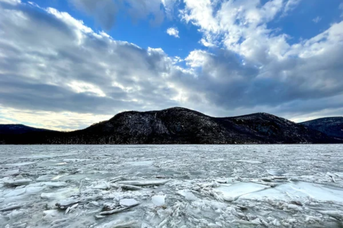
This iconic mountain drops precipitously into the river, creating dramatic cliff faces and massive talus slopes rarely appreciated from standard viewpoints. Paddling directly beneath its imposing mass provides perspectives showing how the river literally carved through the mountain during ancient geological processes.
Dawn paddlers often experience unique weather conditions as morning fog flows dramatically over the mountain’s summit and cascades down its flanks toward the water.
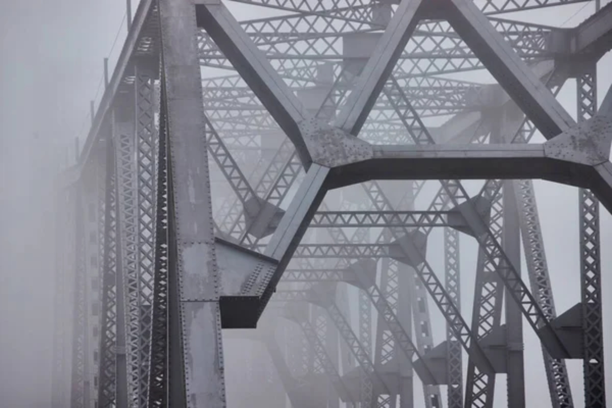
Kingston-Rhinecliff Bridge Passage
This soaring span carries traffic 150 feet above the river’s surface, creating a dramatic aerial panorama for those passing beneath its central section. Kayakers experience the impressive scale of its engineering when viewed from directly below, where massive concrete piers emerge from the water to support the seemingly delicate roadway above.
The crossing represents one of the Hudson’s wider sections, providing expansive views in all directions from this central position.
Stockport Flats Tidal Marshes
This extensive wetland complex north of Hudson represents the largest remaining tidal marsh system in the upper Hudson estuary. Kayakers navigate through a maze of channels where tidal fluctuations transform the landscape twice daily, revealing mudflats teeming with feeding shorebirds during low water.
The National Estuarine Research Reserve conducts ongoing monitoring visible to observant paddlers who might spot researchers collecting samples amidst the dense vegetation.
Like Travel Pug’s content? Follow us on MSN.
Rip Van Winkle Bridge Perspective
This graceful suspended span connects Hudson with Catskill across a particularly scenic section of the river flanked by rolling agricultural landscapes. Paddling beneath its central span provides a unique perspective on the bridge’s elegant engineering while framing views of the Catskill Mountain escarpment rising dramatically to the west.
The bridge’s green painted structure contrasts beautifully with blue skies and often appears to float above the water when viewed from directly below.
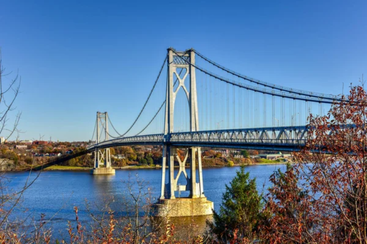
Tappan Zee Panorama
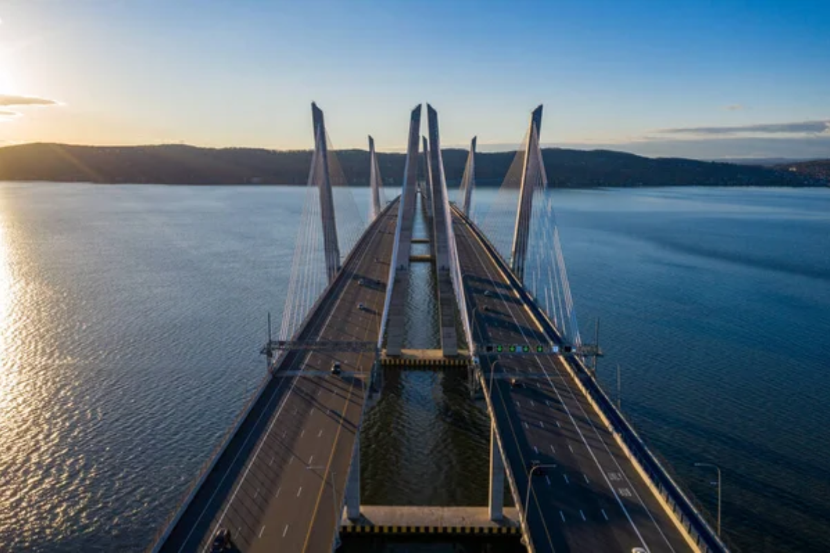
The widest section of the Hudson creates an inland sea-like experience for paddlers crossing between Tarrytown and Nyack, where shore-to-shore paddling requires careful navigation. This expansive crossing provides breathtaking views of both the modern Mario Cuomo Bridge and remaining sections of the original Tappan Zee Bridge being systematically dismantled.
Midstream positions reveal the river’s true scale and significant maritime traffic, including cargo vessels and historic sailing ships, during the summer months.
Iona Island Bird Sanctuary
This former naval ammunition depot transformed into a wildlife refuge allows paddlers to circumnavigate the entire island while observing multiple eagle nests established in recent decades. The marsh areas surrounding the island host diverse waterfowl populations while remnants of military infrastructure emerge from encroaching vegetation in a fascinating blend of natural and human history.
Paddling through the railroad trestle connecting the island to the mainland provides a unique perspective on this critical transportation corridor.
Like Travel Pug’s content? Follow us on MSN.
Hudson Highlands State Park Waterfront
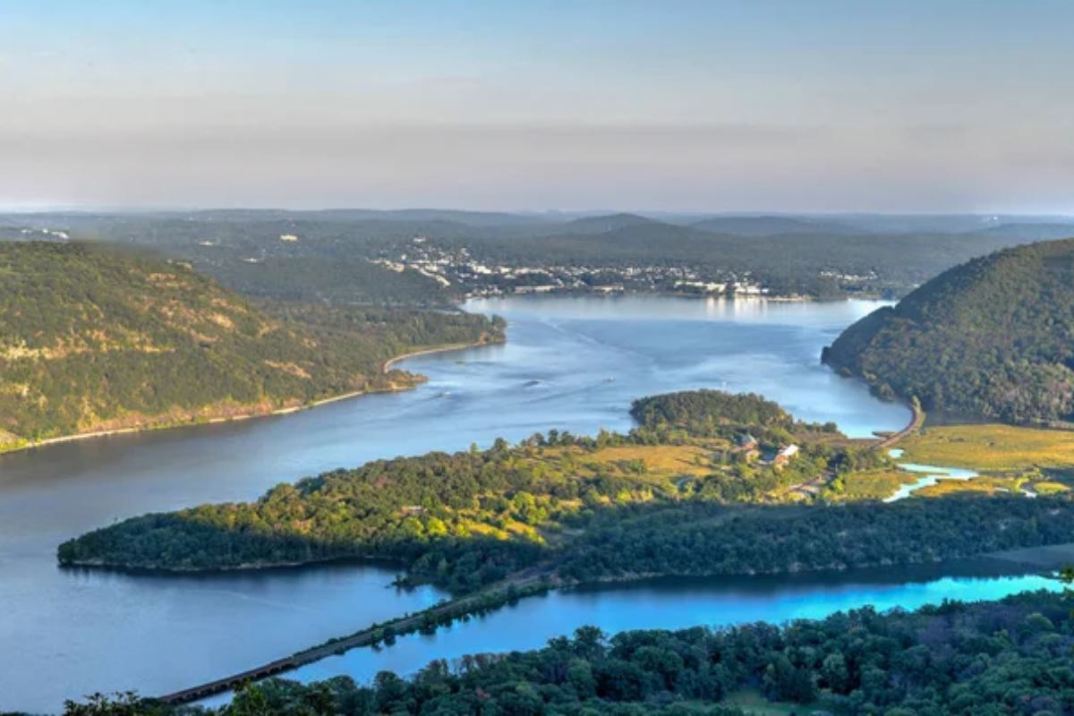
This dramatic section, where the river narrows and deepens, creates turbulent currents flowing around Hudson Highlands peaks rising directly from the water. Paddling close to these steep shorelines reveals intricate rock formations, seasonal waterfalls, and pockets of old-growth forest clinging to seemingly impossible slopes.
Early morning paddlers often witness ethereal mist formations hovering above the water’s surface while drifting silently through this cathedral-like landscape.
Schodack Island Channels
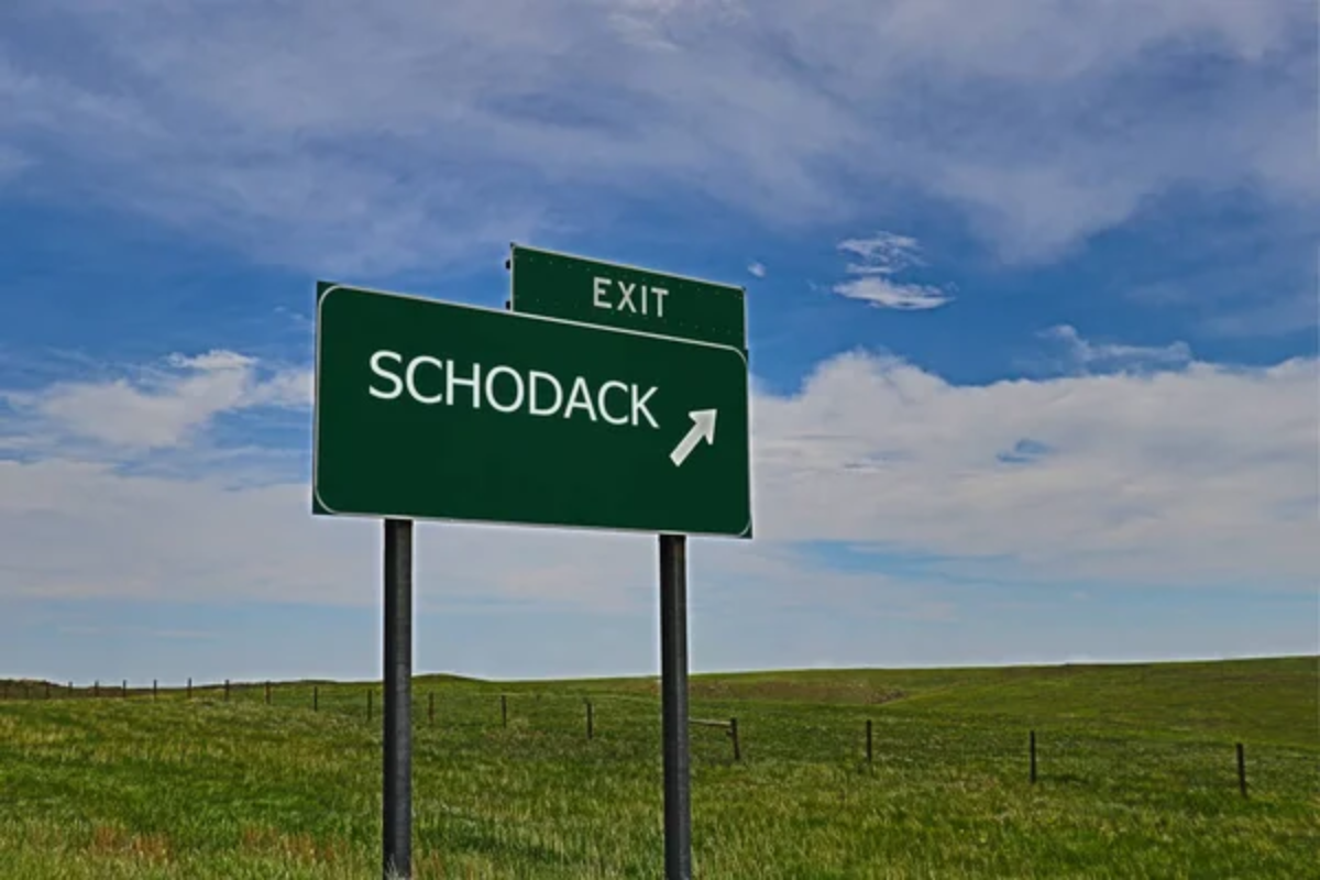
This complex of narrow waterways separates Schodack Island from the eastern shore, creating intimate paddling experiences through forested corridors sheltered from the main river’s commercial traffic. Great blue herons maintain nesting colonies visible from the water level, while bald eagles patrol overhead, searching for fish in the productive backwaters.
The island’s position dividing river flow creates fascinating current patterns paddlers can utilize for effortless exploration of its protected eastern shoreline.
Hudson-Athens Lighthouse
This historic 1874 lighthouse stands directly mid-river at a former navigation choke point where river pilots once guided vessels through tricky shallows. Paddlers can circle the entire structure, appreciating the architectural details of its distinctive Second Empire design featuring a mansard roof and decorative ironwork.
Scheduled summer open houses allow paddlers to land at the structure’s small dock for interior tours that explain the lighthouse keeper’s isolated lifestyle in this river outpost.
Like Travel Pug’s content? Follow us on MSN.
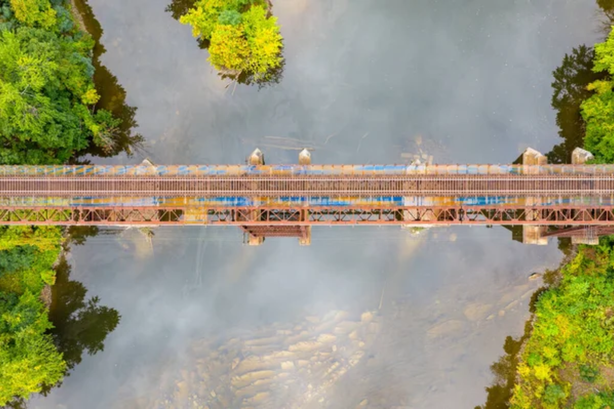
Poughkeepsie Railroad Bridge Underpass
Now transformed into the pedestrian Walkway Over the Hudson, this former railroad bridge towers 212 feet above the river, creating a dramatic ceiling for paddlers passing beneath its massive spans. The juxtaposition of kayakers passing beneath while pedestrians stroll above creates fascinating scale relationships and photographic opportunities from the river level.
The bridge’s century-old steel framework displays impressive engineering when viewed from directly below, where intricate truss systems become fully apparent.
Catskill Creek Confluence
This significant tributary joins the Hudson at the town of Catskill, creating complex current patterns and ecological transitions between freshwater systems. Paddlers can navigate upstream into the protected creek where overhanging trees create dappled lighting effects on the water’s surface while revealing glimpses of historic structures along its banks.
The confluence itself demonstrates visible water mixing patterns where differently colored water masses swirl together in fascinating fluid dynamics displays.
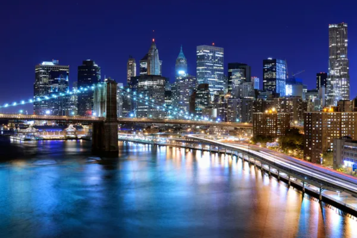
George Washington Bridge from Inwood
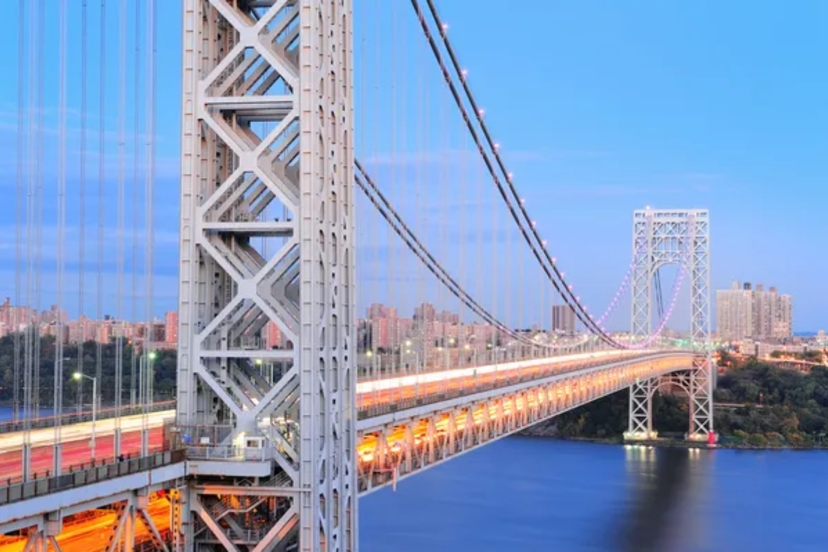
This colossal suspension bridge connecting Manhattan with New Jersey creates a monumental gateway between the river’s urban and more natural northern sections. Paddling beneath its massive span reveals the impressive scale, impossible to fully appreciate from land, with soaring towers anchored by massive concrete piers rising from the water.
Night paddlers witness the bridge’s necklace lighting reflecting on the water while distant Manhattan skyscrapers create a glittering backdrop to this engineering marvel.
Like Travel Pug’s content? Follow us on MSN.
River Highway Perspectives
The Hudson River offers paddlers an intimate connection to a waterway that has shaped American history, commerce, art, and ecology for centuries. These twenty viewpoints represent merely starting suggestions for exploring over 300 miles of navigable waterway accessible to paddlers of varying skill levels with proper safety precautions.
While photographs showcase these locations from fixed positions, actually moving through these environments by kayak creates sensory experiences combining visual beauty with the sounds, scents, and tactile feedback only available to those who venture directly onto the water’s surface.
More from Travel Pug

- Cities Growing so Fast You Won’t Recognize Them in 10 Years
- 13 Destinations Where Tourists Regularly Regret Their Trip
- 16 U.S. Cities That Are Quietly Becoming Travel Hotspots
- Where to Travel If You Love Long Bus Rides and Daydreams
- 20 Cities Perfect for Solo Travelers Who Crave Adventure & Culture
Like Travel Pug’s content? Follow us on MSN.