
Arizona’s diverse landscapes, from desert lowlands to alpine forests, offer some of America’s most spectacular road trip opportunities. The state’s remarkable geography creates dramatic transitions between ecosystems that can be fully appreciated from behind the wheel, with roadside viewpoints capturing vistas that reveal the grand scale of the Southwest.
Here is a list of 20 magnificent driving routes across Arizona that showcase the state’s incredible natural beauty, cultural heritage, and engineering marvels.
Oak Creek Canyon Scenic Drive
The winding passage between Sedona and Flagstaff transitions from red rock country to ponderosa pine forest along Highway 89A. This 28-mile stretch features numerous pull-offs offering views of towering sandstone walls and the crystal-clear creek that carved this verdant canyon.
The Oak Creek Vista point near the top of the switchbacks provides a panoramic overlook where the entire canyon unfolds before you like a living landscape painting.
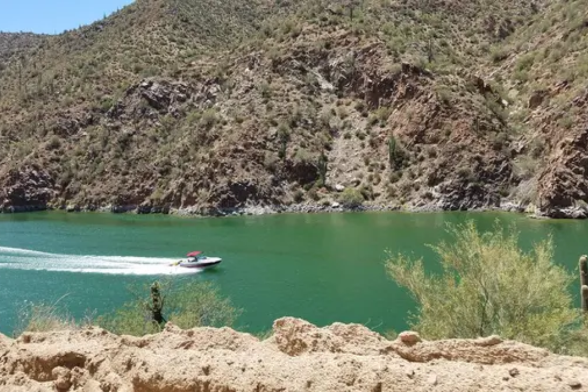
Apache Trail
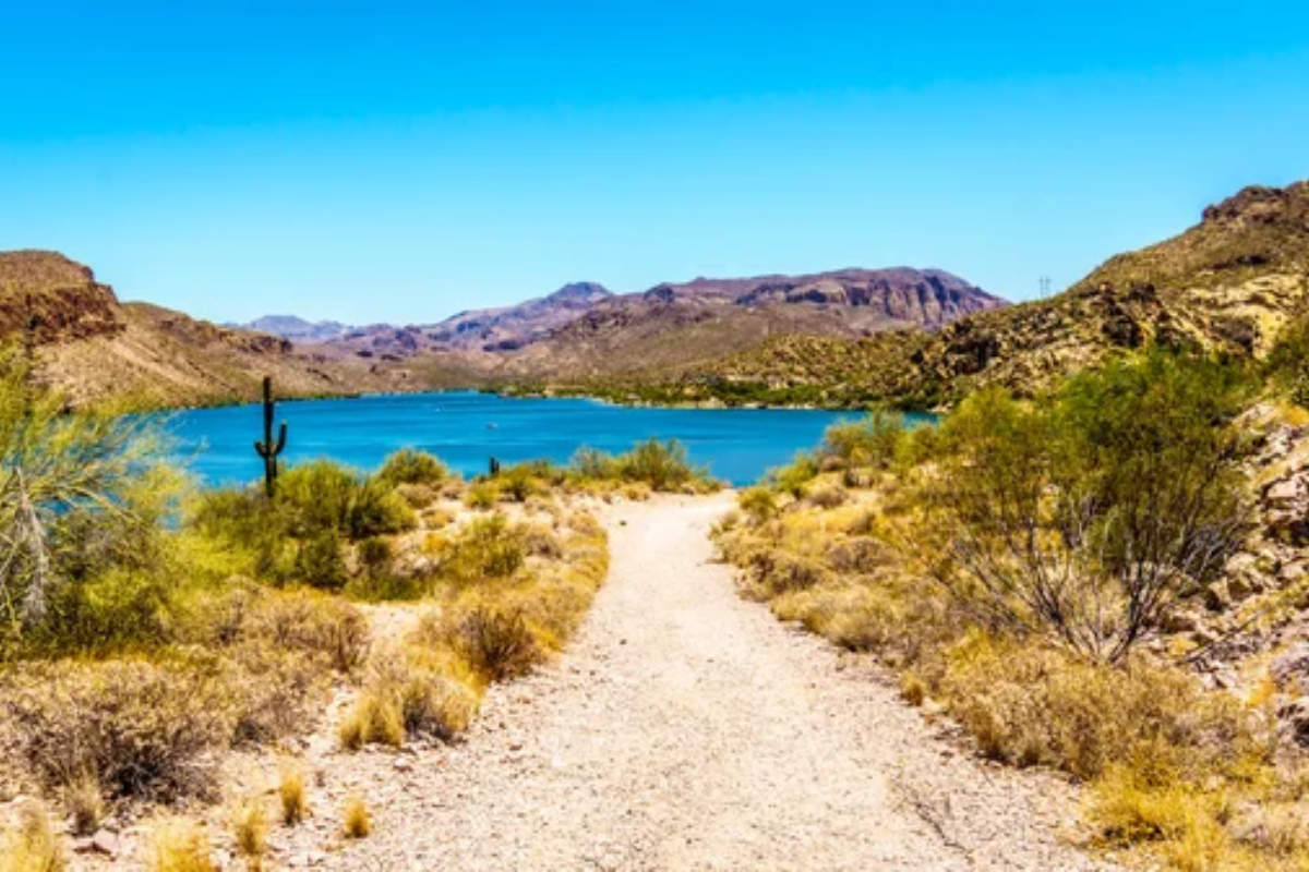
This historic route through the Superstition Mountains follows a path once used by Apache warriors and later stagecoaches. The partially unpaved road skirts canyon edges and passes blue desert lakes with dramatic cliffs reflecting in their waters.
The most dramatic section features Fish Creek Hill, where the narrow road makes a hair-raising descent and breathtaking views of layered canyon walls stretching toward the horizon.
Like Travel Pug’s content? Follow us on MSN.
Monument Valley Tribal Park Loop
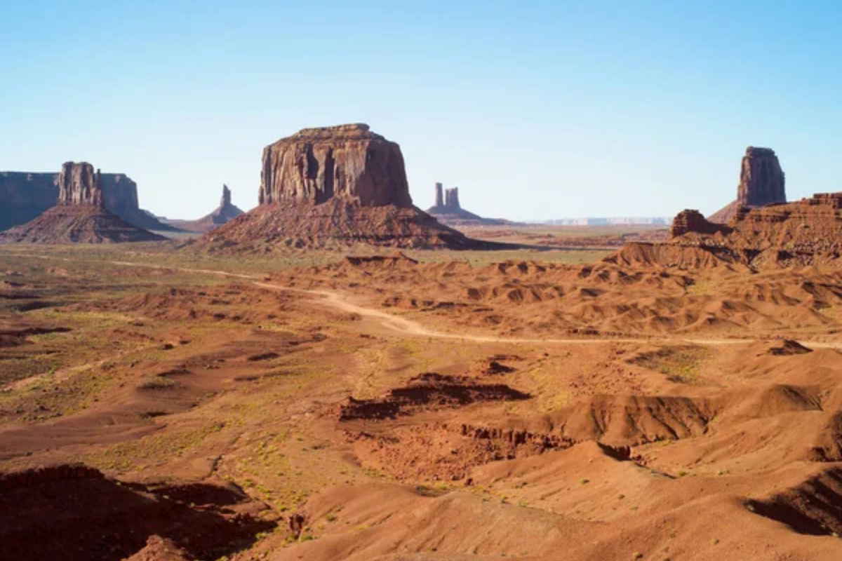
This 17-mile dirt road winds through iconic sandstone formations that have become synonymous with the American West. The valley floor drive passes close to massive buttes and mesas standing in majestic solitude against the vast desert landscape.
Morning and evening light transform the red sandstone monuments with shifting shadows and colors, explaining why filmmakers and photographers have been drawn here for generations.
Mount Lemmon Scenic Byway
Rising from the Sonoran Desert floor to alpine forests, this remarkable route climbs nearly 7,000 feet in just 27 miles. Travelers pass through six distinct ecological zones, equivalent to driving from Mexico to Canada in terms of changing plant and animal communities.
Windy Point Vista may offer the most dramatic view, with massive granite formations in the foreground and Tucson sprawling across the desert floor thousands of feet below.
Historic Route 66
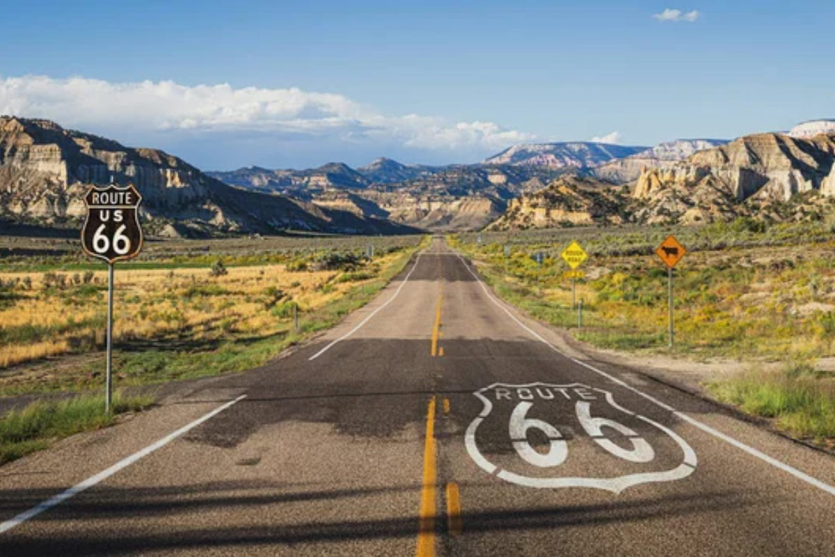
The quintessential American highway cuts across northern Arizona through landscapes made famous in classic road trip literature and music. Small towns with vintage neon signs and classic diners preserve the nostalgic atmosphere of mid-century travel culture.
The drive between Seligman and Kingman represents one of the longest remaining stretches of the original Mother Road, with painted deserts and distant mesas creating a timeless backdrop.
Like Travel Pug’s content? Follow us on MSN.
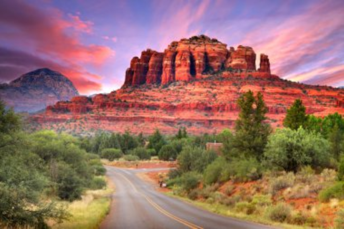
Red Rock Scenic Byway
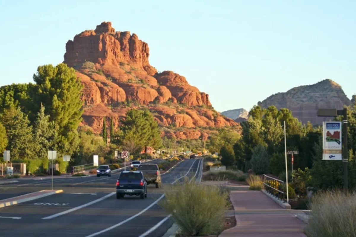
Often called the gateway to Sedona, this 7.5-mile drive along Highway 179 offers a continuous showcase of crimson formations that seem to change shape and color throughout the day. The road’s design intentionally slows traffic with roundabouts that provide varied perspectives of Cathedral Rock, Bell Rock, and other famous formations.
Native landscaping along the route complements the natural beauty while educational stops highlight the geology and cultural significance of the surrounding landscape.
Coronado Trail Scenic Byway
This remote route, following the path of Spanish explorer Francisco Vásquez de Coronado, traverses eastern Arizona’s rugged Blue Range. The drive features more than 400 curves while climbing from desert to alpine elevations along one of America’s most challenging paved roads.
Wildlife sightings are common along less-traveled sections where the roadway winds through pristine forests and mountain meadows far from major population centers.
Sky Island Scenic Byway
The road to Mount Graham International Observatory climbs from desert vegetation through five distinct biological communities. This remarkable transition illustrates the concept of “sky islands,” where mountains rise like biological islands from the surrounding desert sea.
The upper sections pass through the only spruce-fir forest in southern Arizona, home to the endangered Mount Graham red squirrel, which is found nowhere else on Earth.
Like Travel Pug’s content? Follow us on MSN.
Joshua Forest Parkway
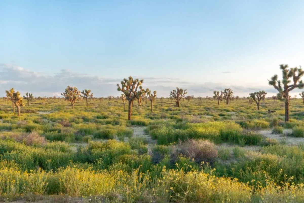
The drive between Wickenburg and Kingman features one of the world’s largest concentrations of Joshua trees, creating an otherworldly landscape. These distinctive yucca plants with their twisted limbs create surreal silhouettes against Arizona’s vivid blue skies.
The route through Mohave County offers long-range views across valleys dotted with these iconic desert sentinels that can live for hundreds of years.
Rim Road (Forest Road 300)
This unpaved forest service road traces the edge of the Mogollon Rim, offering vertigo-inducing views across central Arizona. On clear days, the elevated perspective from atop this massive geological feature reveals panoramas that stretch for over 100 miles.
Ponderosa pines frame vistas of distant mountains and valleys while providing welcome shade for picnics at numerous informal overlooks.
Salt River Canyon Road
Often compared to a miniature Grand Canyon, this dramatic route descends nearly 2,000 feet through colorful rock layers. The highway features tight switchbacks that open to expansive views of the river’s twisting course through the rugged landscape.
The transition between high desert and canyon environments showcases Arizona’s incredible ecological diversity within a relatively short driving distance.
Like Travel Pug’s content? Follow us on MSN.
Kayenta to Monument Valley
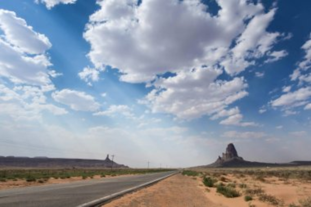
The approach to Monument Valley along Highway 163 creates perhaps the most recognizable road scene in America. The perfectly straight highway stretches toward the iconic buttes, creating the famous image immortalized in countless films and advertisements.
The distant formations gradually grow larger during the approach, revealing their massive scale as the road continues into the heart of the Navajo Nation.
Catalina Highway

This engineering marvel climbs nearly 6,000 feet in 27 miles with spectacular views of Tucson and the surrounding mountain ranges. The road gains about 200 feet in elevation with each mile, passing through distinctly different biotic communities adapted to the changing conditions.
Windy Point and Geology Vista provide dramatic overlooks where visitors can appreciate the remarkable transition from saguaro forests to pine-covered peaks.
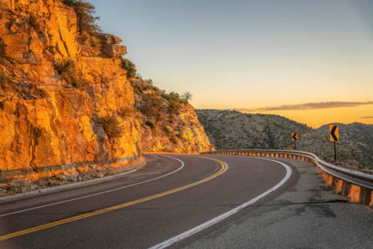
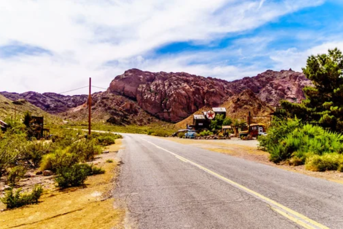
Jerome to Prescott

The winding mountain road connecting these historic mining towns offers stunning views across the Verde Valley. The route passes through the former ghost town of Jerome, perched precariously on Cleopatra Hill, before climbing Mingus Mountain.
Hairpin turns reveal panoramic vistas of red rock formations, distant mountains, and the patchwork of forests and grasslands that define central Arizona’s diverse landscape.
Like Travel Pug’s content? Follow us on MSN.
Petrified Forest National Park Drive
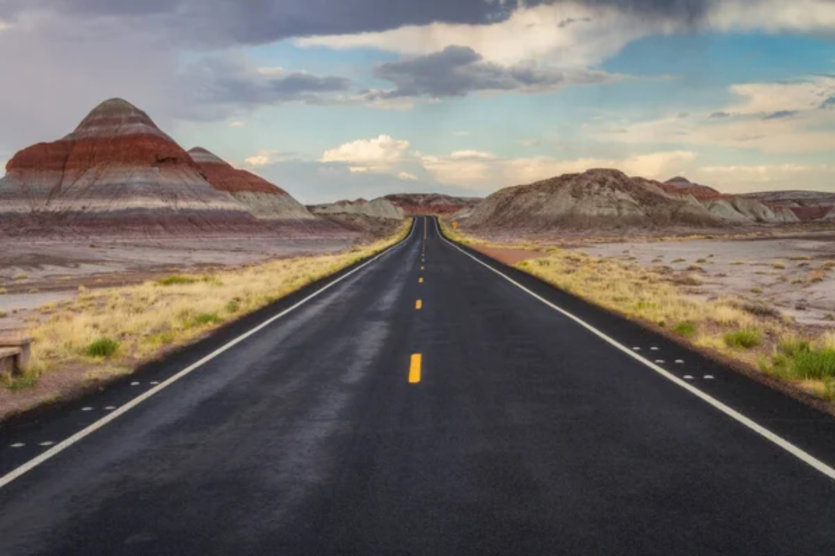
The 28-mile park road winds past colorful badlands, Native American archaeological sites, and the world’s largest concentration of petrified wood. The remarkable landscape of the Painted Desert unfolds in bands of red, orange, and lavender created by mineral deposits in ancient sedimentary layers.
Pullouts along the route allow close examination of 225-million-year-old fossilized trees that have transformed into rainbow-hued quartz crystals while maintaining their original form.
Organ Pipe Cactus National Monument Drives
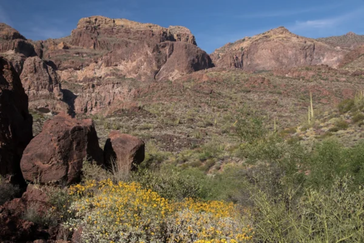
The remote Ajo Mountain Drive and Puerto Blanco Drive showcase the only place in the United States where organ pipe cacti grow naturally. These 21-mile and 37-mile routes reveal incredibly diverse Sonoran Desert plant communities set against rugged mountain backdrops.
Morning and evening light bring dramatic shadows to the landscape, highlighting the sculptural qualities of columnar cacti and creating a photographer’s paradise.
Desert to Tall Pines Scenic Road

This official Arizona scenic road connects Payson with Heber through the dramatic transition zone between desert and mountain environments. The route offers expansive views of the Mogollon Rim, the massive escarpment marking the southern edge of the Colorado Plateau.
Wildlife viewing opportunities abound as the ecosystem shifts from juniper woodlands to dense ponderosa pine forests within a relatively short distance.
Like Travel Pug’s content? Follow us on MSN.
Patagonia-Sonoita Scenic Road
Rolling grasslands reminiscent of the African savanna characterize this scenic drive through southern Arizona’s wine country. The road winds past historic ranches with distant mountain ranges creating a multidimensional backdrop to the golden landscape.
Cottonwood-lined creeks create ribbons of green through the countryside, supporting diverse bird populations that make this region a top destination for wildlife enthusiasts.
Sunset Crater to Wupatki Loop Drive
This fascinating route connects two national monuments within a short drive, showcasing both geological and cultural history. The journey begins amid relatively recent lava flows and cinder cones before descending to ancient pueblo ruins standing in stark red stone against azure skies.
The 36-mile loop offers views of the San Francisco Peaks, expansive desert vistas, and remarkably preserved archaeological sites dating back nearly 900 years.
Highway 89A Through Vermilion Cliffs
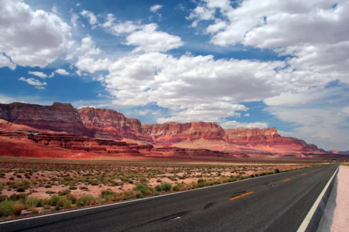
The remote highway between Jacob Lake and Marble Canyon passes through a landscape of massive red cliffs rising dramatically from the surrounding plateau. The Vermilion Cliffs glow with intense color at sunrise and sunset, displaying layered sandstone formations that record hundreds of millions of years of geological history.
The nearby Navajo Bridge spans Marble Canyon, offering pedestrians a vertigo-inducing view of the Colorado River 470 feet below.
Like Travel Pug’s content? Follow us on MSN.
Arizona’s Roadside Wonders
Arizona’s remarkable roadways connect travelers with landscapes that range from otherworldly desert gardens to alpine forests clinging to isolated mountain peaks. Each drive offers a unique perspective on the forces that shaped this diverse state, from ancient geological processes to the cultural heritage of those who have called these lands home.
Whether seeking a short scenic detour or planning an extended road trip, these twenty routes showcase Arizona’s incredible natural beauty in ways that remain etched in memory long after the journey ends.
More from Travel Pug

- Cities Growing so Fast You Won’t Recognize Them in 10 Years
- 13 Destinations Where Tourists Regularly Regret Their Trip
- 16 U.S. Cities That Are Quietly Becoming Travel Hotspots
- Where to Travel If You Love Long Bus Rides and Daydreams
- 20 Cities Perfect for Solo Travelers Who Crave Adventure & Culture
Like Travel Pug’s content? Follow us on MSN.