
America’s national parks system reads like a love letter to the continent’s most spectacular landscapes. From towering redwoods that make you feel like an ant to desert canyons that stretch beyond the horizon, these protected lands offer road trip experiences that no theme park could ever replicate.
The beauty of a national park’s road trip lies in the journey between destinations as much as the parks themselves. Here is a list of 20 road trip routes that connect America’s most incredible national parks into unforgettable adventures.
The Grand Circle
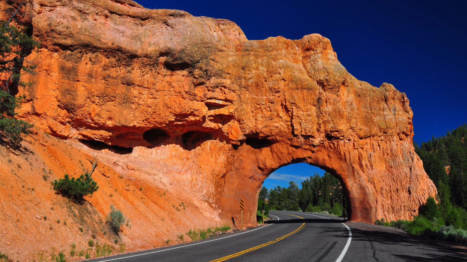
This 1,200-mile loop through Utah and Arizona connects five national parks: Zion, Bryce Canyon, Capitol Reef, Arches, and Canyonlands. Start in Las Vegas and work your way through landscapes that look like they belong on Mars.
The drive between Zion and Bryce Canyon alone takes you from desert floors to alpine meadows in just 85 miles, showcasing how dramatically the Southwest can change.
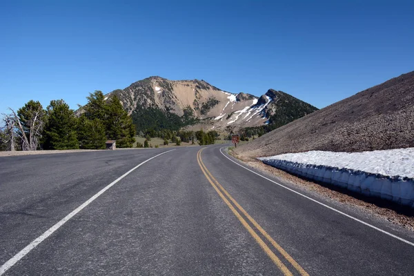
Going-to-the-Sun Road in Glacier National Park

Montana’s Going-to-the-Sun Road stretches 50 miles through Glacier National Park from West Glacier to St. Mary. This engineering marvel climbs over Logan Pass at 6,646 feet, offering views of pristine lakes and snow-capped peaks that’ll make you understand why they call it Big Sky Country.
The road typically opens fully only from late June to mid-October due to snow.
Like Travel Pug’s content? Follow us on MSN.
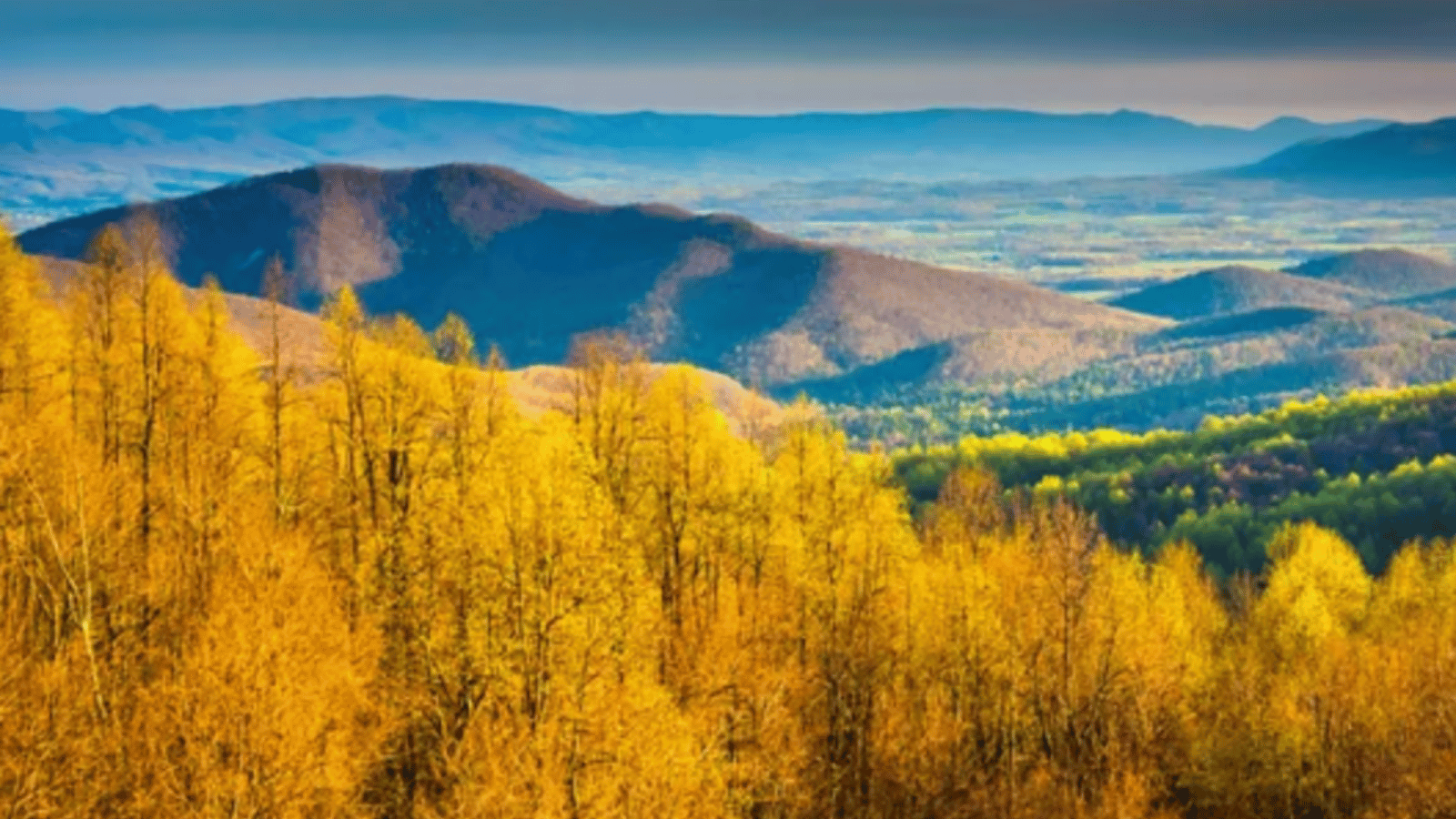
Blue Ridge Parkway Through the Great Smoky Mountains

The Blue Ridge Parkway runs 469 miles from Virginia’s Shenandoah National Park to North Carolina’s Great Smoky Mountains National Park. This scenic route winds through Appalachian highlands where morning mist clings to ancient mountains like nature’s own special effects.
The fall foliage season transforms this drive into a tunnel of gold, orange, and red that stretches for hundreds of miles.
Pacific Coast Highway to Olympic National Park
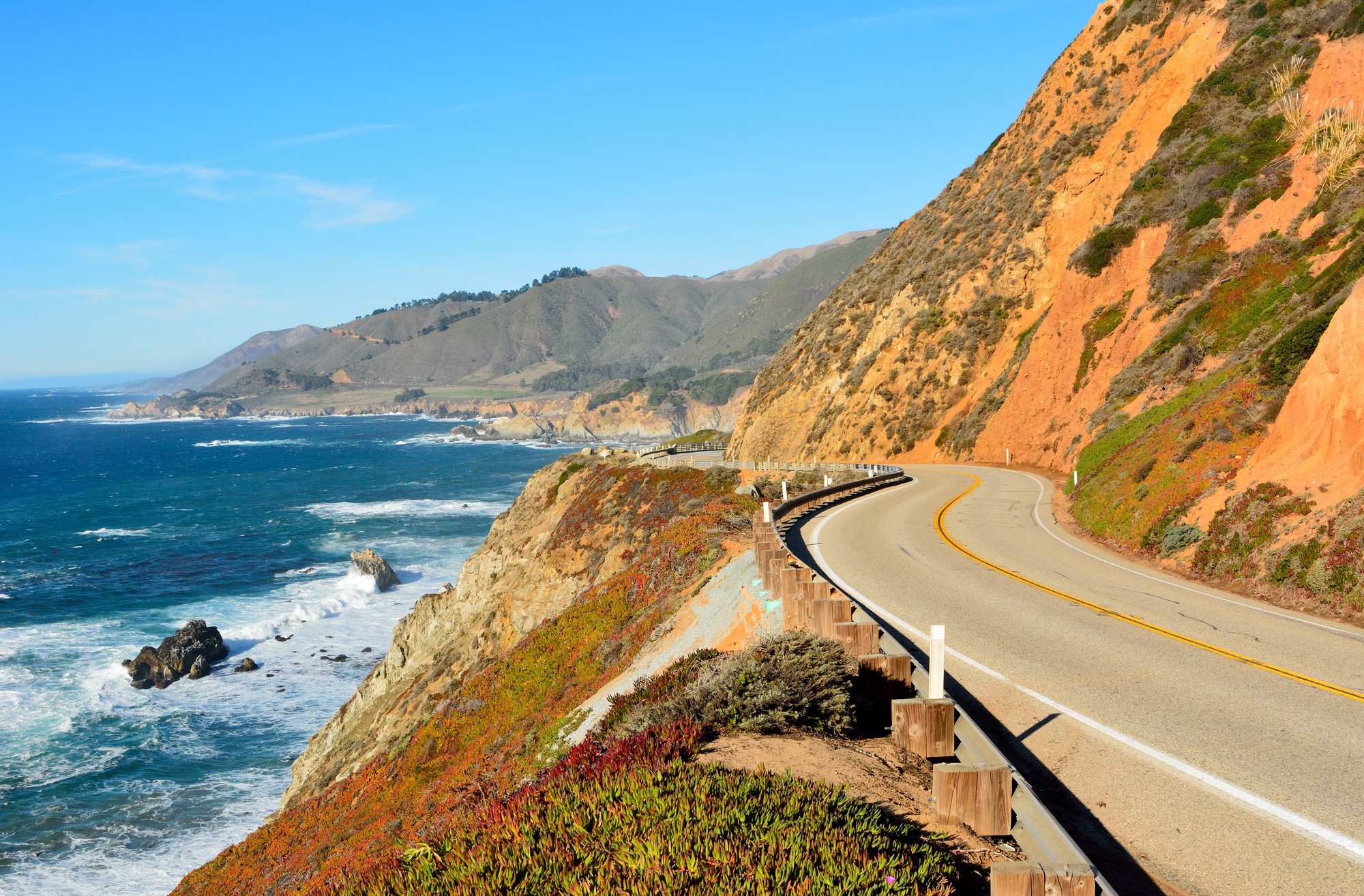
Highway 101 along Washington’s coast leads to Olympic National Park, where temperate rainforests meet rugged Pacific shores. The route from Seattle takes you through logging towns and coastal communities before entering a park that contains three distinct ecosystems.
You can experience glacier-capped mountains, old-growth forests, and wild coastlines all in the same day.
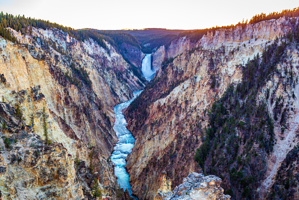
Beartooth Highway to Yellowstone
The Beartooth Highway (US Route 212) connects Red Lodge, Montana, to the northeast entrance of Yellowstone National Park in Wyoming. This 68-mile route climbs to 10,947 feet at Beartooth Pass, making it one of the highest paved roads in America.
The road winds through alpine tundra where wildflowers bloom in July and snow can fall any month of the year.
Like Travel Pug’s content? Follow us on MSN.
Trail Ridge Road in Rocky Mountain National Park

Colorado’s Trail Ridge Road climbs from Estes Park to Grand Lake, reaching 12,183 feet at its highest point. This 48-mile route through Rocky Mountain National Park spends 11 miles above treeline, where the air is thin, and the views stretch to the horizon.
The road typically closes from mid-October to late May due to snow that can pile up 20 feet deep.
Cascade Loop to North Cascades National Park
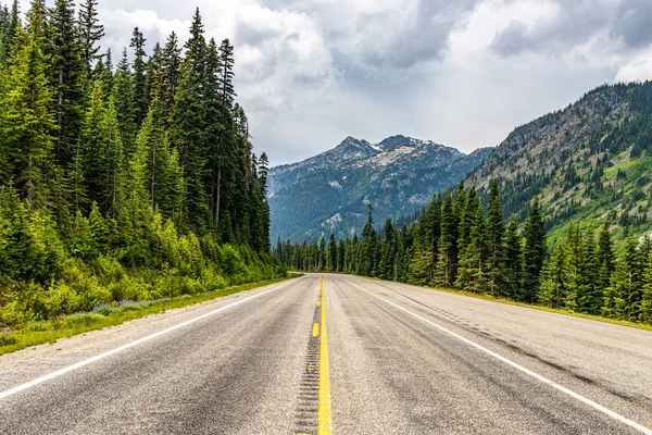
Washington’s Cascade Loop combines Highway 20, Interstate 5, and Highway 2 into a 440-mile circuit that includes North Cascades National Park. The route passes through Bavarian-themed Leavenworth, crosses three mountain passes, and showcases landscapes from temperate rainforests to alpine peaks.
Highway 20 through the park closes in winter due to heavy snowfall.
Desert View Drive in Grand Canyon National Park
Arizona’s Desert View Drive runs 25 miles along the South Rim of Grand Canyon National Park from Grand Canyon Village to Desert View. This route provides multiple viewpoints of one of the world’s most famous geological features, each offering a different perspective of the mile-deep canyon.
The drive connects historic buildings and lookout points that have been inspiring visitors for over a century.
Like Travel Pug’s content? Follow us on MSN.
Skyline Drive Through Shenandoah National Park
Virginia’s Skyline Drive runs 105 miles through Shenandoah National Park from Front Royal to Waynesboro. This scenic route follows the crest of the Blue Ridge Mountains, providing access to over 500 miles of hiking trails and dozens of waterfalls.
The drive offers 75 overlooks where you can stop and admire the Shenandoah Valley stretching toward the horizon.
Mesa Verde National Park Loop
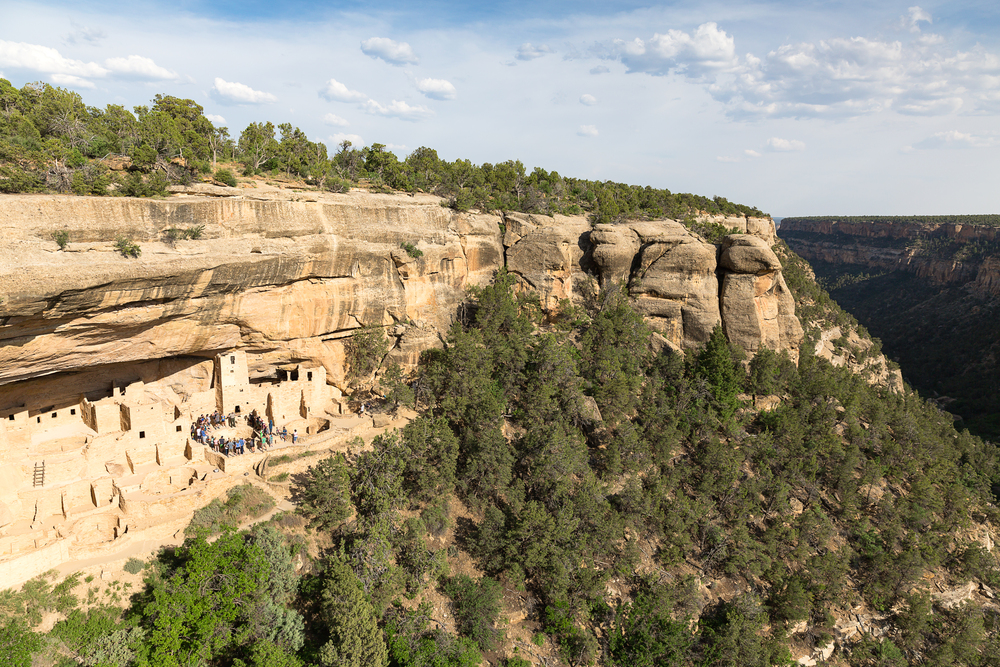
The Mesa Verde National Park loop in Colorado takes you through ancient Ancestral Puebloan cliff dwellings via Mesa Top Loop Road and Cliff Palace Loop Road. These 12-mile routes wind through mesa tops where people lived for over 700 years before mysteriously disappearing around 1300 CE.
The drive connects archaeological sites that preserve some of the best-preserved cliff dwellings in North America.
Acadia National Park’s Park Loop Road
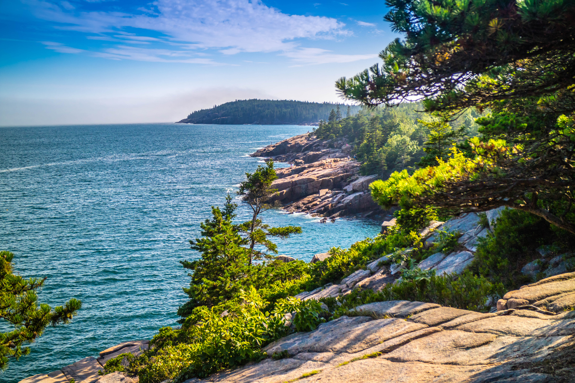
Maine’s Park Loop Road covers 27 miles through Acadia National Park on Mount Desert Island. The route combines ocean views along the rocky Atlantic coast with forested interior roads that lead to Cadillac Mountain, the highest point on the East Coast.
This drive showcases New England’s rugged beauty, where granite cliffs meet crashing waves.
Like Travel Pug’s content? Follow us on MSN.
Death Valley Scenic Byway

California’s Death Valley Scenic Byway (Highway 190) crosses Death Valley National Park from east to west, connecting Nevada to California’s Central Valley. This route takes you through the lowest point in North America at Badwater Basin, 282 feet below sea level, and past landscapes so harsh they’re used to testing Mars rovers.
The drive covers 130 miles of desert that receives less than 2 inches of rain per year.
Crater Lake Rim Drive
Oregon’s Rim Drive circles Crater Lake National Park’s caldera for 33 miles, providing views of the deepest lake in the United States. This route climbs to over 7,000 feet elevation around a lake formed when Mount Mazama collapsed 7,700 years ago.
The intense blue water and surrounding cliffs create scenery that looks almost too perfect to be real.
Badlands Loop Road
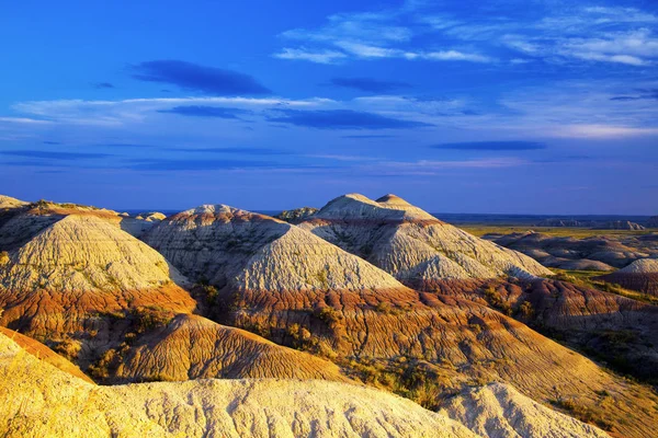
South Dakota’s Badlands Loop Road (Highway 240) runs 39 miles through Badlands National Park’s otherworldly landscape of eroded buttes and spires. This route showcases geological formations created over millions of years by wind and water carving through ancient sea beds.
The drive passes prairie dog towns and fossil sites where paleontologists continue discovering new species.
Like Travel Pug’s content? Follow us on MSN.
Arches National Park Scenic Drive
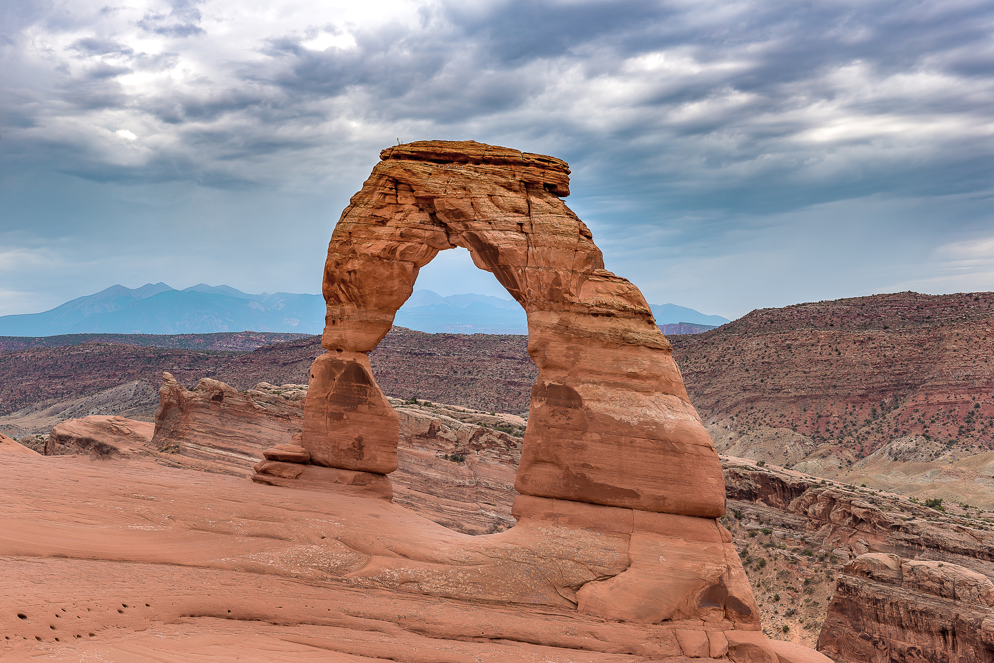
Utah’s Arches National Park Scenic Drive covers 18 miles from the visitor center to Devils Garden, passing over 2,000 natural stone arches. The route includes spur roads to famous formations like Delicate Arch and Landscape Arch, which span distances that seem to defy gravity.
This red rock country drive showcases erosion’s artistic capabilities in creating natural sculptures.
Great Sand Dunes National Park Access Road

Colorado’s Great Sand Dunes National Park access road (Highway 150) leads to North America’s tallest dunes, rising 750 feet against the backdrop of the Sangre de Cristo Mountains. The 16-mile drive from Highway 160 takes you through the San Luis Valley to dunes that migrate and change shape with wind patterns.
This unusual landscape combines alpine peaks with Sahara-like sand formations.
Everglades National Park Main Park Road
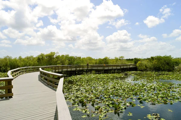
Florida’s Main Park Road runs 38 miles from the Ernest F. Coe Visitor Center to Flamingo on Florida Bay through Everglades National Park. This route crosses the River of Grass, a slow-moving sheet of water that supports alligators, manatees, and hundreds of bird species.
The drive ends at the southernmost point in the continental United States accessible by car.
Like Travel Pug’s content? Follow us on MSN.
Joshua Tree National Park Loop
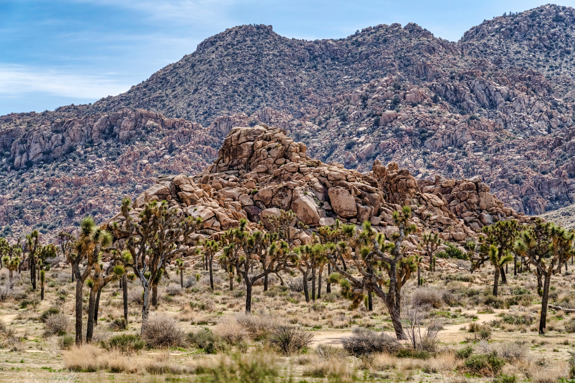
California’s Joshua Tree National Park features two main routes: Park Boulevard and Pinto Basin Road, which combine for a 50-mile loop through desert ecosystems. The drive connects the Mojave and Colorado deserts, showcasing the weird and wonderful Joshua trees that look like something Dr. Seuss might have invented.
These unique landscapes inspired countless musicians and artists seeking creative inspiration.
Sequoia National Park’s Generals Highway
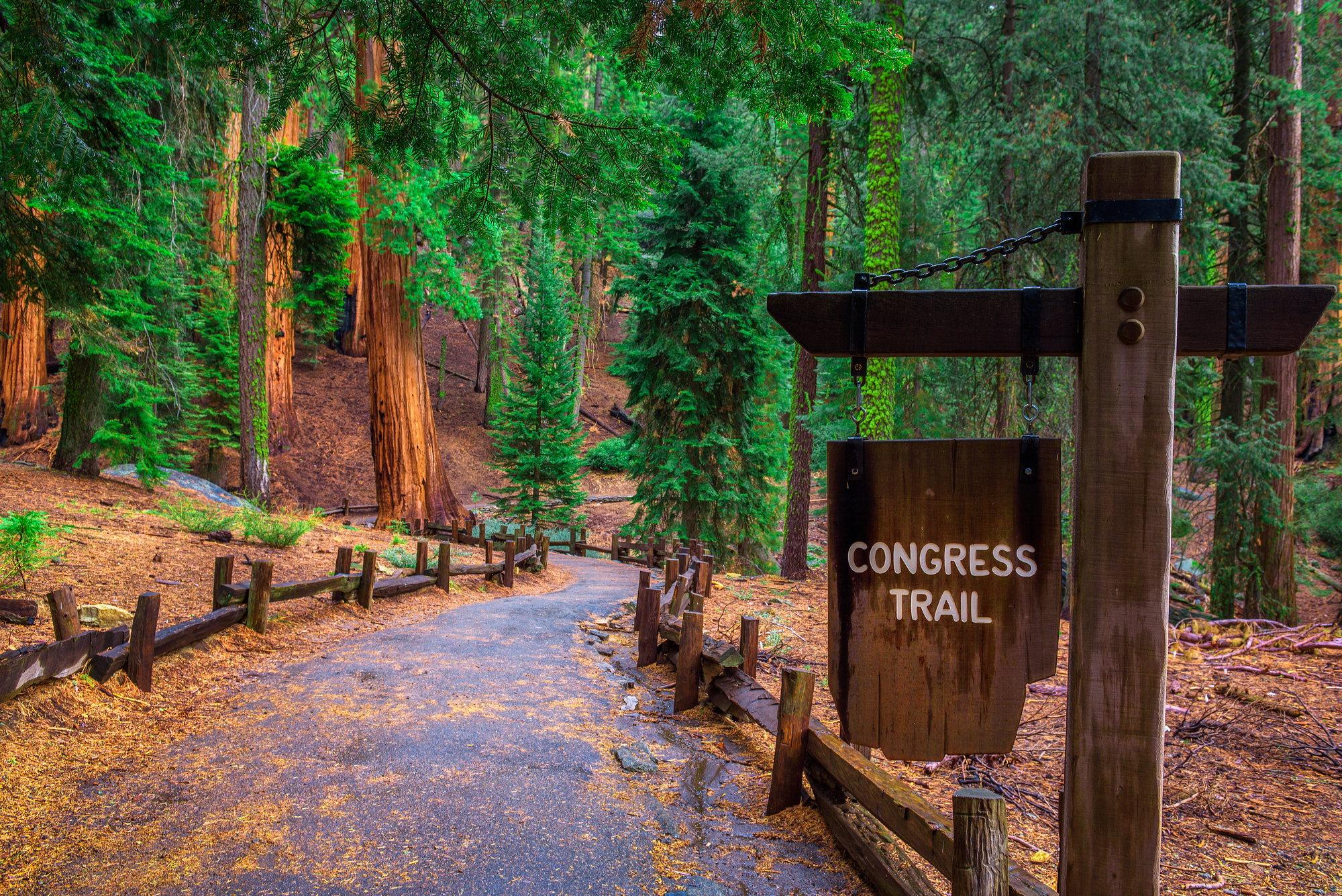
California’s Generals Highway runs 46 miles through Sequoia and Kings Canyon National Parks, connecting groves of the world’s largest trees by volume. The route climbs from 1,700 feet to over 7,000 feet elevation, passing General Sherman, the largest living tree on Earth by volume.
This winding mountain road showcases giant sequoias that were ancient when Rome was founded.
Black Hills Loop Through Wind Cave National Park

South Dakota’s Black Hills loop combines several highways into a 100-mile circuit that includes Wind Cave National Park, Custer State Park, and Mount Rushmore. The route through Wind Cave showcases prairie grasslands and ponderosa pine forests that support bison herds and other wildlife.
This drive connects geological wonders with presidential monuments in the heart of the Great Plains.
Like Travel Pug’s content? Follow us on MSN.
From Sea to Shining Sea Adventures
The national parks system represents America at its most spectacular, preserving landscapes that early explorers could barely describe in letters home. These protected lands tell the story of a continent shaped by ice ages, volcanic eruptions, and millions of years of patient erosion.
Today’s road trippers can experience more natural diversity in a single vacation than previous generations saw in lifetimes of exploration. Each route offers its character, from the red rock canyons of the Southwest to the temperate rainforests of the Pacific Northwest, proving that America’s greatest treasures aren’t found in museums but in the wild places we’ve chosen to protect for future generations.
More from Travel Pug

- 20 Best Beach Towns in the Carolinas
- 13 Destinations Where Tourists Regularly Regret Their Trip
- 20 Things You Actually Get in First Class
- 20 Small Airports With Aviation Museums
- 20 Places in the U.S. That Are Perfect for a Reset Trip
Like Travel Pug’s content? Follow us on MSN.