
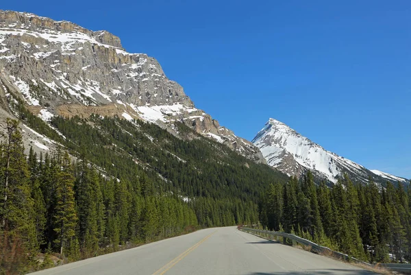
British Columbia serves up some of the world’s most jaw-dropping road trips, where every turn reveals something spectacular. From coastal highways hugging dramatic fjords to mountain passes cutting through glacier-capped peaks, BC’s scenic drives offer front-row seats to nature’s greatest show.
Whether you’re chasing waterfalls, wine country sunsets, or that perfect Instagram shot, these routes deliver experiences that’ll stick with you long after you’ve unpacked your suitcase. Here is a list of 20 scenic drives that showcase the very best of British Columbia’s diverse landscapes and unforgettable beauty.
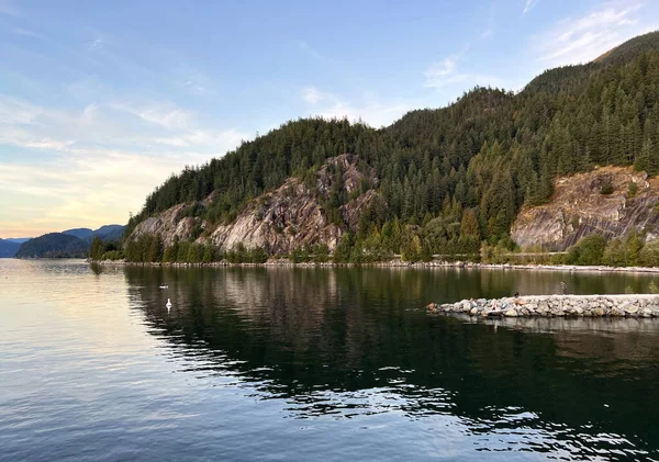
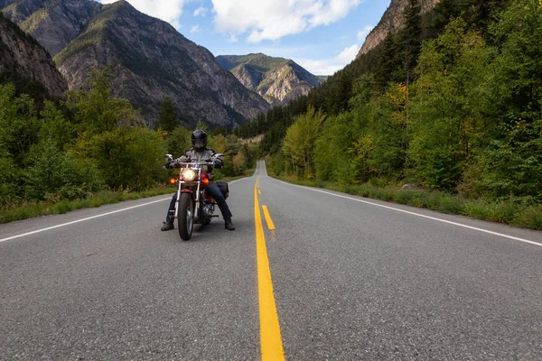
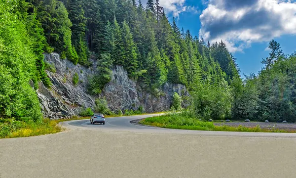
Sea-to-Sky Highway
The Sea-to-Sky Highway (Highway 99) connects Vancouver to Whistler and beyond, earning its name from the dramatic shift in landscape as it begins at sea level around Howe Sound and climbs into the coastal mountains. This 101-mile stretch feels like a master class in Pacific Northwest beauty, with bald eagles often soaring overhead, seemingly within arm’s reach.
The highway underwent a $600 million upgrade before the 2010 Winter Olympics, transforming it from a challenging two-lane road into a safer, more accessible route.
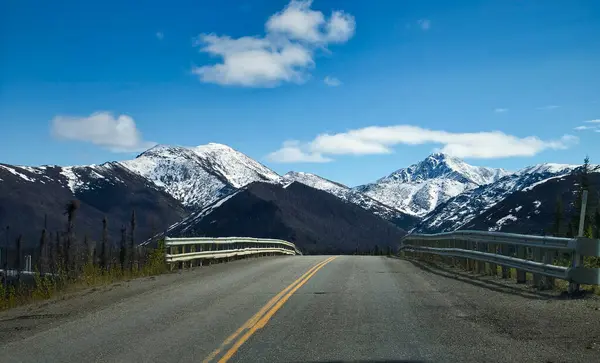
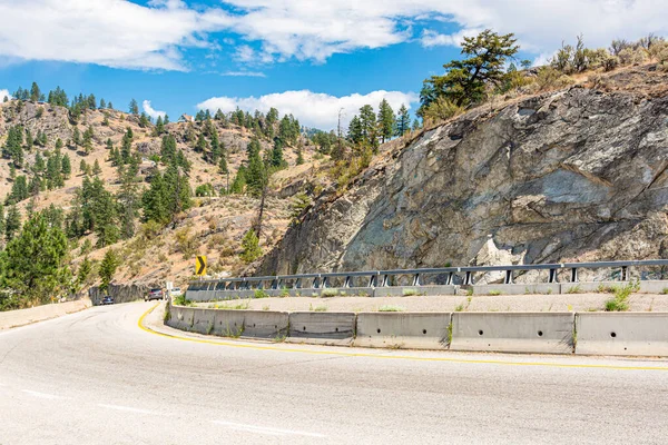
Coquihalla Highway
The Coquihalla Highway (Highway 5) connects the Lower Mainland with BC’s Interior, climbing from sea level to over 1,200 meters through the Cascade Mountains. Locals call it ‘the Coke,’ and this route transforms from Fraser Valley farmland to alpine wilderness in just a couple of hours, passing through terrain so dramatic it feels like you’re driving through a movie set.
The highway offers spectacular mountain vistas, river valleys, and access to world-class skiing at resorts along the route.
Like Travel Pug’s content? Follow us on MSN.
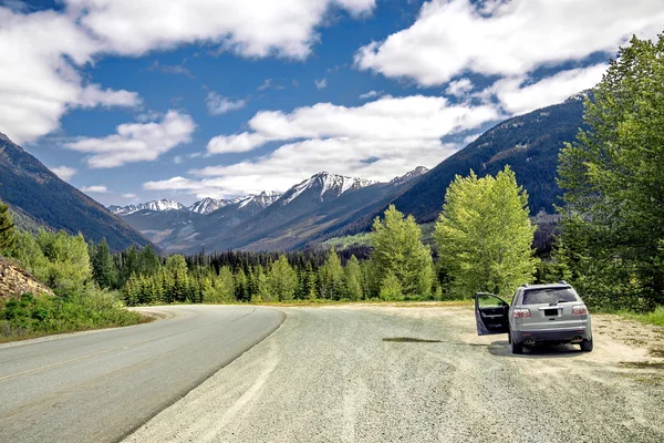
Rogers Pass
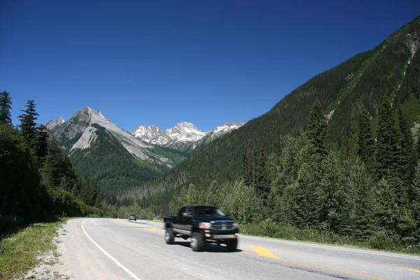
Rogers Pass cuts through the Selkirk Mountains via the Trans-Canada Highway, providing a shortcut along the southern perimeter of the Big Bend of the Columbia River from Revelstoke to Golden. This route feels like traveling through railway history, following the path originally traced by the Canadian Pacific Railway in the 1880s.
Parks Canada and the Canadian Forces operate the world’s largest mobile avalanche control program here, using howitzers to safely trigger snow releases.
Sunshine Coast Highway
Highway 101, known as the Sunshine Coast Highway, stretches 156 kilometers but requires two ferry rides, making it one of BC’s most unique driving experiences. The route forms part of the Pan-American Highway system, which at Lund represents one of the northernmost points of this continental network that stretches from South America.
The combination of ferry rides, coastal views, and forest roads creates a distinctly British Columbian adventure that feels worlds away from city life.
Pacific Rim Highway
Highway 4, known locally as the Pacific Rim Highway west of Port Alberni, stretches 162 kilometers and serves as the main route to Tofino and Ucluelet on Vancouver Island’s wild west coast. This route transformed from a tortuous road that required adventurers to ‘coax’ vehicles across treacherous terrain into a paved highway that now brings one million visitors annually to experience Pacific Rim National Park.
The winding mountain road through ancient forests suddenly opens to reveal endless Pacific Ocean views.
Like Travel Pug’s content? Follow us on MSN.
Juan de Fuca Marine Drive
Highway 14, known as the West Coast (Sooke) Highway, runs along Vancouver Island’s southwestern coastline from Victoria’s suburbs to the remote community of Port Renfrew. This route reveals the true personality of the Pacific, where rolling swells and winter storms create conditions dramatically different from the sheltered waters of the Strait of Georgia.
The drive passes spectacular beaches like Mystic Beach and Botanical Beach, where tide pools teem with marine life.
Crowsnest Highway
The Crowsnest Highway (Highway 3) stretches from Hope to the Alberta border, providing the shortest highway connection between the Lower Mainland and southeast Alberta through the Canadian Rockies. The Hope to Osoyoos section covers 246 kilometers and features two distinct landscapes: the rugged mountains of Manning Provincial Park and the lush farmlands of the Similkameen Valley transitioning into a desert microclimate.
This route offers everything from mountain wilderness to wine country in a single drive.
Stewart-Cassiar Highway
Highway 37, the Stewart-Cassiar Highway, serves as the artery to some of North America’s wildest scenery, following a stunning route on the east side of the Coast Mountains through the Cassiar Mountains and Liard Plain. The highway stretches from Kitimat, conceived by Alcan in 1948, through wilderness areas where Princess Royal Island provides refuge for the elusive Kermode Bear, the white spirit bear of the North BC Coast.
This route feels like driving through untouched wilderness where wildlife encounters are more common than traffic jams.
Like Travel Pug’s content? Follow us on MSN.
Pacific Marine Circle Route
The Pacific Marine Circle Route creates a 289-kilometer loop on southern Vancouver Island, featuring beach pullouts, broad ocean views, and some of the most majestic old-growth forest on the island. The route allows visitors to walk on beaches, hike through rainforest, visit waterfalls, see Canada’s tallest Douglas firs, and camp by the ocean — all in a single drive.
It’s like experiencing multiple ecosystems in fast-forward, from coastal temperate rainforest to rugged Pacific shoreline.
Mountains & Vineyards Circle Route
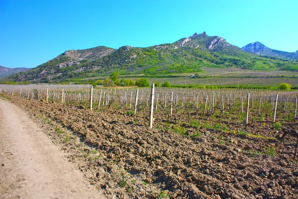
The Mountains & Vineyards Circle Route starts in Golden and follows a 1,260-kilometer journey through the Kootenay Rockies, combining wine country visits with hot springs resorts. The route takes visitors along the lakes and vineyards of the Okanagan Valley, through Canada’s only true desert, and past the peaks and glaciers of the Rocky Mountains.
Imagine transitioning from championship golf courses to lift-accessed hiking, then soaking in natural hot springs while surrounded by mountain peaks.
Great Northern Circle Route
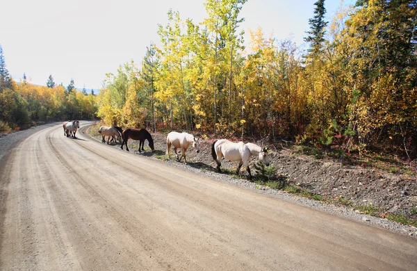
The legendary Great Northern Circle Route covers 3,190 kilometers, starting and finishing in Prince George, and includes the famous Alaska Highway. This odyssey through Northern BC and into the Yukon features stone sheep, moose, grizzly and black bears, natural hot springs, ancient totem poles, glaciers, and the Northern Lights.
It’s the ultimate wilderness road trip for those seeking adventure in Canada’s true north, where services are sparse, but the scenery is limitless.
Like Travel Pug’s content? Follow us on MSN.
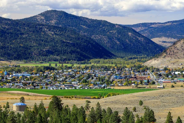
Okanagan Valley Highway
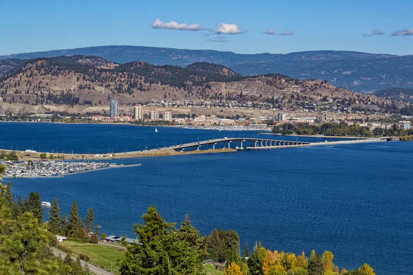
Highway 97 crosses the United States/Canada border near Osoyoos and winds north through the fertile Okanagan Valley toward Kelowna and Vernon, covering approximately 150 kilometers of wine country and lake scenery. The route passes numerous fruit stands piled high seasonally with ripe cherries, peaches, or apples, while offering opportunities for wine tasting, swimming in Lake Okanagan, and paddleboarding on Kalamalka Lake.
This drive perfectly captures BC’s reputation as Canada’s premier wine region.
Yellowhead Highway — Skeena Section
Highway 16 from Smithers to Terrace follows the mighty Skeena River, offering views of the glorious Seven Sisters Peaks and opportunities to spot mountain goats, grizzly bears, and black bears. The route passes through areas where visitors can learn about First Nations culture at ‘Ksan Historical Village and Museum in Hazelton, while Smithers and Terrace serve as outdoor enthusiast hubs for fishing, boating, and winter sports.
The combination of river views, mountain peaks, and cultural experiences makes this section particularly rewarding.
Fraser Canyon
The Trans-Canada Highway follows the Fraser River north to Hell’s Gate, the deepest and narrowest point of the river, where visitors can take a dramatic airtram ride over the raging waters. The route continues to Tuckkwiowhum Village, a First Nations heritage site near Boston Bar offering lessons in Nlaka’pamux culture, and onward to Cache Creek, which once served as the halfway point for Cariboo gold field prospectors.
This historic route combines natural drama with gold rush history.
Like Travel Pug’s content? Follow us on MSN.
Highway 20 to Bella Coola
Highway 20 starts at the ranching town of Williams Lake and heads west toward the Coast Mountains, crossing the arid Fraser River plateau famous for traditional cattle ranches before reaching high country near Anaheim Lake. After passing through Heckman Pass at 1,500 meters elevation, the route descends ‘The Hill’ — a 32-kilometer stretch dropping to sea level with gradients of 18%, terminating at Bella Coola on the Pacific.
This drive transitions from cowboy country to coastal wilderness in spectacular fashion.
Duffey Lake Road
Highway 99 continues from Pemberton to Lillooet on the Duffey Lake Road, paralleling several rivers including the Green River and Lillooet River, and climbing through Cayoosh Pass at 1,275 meters — the highest point on the highway. The route passes Joffre Lakes Provincial Park and skirts Duffey Lake Provincial Park while following Cayoosh Creek through dramatic mountain terrain.
Consider this the ‘secret extension’ of the Sea-to-Sky Highway, offering high-alpine scenery without the crowds.
Kootenay Skyway
The Salmo-Creston Highway section of Highway 3 crosses Kootenay Pass at 1,774 meters elevation, earning the nickname ‘Kootenay Skyway’ and representing one of the highest highway-served passes in Canada. The road spans 64 kilometers from Salmo to Creston with steep inclines reaching 13% gradient, and the pass experiences hundreds of avalanches annually, requiring careful winter driving.
The dramatic elevation changes create an almost alpine coaster experience through the Selkirk Mountains.
Like Travel Pug’s content? Follow us on MSN.
Highway 3A — Kootenay Lake
Highway 3A follows the eastern shore of Kootenay Lake from Creston to the Kootenay Lake Ferry, offering a scenic alternative to the direct Highway 3 route. Kootenay Lake stretches 67 miles long and up to three miles wide, making it one of BC’s largest lakes, while the free Kootenay Lake Ferry provides what it bills as ‘the longest free ferry ride in the world’ at 35 minutes.
The winding lakeside road provides constant mountain and water views, with unique stops like The Glass House built by a former funeral director.
Highway 6 — Slocan Valley
Highway 6 creates a winding 407-kilometer north-south and east-west route connecting the Kootenay and Okanagan regions, with its path through the western Kootenays unchanged since opening in 1941. The highway follows the Salmo River from Nelson to the US border, then heads north through the Slocan Valley, passing communities like Winlaw, Slocan City, and Silverton to New Denver.
This route showcases the hidden valleys and mountain communities that give the Kootenays their reputation as BC’s best-kept secret.
Highway 16 — Terrace to Prince Rupert
Highway 16 from Terrace to Prince Rupert follows the Skeena River through some of the most spectacular coastal mountain scenery in northern BC, covering roughly 150 kilometers of wilderness beauty. The route passes through traditional territories where salmon runs have sustained communities for thousands of years, and the combination of river, mountain, and coastal forest views creates an ever-changing panorama.
Prince Rupert, known as the ‘City of Rainbows,’ serves as a gateway to Haida Gwaii and offers some of the best whale watching opportunities on the BC coast.
Like Travel Pug’s content? Follow us on MSN.
Roads That Connect Us to Nature’s Best
These 20 scenic drives represent more than just transportation routes — they’re gateways to experiences that remind us why British Columbia earned its ‘Super, Natural’ reputation. From the Sea-to-Sky’s dramatic coastal-to-alpine transition to the Icefields Parkway’s world-renowned glacier views, each route offers its unique perspective on BC’s diverse landscapes.
Whether you’re seeking the wild remoteness of the Stewart-Cassiar Highway or the refined beauty of the Pacific Marine Circle Route, these drives prove that the journey itself can be the destination. Pack your camera, plan your stops, and prepare for scenery that’ll make you understand why people move across continents just to call this province home.
More from Travel Pug
- 20 Best Beach Towns in the Carolinas
- 13 Destinations Where Tourists Regularly Regret Their Trip
- 20 Things You Actually Get in First Class
- 20 Small Airports With Aviation Museums
- 20 Places in the U.S. That Are Perfect for a Reset Trip
Like Travel Pug’s content? Follow us on MSN.