
The Rocky Mountains stretch over 3,000 miles from northern British Columbia to New Mexico, creating some of North America’s most spectacular driving experiences. These towering peaks, alpine lakes, and dramatic valleys offer road trips that’ll leave you questioning whether you’re still on Earth or somehow driving through a postcard collection.
Here’s a list of 20 scenic drives that showcase the Rocky Mountains’ incredible diversity and natural grandeur.
Trail Ridge Road, Colorado
Rocky Mountain National Park’s crown jewel reaches 12,183 feet above sea level, making it one of America’s highest paved roads. This 48-mile route connects Estes Park to Grand Lake while crossing the Continental Divide through alpine tundra that exists nowhere else at this latitude.
You’ll drive above treeline for 11 miles, where the landscape resembles Arctic conditions despite being in temperate Colorado.
Going-to-the-Sun Road, Montana

Glacier National Park’s engineering marvel spans 50 miles of some of the most dramatic mountain scenery in North America. The road clings to cliff faces while offering views of pristine glacial valleys, waterfalls, and wildlife.
Logan Pass provides access to alpine hiking trails, though the narrow, winding road challenges even experienced mountain drivers.
Like Travel Pug’s content? Follow us on MSN.
Beartooth Highway, Montana/Wyoming
This 68-mile route connecting Red Lodge, Montana, to Yellowstone’s northeast entrance climbs to 10,947 feet through landscapes that seem borrowed from another planet. The highway crosses windswept plateaus where snow persists year-round, creating a moonscape punctuated by crystal-clear alpine lakes.
The weather can change instantly at these elevations, making this drive both spectacular and potentially dangerous.
San Juan Skyway, Colorado

Colorado’s 236-mile loop combines four separate scenic byways into one incredible mountain circuit. The route passes through historic mining towns like Telluride, Ouray, and Silverton while crossing three major mountain passes.
Fall colors along this drive are legendary, though any season offers stunning views of 14,000-foot peaks and dramatic valley landscapes.
Independence Pass, Colorado
Highway 82 between Aspen and Twin Lakes reaches 12,095 feet, making it Colorado’s highest paved pass. The narrow, winding road challenges drivers with steep grades and sharp curves while delivering views of the Sawatch Range’s highest peaks.
Summer wildflower displays transform alpine meadows into natural gardens that rival any cultivated landscape.
Like Travel Pug’s content? Follow us on MSN.
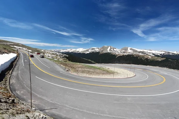
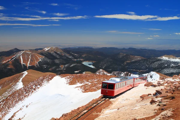
Pikes Peak Highway, Colorado
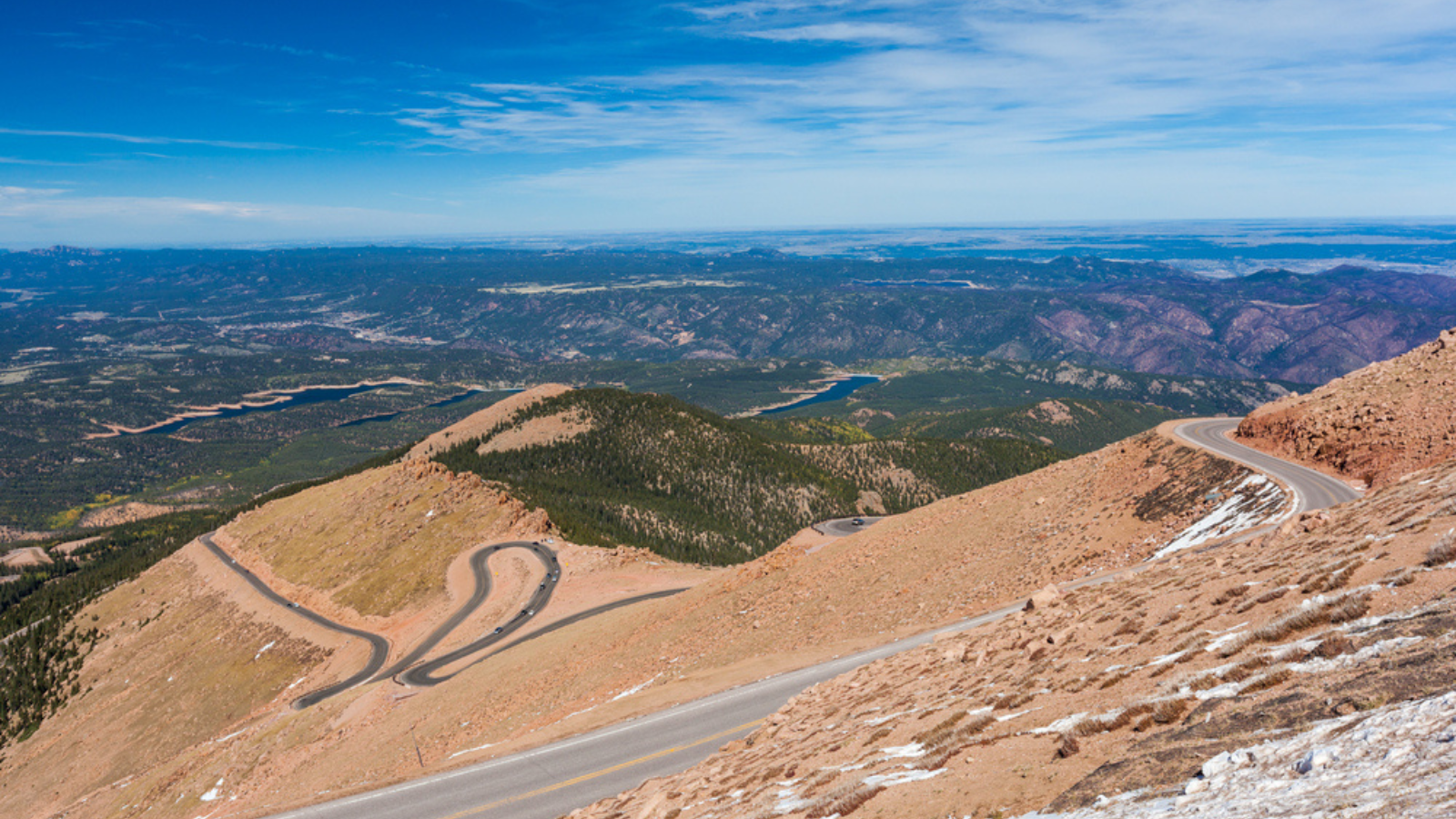
America’s Mountain offers a 19-mile toll road to the 14,115-foot summit that inspired ‘America the Beautiful.’ The paved route includes 156 turns while climbing nearly 7,000 feet from the entrance gate.
Views from the summit encompass four states on clear days, though afternoon thunderstorms can develop quickly at these elevations.
Mount Evans Scenic Byway, Colorado
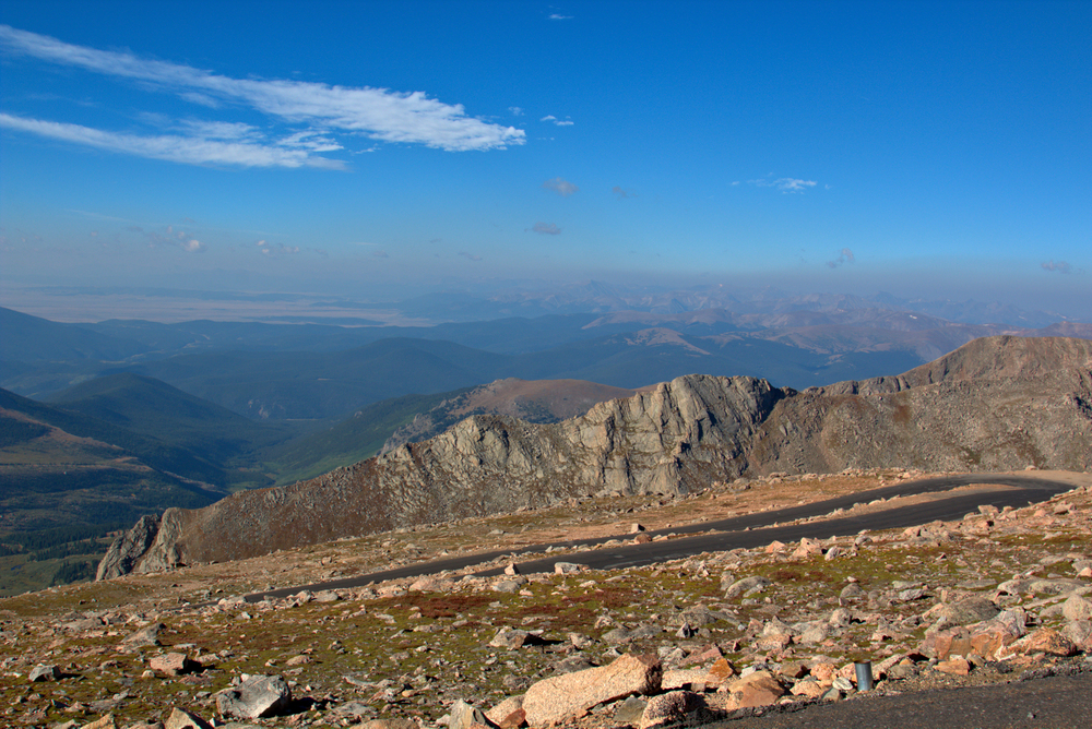
This 28-mile paved road reaches 14,130 feet, making it North America’s highest automobile road. The route passes through multiple ecosystems, from montane forests through alpine tundra to the summit’s rocky moonscape.
Mountain goats often graze near the parking area, seemingly unbothered by the elevation that leaves many visitors gasping for breath.
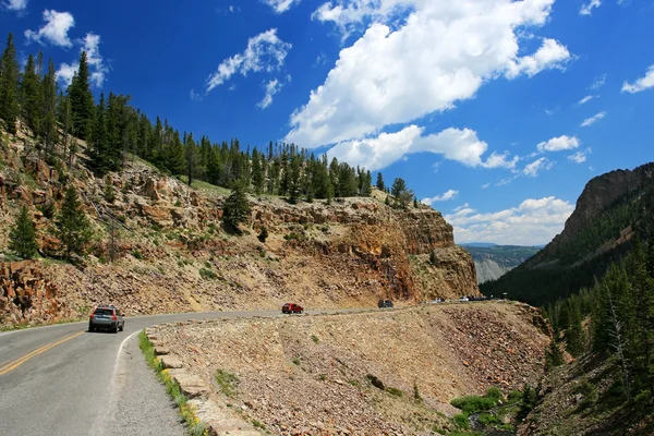
Million Dollar Highway, Colorado
US Highway 550 between Ouray and Silverton earned its nickname from either construction costs or the ore-rich gravel used in its roadbed. This 25-mile stretch includes dramatic cliff-side driving with minimal guardrails and stunning views of the San Juan Mountains.
The route passes through Uncompahgre Gorge, where waterfalls cascade hundreds of feet from canyon walls.
Like Travel Pug’s content? Follow us on MSN.
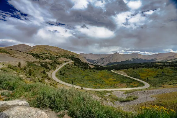
Top of the Rockies Scenic Byway, Colorado
Highway 24 from Minturn to Buena Vista crosses Tennessee Pass while offering views of Colorado’s two highest peaks – Mount Elbert and Mount Massive. The 75-mile route passes through the Arkansas River Valley, where historic mining operations left behind fascinating ghost towns.
Autumn transforms aspen groves into golden corridors that seem to glow from within.
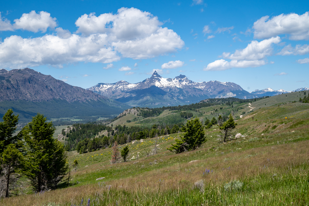
Grand Teton Park Loop, Wyoming

The 42-mile park loop road provides constantly changing perspectives of the dramatic Teton Range rising directly from the valley floor. Unlike most mountain ranges that build gradually, the Tetons thrust skyward nearly 7,000 feet from Jackson Hole with no foothills to soften their impact.
Wildlife viewing opportunities include moose, elk, and bears throughout the valley.
Snowy Range Scenic Byway, Wyoming

Highway 130 between Laramie and Saratoga crosses the Medicine Bow Mountains through landscapes that remain snow-covered well into summer. The 29-mile route reaches 10,847 feet at Snowy Range Pass, where alpine lakes reflect jagged peaks that gave the range its name.
Wildflower displays their peak in July when the snow finally retreats from higher elevations.
Like Travel Pug’s content? Follow us on MSN.
Guanella Pass, Colorado
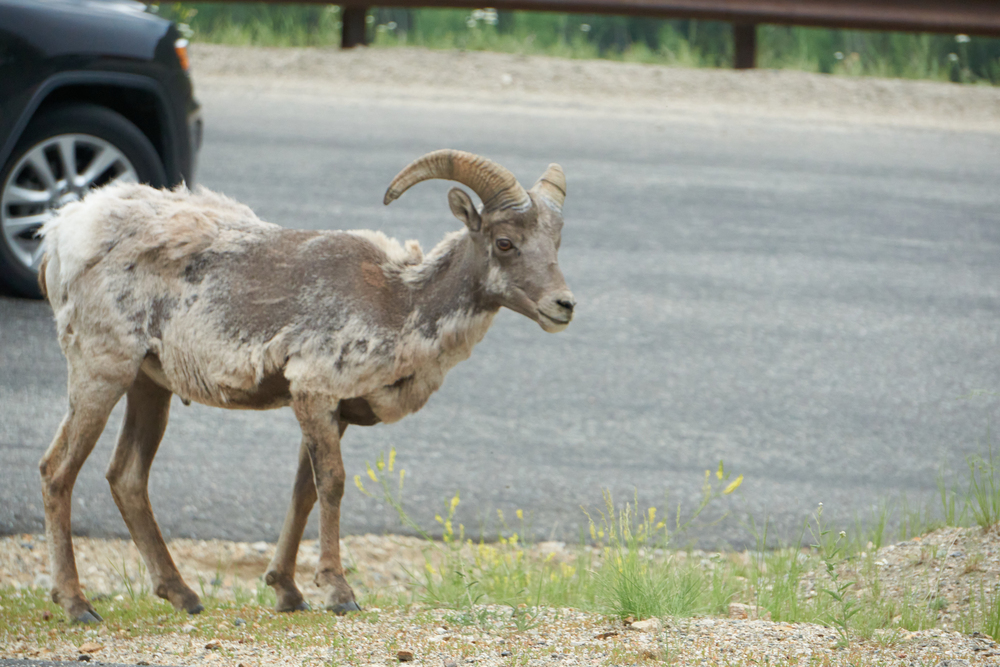
This relatively easy 22-mile drive connects Georgetown to Grant while reaching 11,669 feet through some of Colorado’s most accessible alpine scenery. The paved road offers excellent wildlife viewing opportunities, particularly for mountain goats and bighorn sheep.
Fall colors are spectacular when aspen groves turn golden against the backdrop of snow-dusted peaks.
Flaming Gorge-Uintas Scenic Byway, Utah/Wyoming
This 80-mile route showcases the geological diversity where the Rocky Mountains meet the Colorado Plateau. The drive includes dramatic red rock canyons, high mountain meadows, and the brilliant blue waters of Flaming Gorge Reservoir.
Wildlife viewing opportunities include elk, deer, and various bird species adapted to both desert and mountain environments.
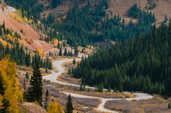
Kebler Pass, Colorado
The dirt road over Kebler Pass between Crested Butte and Paonia offers what many consider Colorado’s best aspen viewing. The 30-mile route stays mostly above 9,000 feet while passing through extensive aspen groves that create natural cathedrals of white-barked trees.
Fall colors typically peak in late September when entire mountainsides turn brilliant gold.
Like Travel Pug’s content? Follow us on MSN.
Peak to Peak Scenic Byway, Colorado
Highways 7, 72, and 119 create a 55-mile loop through some of Colorado’s most accessible mountain scenery. The route connects Nederland, Ward, and Estes Park while offering views of Longs Peak and the Continental Divide.
Historic mining towns and mountain communities provide glimpses into Colorado’s colorful past.
Cache la Poudre-North Park Scenic Byway, Colorado
This 101-mile route follows the Cache la Poudre River through Roosevelt National Forest before crossing Cameron Pass into North Park. The drive showcases Colorado’s transition from Front Range foothills through montane forests to high mountain valleys.
Wildlife viewing opportunities include elk, moose, and various bird species.
Cottonwood Pass, Colorado
Highway 306 between Buena Vista and Gunnison reaches 12,126 feet while offering panoramic views of the Sawatch and Elk Ranges. The paved road provides access to multiple 14,000-foot peaks and extensive alpine terrain.
Wildflower displays in July rival any mountain location, with entire meadows carpeted in colorful blooms.
Like Travel Pug’s content? Follow us on MSN.
Enchanted Circle, New Mexico

New Mexico’s 84-mile scenic loop combines Highways 64, 38, and 522 through the Sangre de Cristo Mountains. The route connects Taos, Questa, Red River, and Eagle Nest while showcasing the Southwest’s unique blend of Hispanic, Native American, and frontier cultures.
Views include Wheeler Peak, New Mexico’s highest summit at 13,161 feet.
Loveland Pass, Colorado
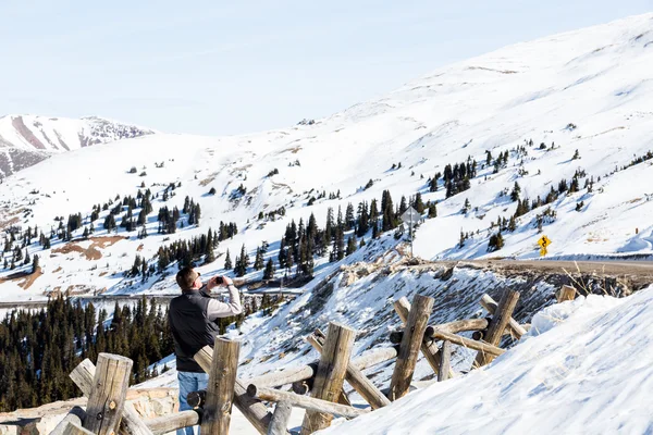
US Highway 6 crosses the Continental Divide at 11,990 feet between Keystone and Georgetown through terrain that inspired Colorado’s skiing industry. The pass remains open year-round, though winter conditions can be treacherous with howling winds and sudden whiteouts.
Summer offers access to alpine hiking trails and stunning views of surrounding peaks.
Bear Lake Scenic Byway, Idaho/Utah
Highway 89 through Bear Lake Valley showcases the northern Rockies’ gentler side while offering views of the brilliant blue lake that straddles the Idaho-Utah border. The 55-mile route passes through historic Mormon settlements and provides access to outdoor recreation opportunities.
Raspberry shakes from local stands have become a beloved tradition for travelers.
Like Travel Pug’s content? Follow us on MSN.
Where mountain roads meet endless sky
Driving the Rocky Mountains connects you to landscapes that humbled early explorers and continue inspiring modern travelers. These roads represent human determination to access seemingly impossible terrain while respecting the natural forces that shaped these peaks over millions of years.
The experience goes beyond scenic beauty – mountain driving teaches patience, respect for weather, and appreciation for engineering marvels that make these journeys possible. Each route offers its personality, from the raw wilderness of Glacier National Park to Colorado’s mining heritage preserved in mountain ghost towns.
More from Travel Pug

- 20 Best Beach Towns in the Carolinas
- 13 Destinations Where Tourists Regularly Regret Their Trip
- 20 Things You Actually Get in First Class
- 20 Small Airports With Aviation Museums
- 20 Places in the U.S. That Are Perfect for a Reset Trip
Like Travel Pug’s content? Follow us on MSN.