

Many travelers plan a city around its transit map and discover too late that the best parts sit a short stroll apart. A taxi turns a neighborhood into a blur between two addresses.
Walking turns it into a place.
Some cities earn a reputation for being easy on foot, and crowds follow that reputation. Others get written off as too hilly, too hot, too sprawling or too car-bound, and visitors keep booking rides they never needed.
Ljubljana Took the Cars Out of Its Center

The Slovenian capital began transforming its city center into a pedestrian and cycling area in 2007, and the change reshaped how the city feels at street level. Prešeren Square, the Triple Bridge and the riverside cafes along the Ljubljanica now sit inside a compact pedestrian zone that takes minutes to cross.
Small electric carts called Kavalir circulate through the car-free area and offer free rides primarily to older visitors, people with reduced mobility and others who find longer distances difficult. Because the historic core is so compact, visitors can cover much of it in a morning and spend the afternoon wandering upstream simply because the walk is so pleasant.
Bologna Covers Its Sidewalks
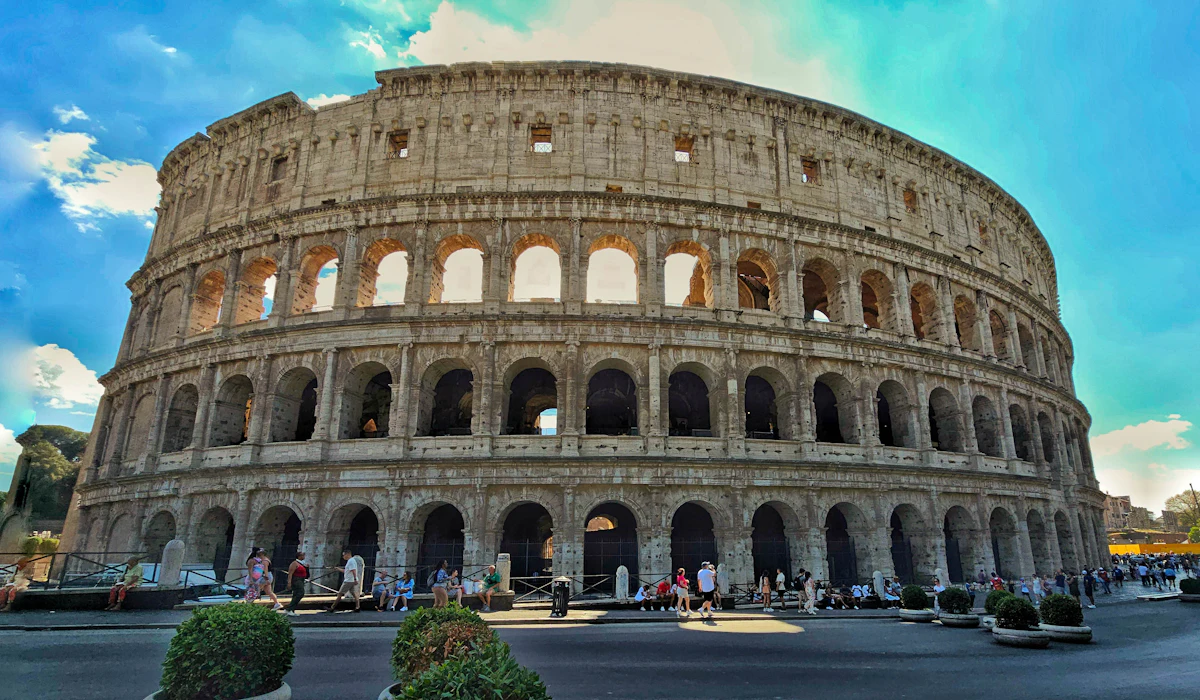
Rain and summer sun barely interrupt a walk in Bologna because the city built its sidewalks under arcades. The porticoes run for roughly 38 kilometers inside the historic center and about 62 kilometers across the wider city, and UNESCO added them to its World Heritage List in 2021.
The longest single stretch climbs to the Sanctuary of San Luca on a covered path with 666 arches. Some visitors treat Bologna as a food stop between Florence and Venice, then realize the city is built for exactly the kind of slow, sheltered wandering that makes a second day worthwhile.
Ghent Split Itself Into Sectors
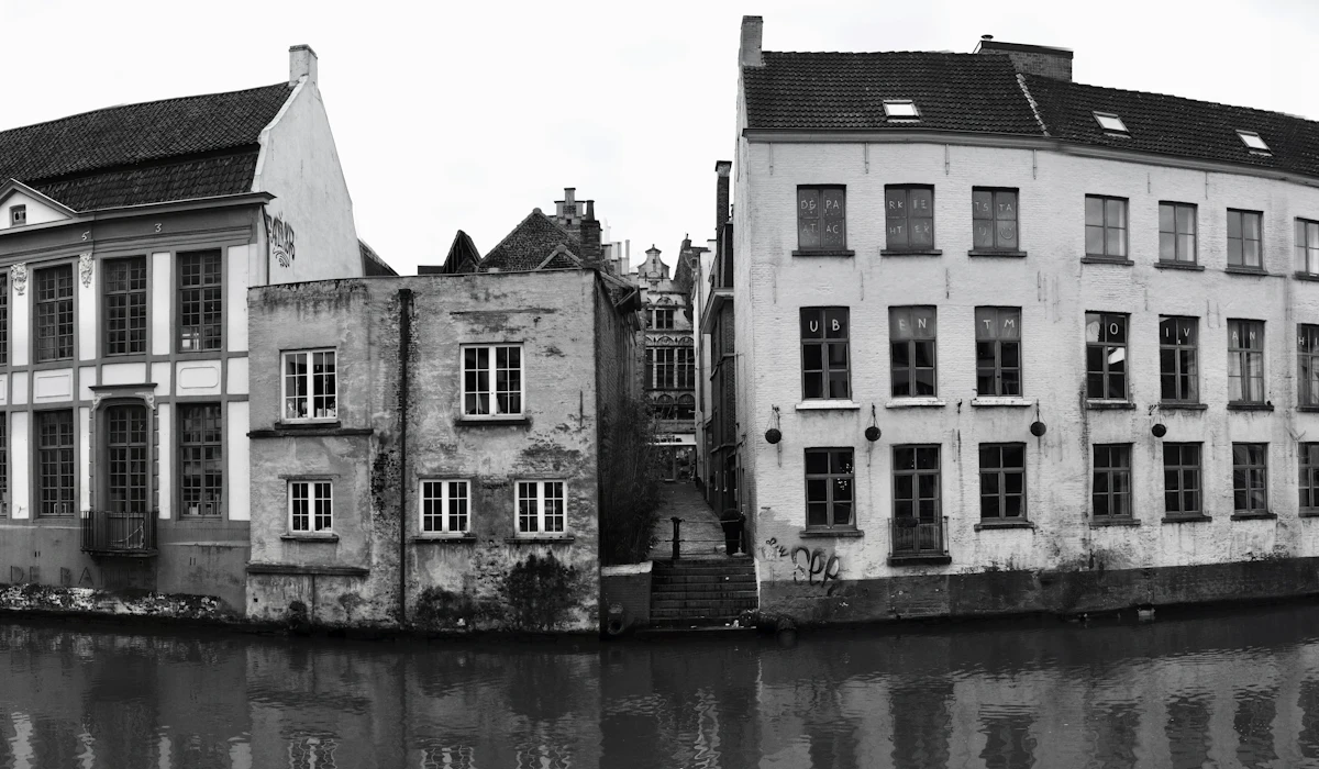
Ghent introduced a circulation plan in 2017 that divided the city into sectors around a car-free core, so drivers can no longer cut straight through the center. The practical effect for a visitor is quiet streets between the Graslei, the Gravensteen castle and St.
Bavo’s Cathedral, where the Ghent Altarpiece hangs. Bruges gets the day-trip crowds and the reputation, yet Ghent offers the same canals and medieval facades in a setting that often feels less crowded.
The city also keeps a lively student population, which means its evenings can stay busy long after the tour groups have gone back to the train station.
Valencia Turned a River Into a Footpath
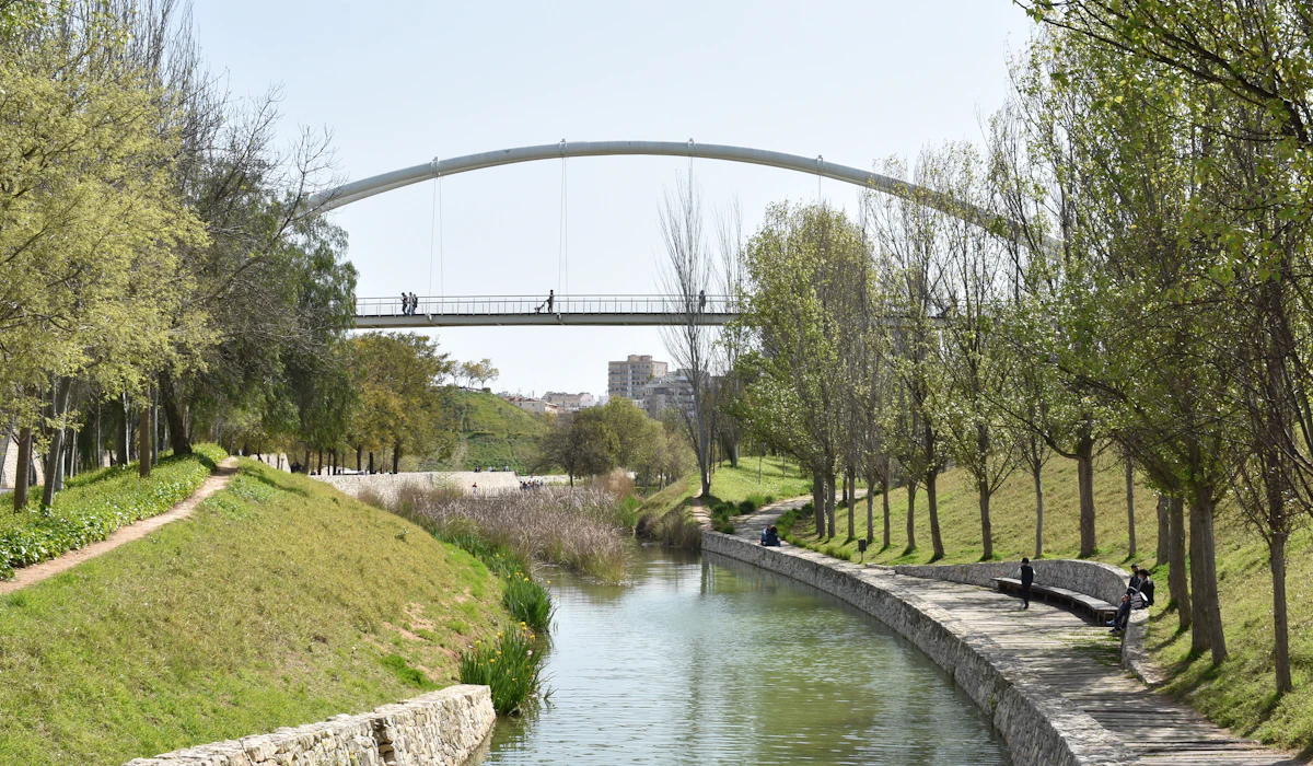
After a catastrophic flood in 1957, Valencia diverted the Turia River around the city and eventually converted the empty riverbed into a sunken park of roughly nine kilometers. The Turia Gardens now thread past orange trees, playgrounds, sports fields and the City of Arts and Sciences, crossed by the old stone bridges that once spanned water.
Walkers can travel from the edge of the old town toward the port along long stretches away from car traffic. It is one of the city’s longest green corridors running directly through the center, and it turns what looks like a sprawling city into a surprisingly easy walk.
Porto Rewards Every Hill
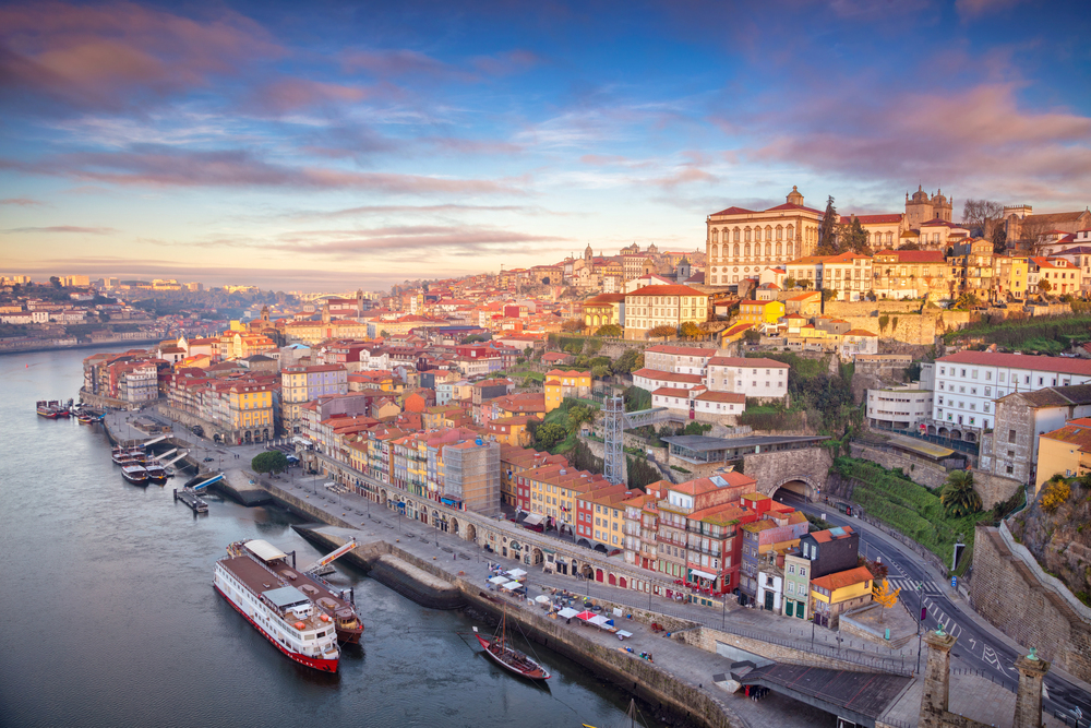
Porto scares off plenty of visitors with its steep streets, yet the climbs are short and the views arrive fast. The double-decked iron bridge named for King Luís I, completed in 1886, carries pedestrians across its upper deck alongside the metro, high above the Douro River.
From there it is a gentle downhill walk into the port wine lodges of Vila Nova de Gaia, and a funicular spares tired legs the return climb from the Ribeira waterfront. The trick is to plan routes downhill whenever possible and let the Guindais Funicular handle the steepest stretch back up.
Kyoto Hides Its Quiet Paths Between Temples
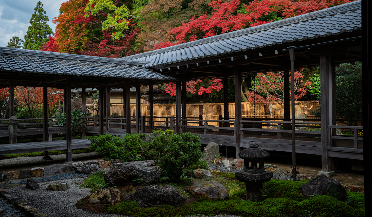
Kyoto spreads wide, so many visitors treat it as a series of bus rides between famous temples. The eastern districts tell a different story.
The Philosopher’s Path runs about two kilometers along a canal lined with cherry trees, linking Ginkakuji to the Nanzenji area and named for the philosopher Nishida Kitaro, who used the route as part of his daily walking routine. South of there, the lanes of Higashiyama connect Kiyomizu-dera, Yasaka Shrine and Gion on foot in well under an hour.
Walking this side of the city also means passing small shrines and residential gardens that no bus route would ever reveal.
Montreal Built a Second City Underground
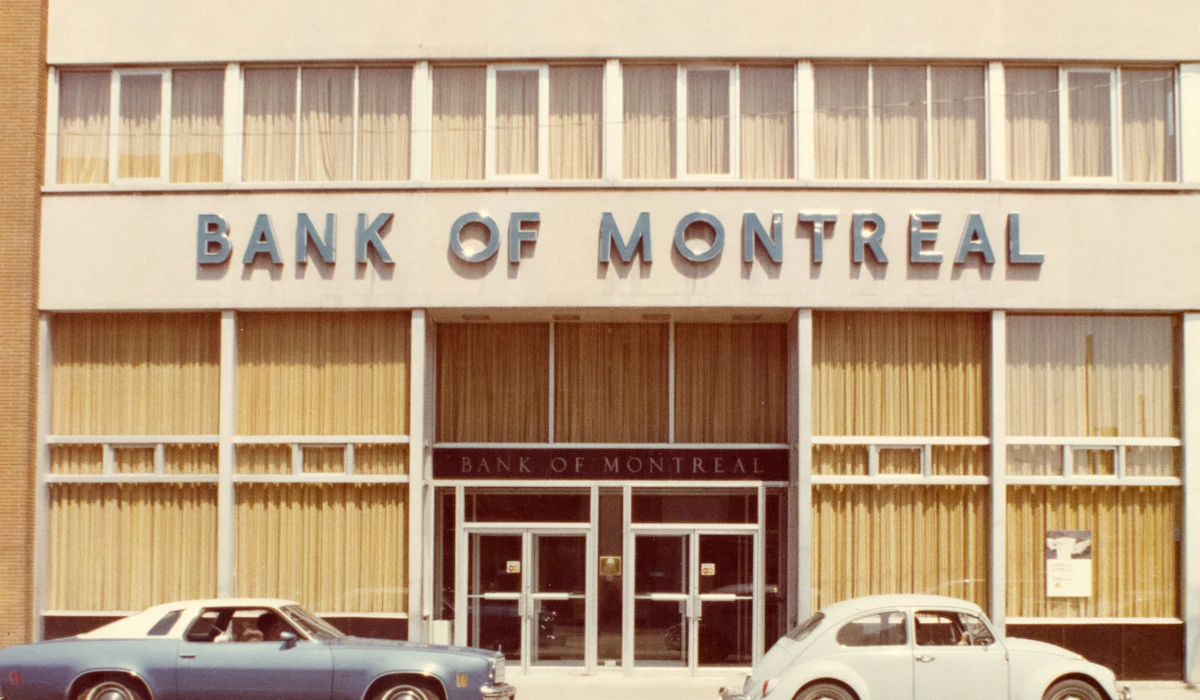
Winter convinces many visitors that Montreal is a place to drive through, yet the city planned for its climate decades ago. The underground network known as RESO links metro stations, shopping centers, universities, hotels and office towers through roughly 32 kilometers of tunnels.
Above ground, Old Montreal and the Plateau are compact and full of detail, from cobbled streets near the Notre-Dame Basilica to the outdoor staircases that climb the fronts of Plateau row houses. A cold January day can still include hours of sheltered walking downtown without spending all of that time outdoors.
Philadelphia Runs on William Penn’s Grid
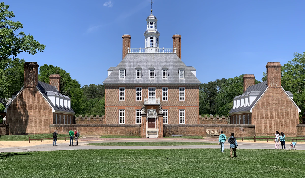
William Penn laid out Philadelphia’s street grid in 1682, and the plan still makes the center easy to read on foot. Independence Hall, the Liberty Bell, Reading Terminal Market and Rittenhouse Square all sit within a comfortable walk of each other in Center City.
Elfreth’s Alley, a narrow lane of small brick houses dating to the early 1700s, is often described as the oldest continuously inhabited residential street in the country. Many visitors can see much of the historic core with little need for public transit.
Savannah Stitches Its Streets Together With Squares
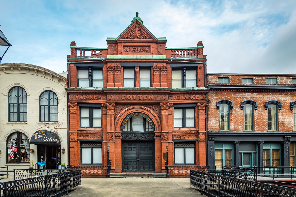
James Oglethorpe’s 1733 plan for Savannah arranged the city around a repeating pattern of wards, each centered on a public square. Twenty-two of those squares survive, shaded by live oaks draped in Spanish moss and set only a block or two apart.
The layout helps calm traffic and gives walkers a green pause every few minutes. Visitors can book trolley tours, but the historic district is small enough to cover in an afternoon and far more pleasant at walking pace than from a seat on wheels.
Seville Stays Flat and Close
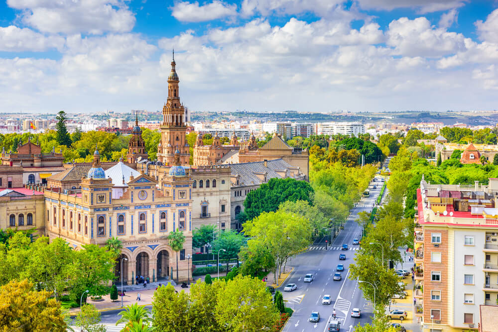
Seville’s heat has a fearsome reputation, which pushes some visitors into taxis for distances that barely justify them. The historic center is flat and dense, and the Cathedral, the Real Alcazar, the Santa Cruz quarter and the Metropol Parasol sit within easy reach of one another.
The narrow streets of Santa Cruz were laid out partly to trap shade, and they still do. Visitors can make the summer heat more manageable by walking early in the morning or later in the day, when temperatures ease and plazas become more active.
Edinburgh Stacks Its Sights Along One Spine
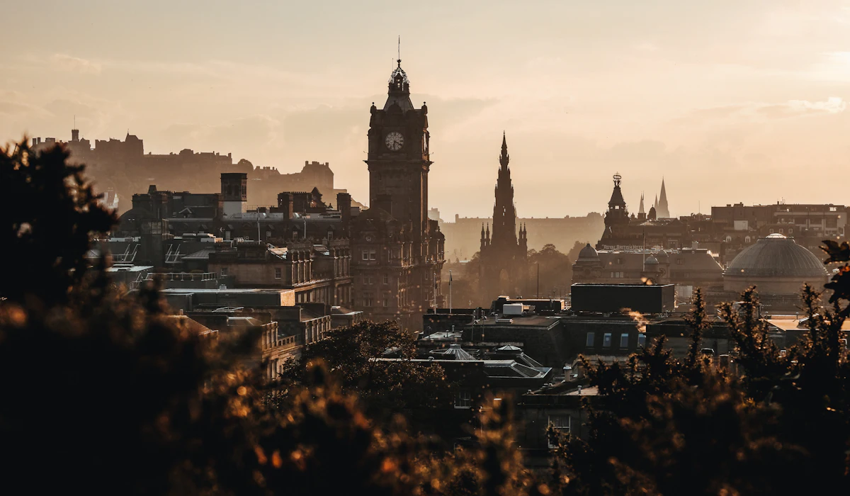
Edinburgh looks complicated on a map because of its bridges and levels, yet the Old Town follows a single ridge. The Royal Mile runs from the castle down to the Palace of Holyroodhouse over a distance close to one old Scots mile, which works out to a little more than a standard mile.
The narrow closes branching off it lead to courtyards, stairways and views over the New Town. Arthur’s Seat rises right at the end of the route, so a morning walk through the city can end on top of an extinct volcano.
Mexico City Closes Its Grandest Avenue on Sundays
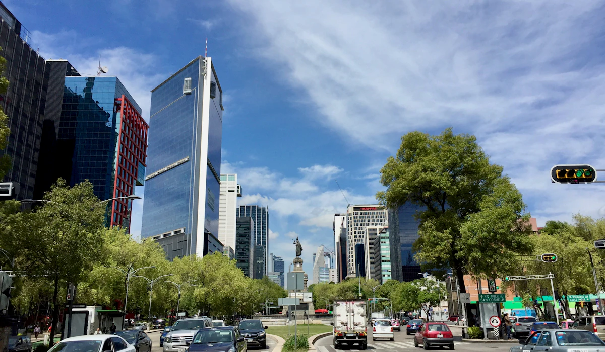
Mexico City’s size makes it seem impossible on foot, but its best neighborhoods cluster tightly. Every Sunday morning, a long stretch of Paseo de la Reforma closes to cars so cyclists, runners and walkers can take over the boulevard.
In Condesa, Avenida Amsterdam traces a leafy oval that follows the outline of an old horse-racing track, with a tree-lined median built for strolling. Roma, Condesa and the historic center reward walkers with cafes, markets and architecture at a density few visitors expect from a city this large.
Pittsburgh Has Stairs Where Streets Should Be
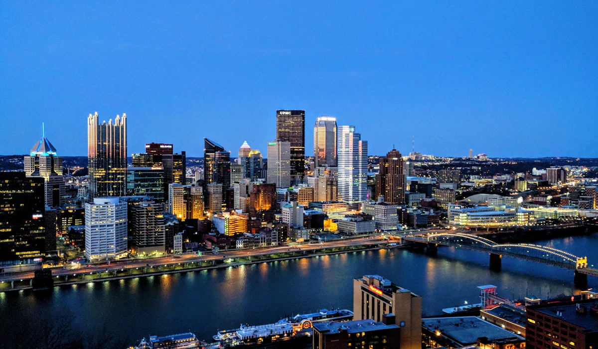
Pittsburgh’s hills convince visitors to drive, yet the city has a pedestrian network of public stairways that helps people navigate them. Public stairways number roughly seven hundred by most counts, and some appear on maps as streets even though no car could ever use them.
The longest, along Ray Avenue in Brookline, climbs 378 steps. Downtown, the Strip District and the North Shore sit close together across short bridges, and the Duquesne Incline carries walkers up Mount Washington for the classic view of the three rivers.
It is a hilly city, but the stairs make it a walkable one.
San Sebastián Fits a Beach and an Old Town in One Stroll
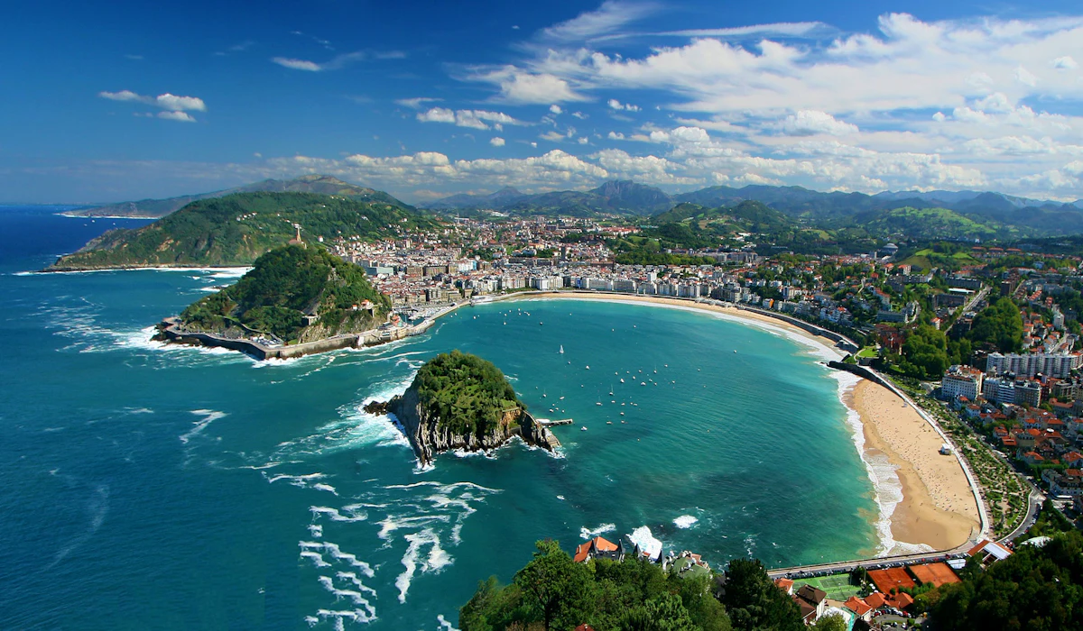
San Sebastian packs a crescent beach, a historic quarter and two hilltop viewpoints into an area most people can cross in half an hour. The promenade along La Concha runs with an ornate white railing that has become a symbol of the city.
The Parte Vieja, the old town, is where pintxos bars line up counter to counter, and hopping between them is the local way to eat dinner. Visitors who rent a car for the Basque coast often leave it parked for their entire stay here.
Melbourne Makes the Tram Free Downtown
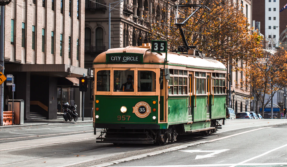
Melbourne’s central grid is laced with narrow laneways and arcades full of cafes, street art and small bars, and the best way to see them is on foot. For anyone who tires, trams inside the central Free Tram Zone cost nothing, a policy the city has run since 2015.
Hosier Lane, Degraves Street and the Block Arcade sit within minutes of one another. The city’s reputation for sprawl comes from its suburbs, while the center is compact enough to explore without ever buying a ticket.
Copenhagen Pedestrianized Early
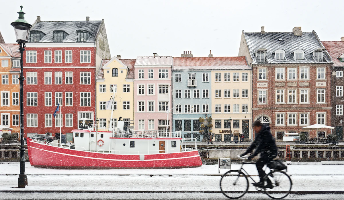
Copenhagen closed Strøget to cars in 1962, turning one of the city’s main shopping routes into a pedestrian street long before the idea caught on elsewhere. The experiment spread across the center, and today walkers can move from City Hall Square to Nyhavn, Rosenborg Castle and the Round Tower with little need for transit.
Cyclists get most of the attention in Copenhagen, and they deserve it, but the city is equally generous to people on foot. Harbor promenades and pedestrian-friendly bridges add walking routes along the water.
Quebec City Hides Inside Its Walls
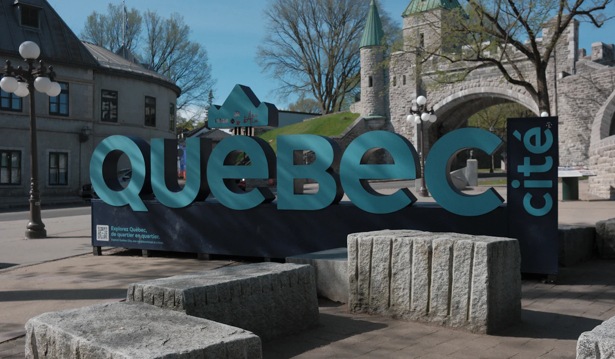
Quebec City is the only fortified city north of Mexico to keep most of its walls, and everything inside them sits within a short walk. The Upper Town and Lower Town connect by a funicular and by the Breakneck Stairs, one of the oldest staircases in the city.
Petit Champlain, the Château Frontenac and the Dufferin Terrace boardwalk are all a few minutes apart. Visitors who drive in often find the old streets narrow and parking scarce, while those who arrive on foot find the place easy.
Chicago Walks Along Its River and Lake
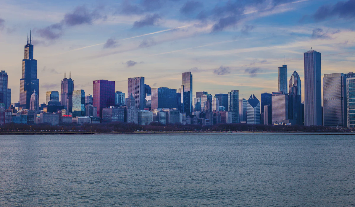
Chicago’s size and highways fool visitors into thinking it is built for cars. The Chicago Riverwalk runs about a mile and a quarter along the main branch of the river, lined with cafes, boat docks and some of the finest architecture in the country.
The Lakefront Trail follows Lake Michigan for about 18.5 miles, and the Loop, Millennium Park and the Magnificent Mile sit close together. An architecture boat tour is popular for good reason, but the same buildings reward anyone willing to look up from the sidewalk.
Vancouver Rings Its Park With a Seawall
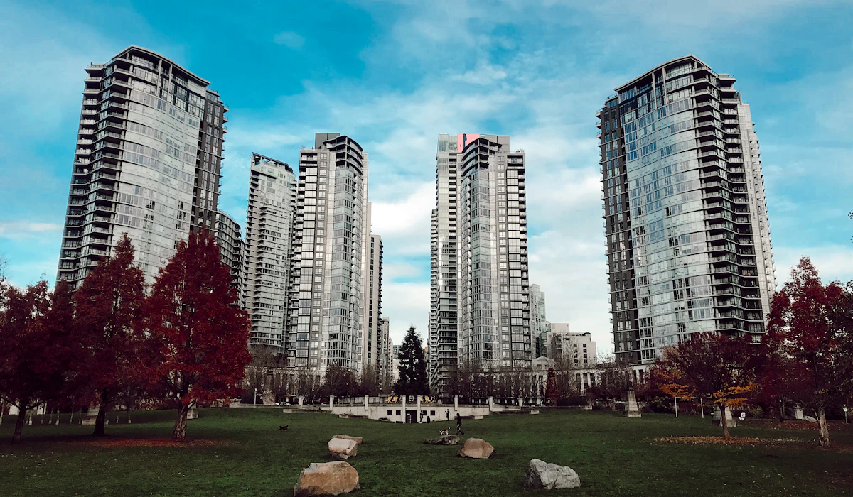
Vancouver’s seawall runs for more than 20 kilometers, and its most famous section circles Stanley Park for close to nine kilometers of flat, waterfront walking. The path links downtown, the West End, English Bay and False Creek, with Granville Island reachable by a small ferry.
Downtown itself sits on a peninsula, so almost everything in the core is bounded by water and easy to navigate. Visitors often expect a car-dependent West Coast city and discover one of the most pleasant urban shorelines anywhere on foot.
Seoul Restored a Buried Stream
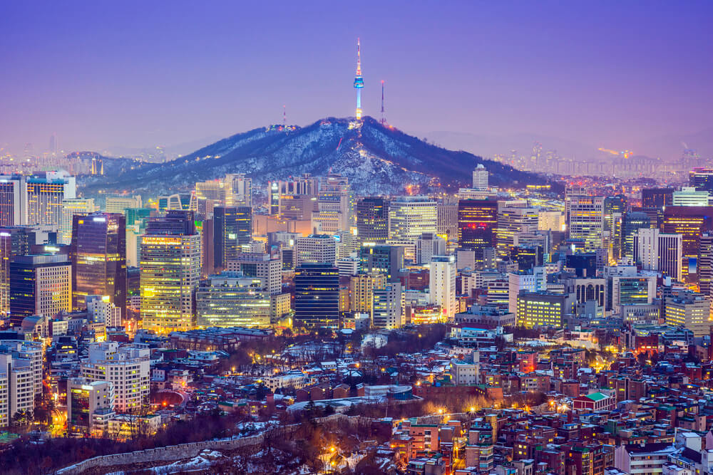
Seoul once covered the Cheonggyecheon stream with a raised highway, then tore the road down and reopened the waterway to the public in 2005. The restored stream now runs for close to 11 kilometers through the heart of the city, with stepping stones, footbridges and a sunken walking path below street level.
It connects easily to Gwanghwamun, Insadong and the palace district. The city looks overwhelming from a map, yet its historic center rewards walkers with palaces, markets and alleyways that sit only minutes apart.
Hong Kong Put an Escalator on a Hillside
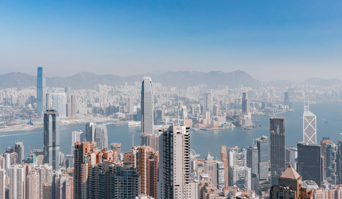
Hong Kong’s steep streets and humidity seem to rule out walking, but the city solved the problem with engineering. The Central to Mid-Levels escalator system stretches about 800 meters through a chain of covered escalators and moving walkways, and it opened in 1993.
It runs downhill in the early morning for commuters before reversing to run uphill for the rest of the day. Footbridges link much of Central without a need to cross traffic at street level.
Soho, Sheung Wan and the old markets all sit along the route, which makes a climb through the district far less punishing than it looks.
Lyon Tunnels Through Its Own Buildings
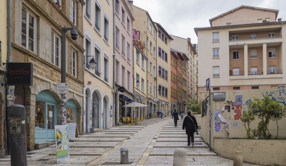
Lyon hides a pedestrian network inside its architecture. Its traboules are covered passageways that cut through courtyards and buildings from one street to the next, especially in Vieux Lyon and on the Croix-Rousse hill, and a number of them are open to visitors during the day.
The routes once helped silk workers move fabric through the city while staying out of the weather. The city’s reputation rests on its food, yet walkers who seek out these passages discover a second, hidden street plan running beneath the obvious one.
Kraków Wraps Its Old Town in a Park
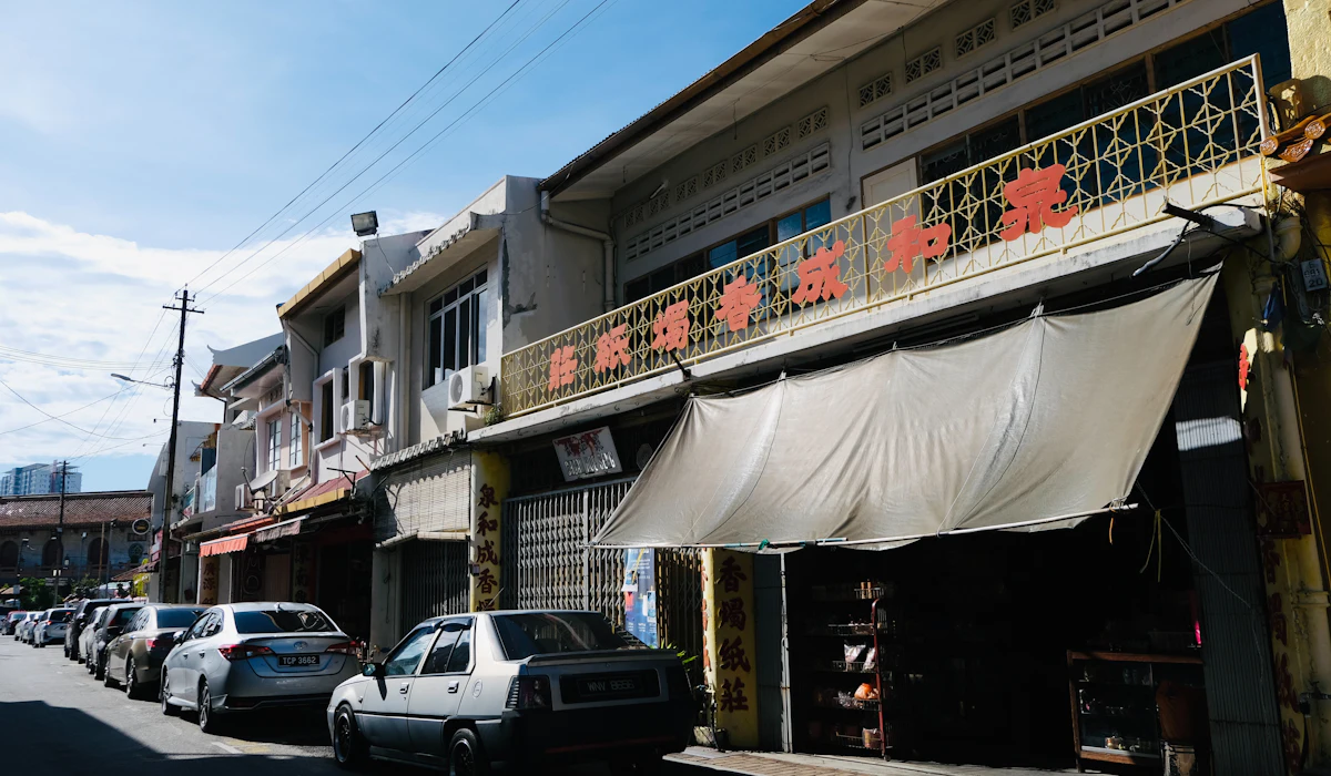
Krakow’s medieval walls were mostly torn down in the early 19th century, and the city replaced them with the Planty, a ring of gardens about four kilometers long. The park encircles the Old Town, where the Main Market Square sits a few minutes from Wawel Castle and the Jewish quarter of Kazimierz.
Almost everything a first-time visitor wants to see sits inside or just beyond that green ring. The square itself counts among the largest medieval town squares in Europe, and it turns into an open-air living room on summer evenings.
Boston Painted a Line on the Sidewalk
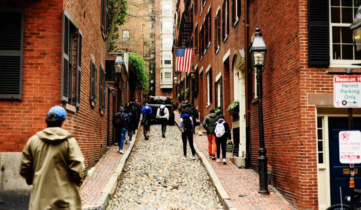
Boston’s Freedom Trail runs about two and a half miles through the city, marked by a red line of paint and brick in the pavement. It links 16 historic sites, from Boston Common to the Old North Church and the USS Constitution in Charlestown.
The city’s winding colonial streets confuse drivers far more than walkers, and the North End, Beacon Hill and the waterfront are all compact enough to explore in a day. Parking costs alone make a strong case for leaving the car behind.
Cape Town Walks the Atlantic Edge
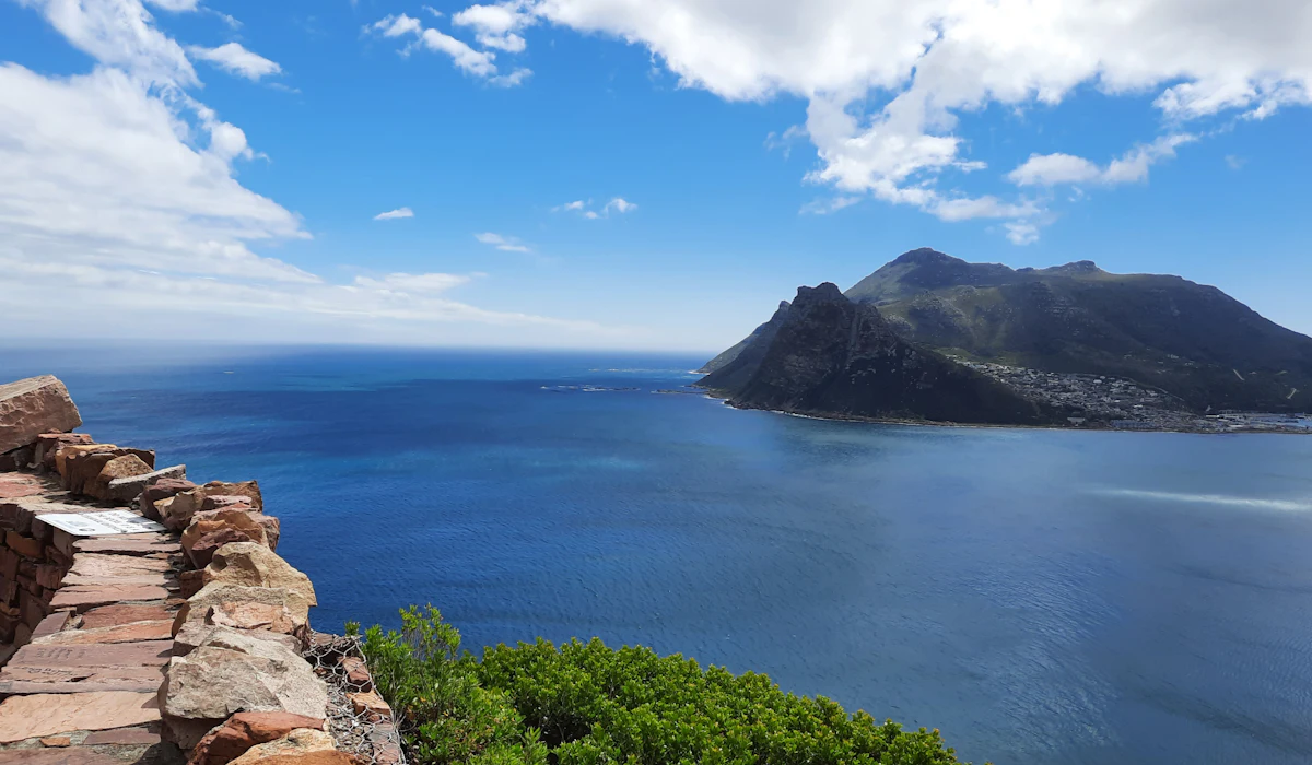
Cape Town gets labeled a driving city because of its wide suburbs and famous coastal roads. The Sea Point Promenade offers a long, flat path along the Atlantic from Mouille Point toward Bantry Bay, with lawns, public pools and views across to Robben Island.
The V&A Waterfront, Bo-Kaap and the Company’s Garden are close enough to link on foot in daylight. Table Mountain rises right above the center, and some visitors choose to hike the Platteklip Gorge route instead of taking the cableway to the top.
Washington Keeps Its Museums Free and Close
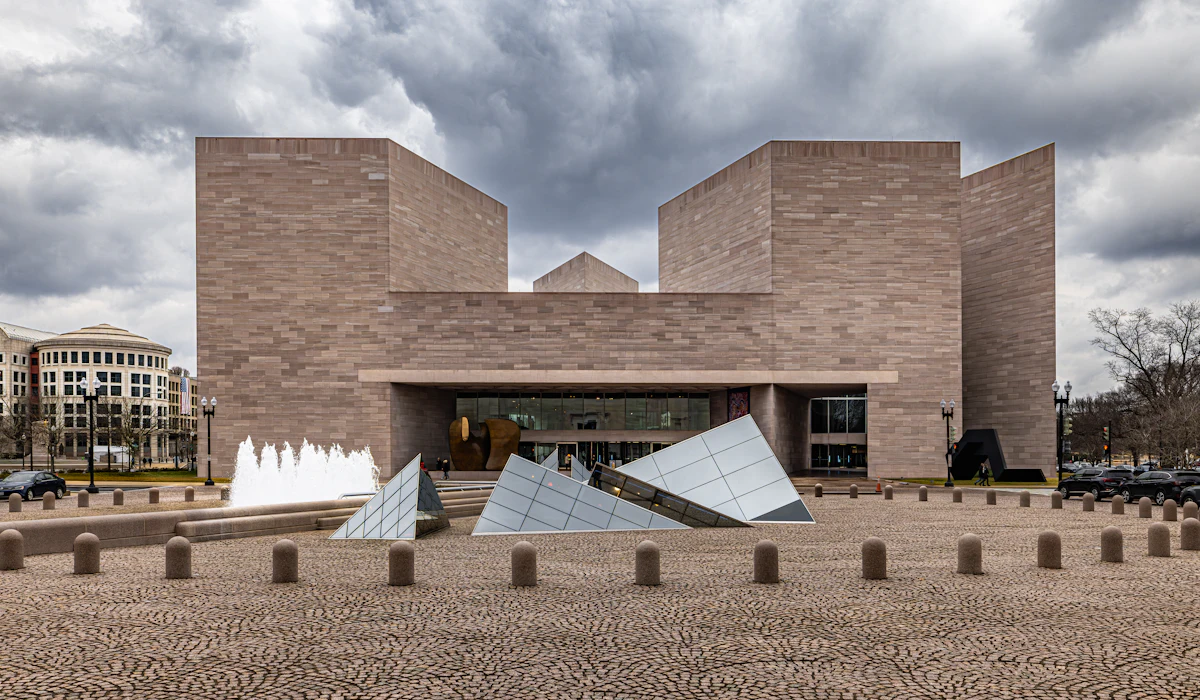
Washington’s monuments look far apart in photographs, yet the National Mall runs only about two miles from the Capitol to the Lincoln Memorial. The Smithsonian museums lining it are free to enter, although some require timed-entry passes, so a walker can visit the National Air and Space Museum or the National Museum of African American History and Culture without paying admission, while checking entry requirements in advance.
Georgetown, Dupont Circle and the Wharf round out a surprisingly walkable core. Summer heat is real, so the museums double as air-conditioned rest stops along the way.
Early mornings on the Mall are cool, quiet and nearly empty.
Singapore Turned an Old Railway Into a Trail
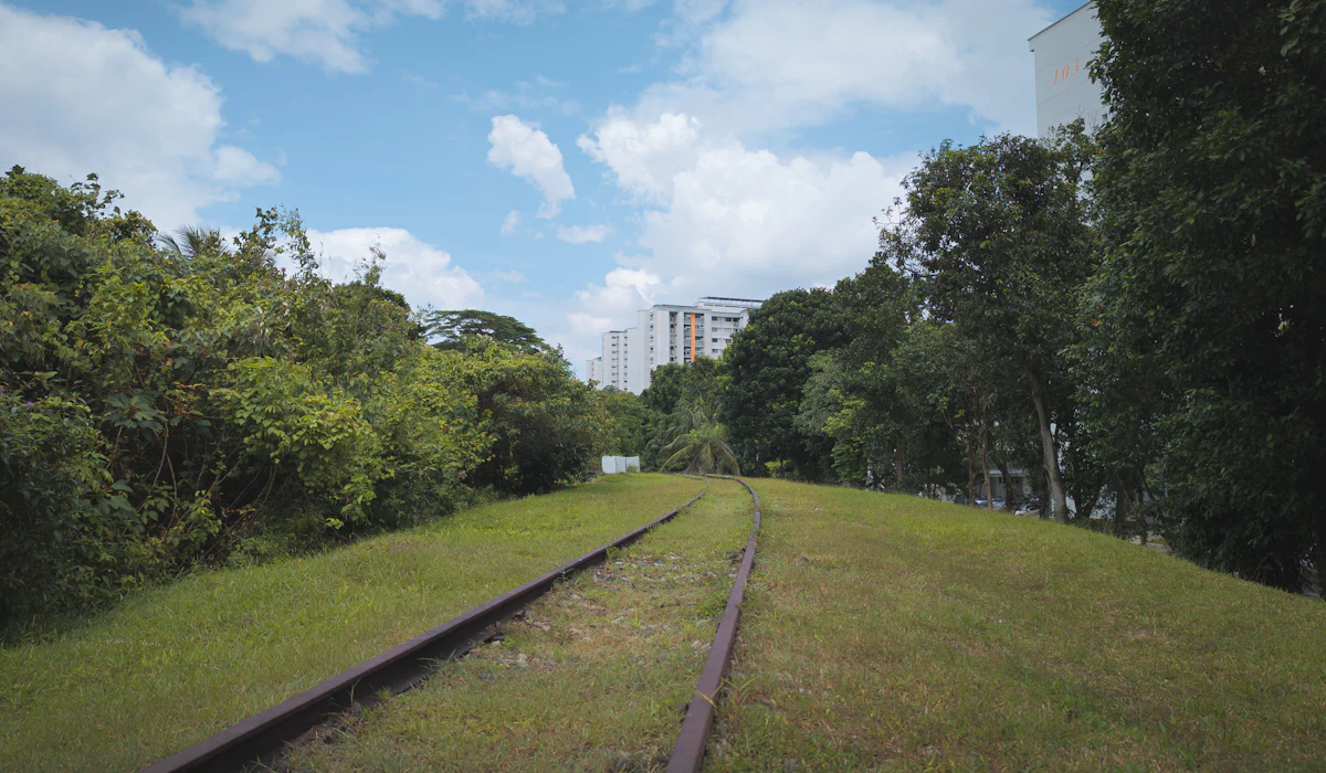
Singapore’s heat and humidity push visitors into taxis and the metro, but the city has invested heavily in shaded, covered walkways. The Rail Corridor follows the path of an old railway line for about 24 kilometers across the island.
Much of the route is open to walkers and cyclists, although sections can close temporarily for improvement works. Downtown, covered links connect many metro stations to shopping districts and offices.
Chinatown, Kampong Glam and the Marina Bay waterfront reward anyone willing to walk them in the cooler early morning. The heat is real, but so is the shade the city has built.
Tokyo Works Neighborhood by Neighborhood
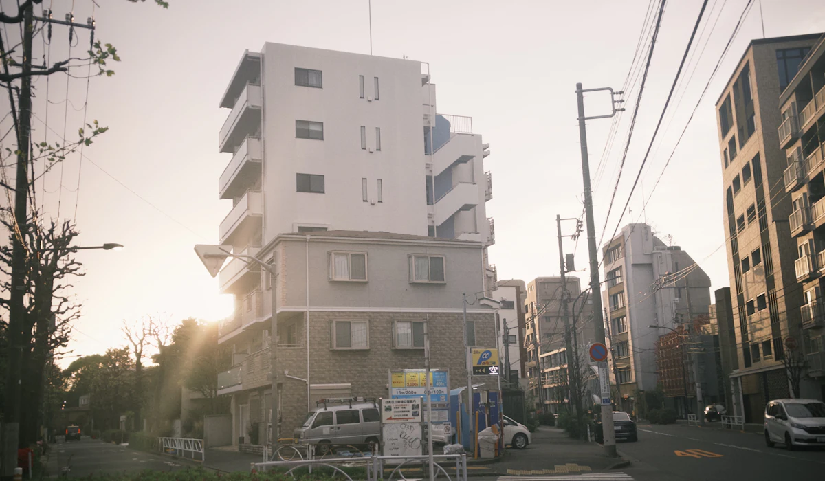
Tokyo’s scale leads visitors to spend their days underground, riding trains from one famous district to another. The better approach is to pick a neighborhood and walk it end to end.
Yanaka keeps quiet temple lanes and old wooden shops, Shimokitazawa is packed with vintage stores, and the stretch from Harajuku through Omotesando to Aoyama shows off design at street level. The city is remarkably safe and quiet for its size, and a few hours on foot reveal a Tokyo that rarely appears in guidebooks.
Distance Is a Story Visitors Tell Themselves
Most of these places lost their walking reputation to a single fact, whether a hill, a winter, a highway or a population figure. None of those facts measures the distance between two things worth seeing.
Cities that plan for pedestrians tend to hide that planning in stairs, arcades, tunnels and parks. The effort shows only to someone moving slowly enough to notice it.
A ride can save minutes but often costs context. Walkers learn where locals buy bread, which corners hold shade in July and how one neighborhood slides into the next.
Those are the details that make a city feel understood rather than visited. The map is not always the constraint.
More from Travel Pug

- Underrated Italian Towns That Beat the Tourist Crowds
- Las Vegas Tourist Traps to Skip
- Prettiest Towns in Every US State
- 18 passport-free countries for Americans
- Signs Your Cruise Is Not Worth The Cost
Like Travel Pug’s content? Follow us on MSN.