

America’s waterways offer some of the planet’s most diverse paddling experiences, from glassy mountain lakes to churning whitewater rivers that test even expert kayakers.
Most paddlers stick to familiar local spots, never realizing that extraordinary routes exist within a few hours’ drive or a short flight away.
Here are the unforgettable kayaking routes across the United States that transform casual paddlers into devoted enthusiasts and remind experienced kayakers why they fell in love with the sport.
Apostle Islands Sea Caves, Wisconsin
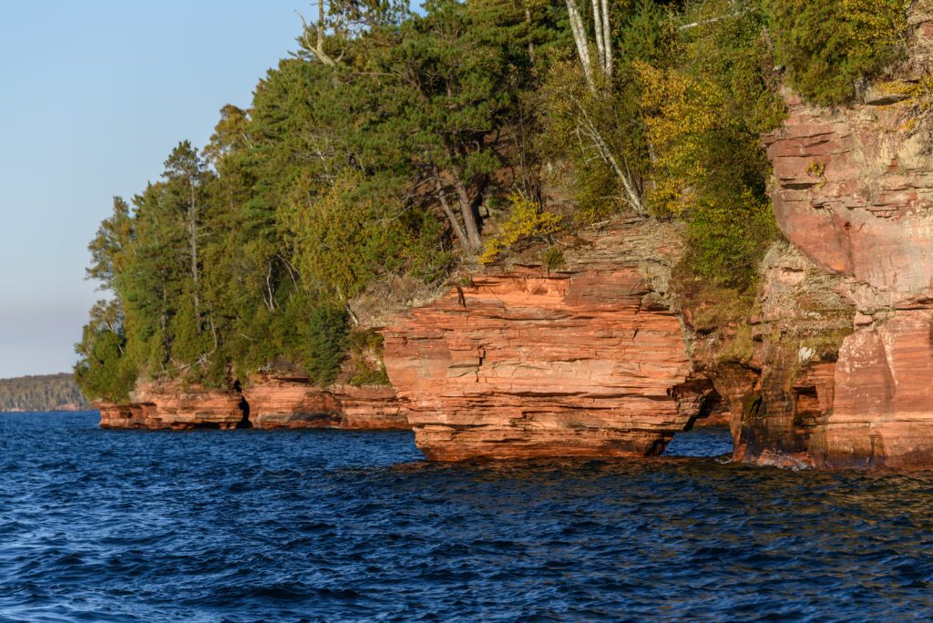
Lake Superior’s Apostle Islands feature a twenty-one-island archipelago with sea caves carved into rust-colored sandstone cliffs by centuries of wave action.
The caves are accessible only by water, making kayaking the primary way to explore these geological formations.
Paddling into the caves reveals chambers with natural skylights, arches, and passages that glow orange and red when sunlight filters through.
The water here is cold even in summer—Superior rarely warms above fifty degrees—so wetsuits or drysuits are essential.
Ice formations in winter transform the caves into frozen cathedrals, though kayaking then becomes obviously impossible.
Everglades National Park, Florida
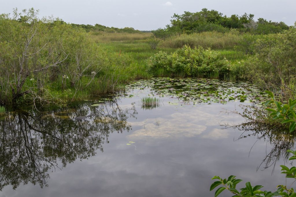
The Everglades offers a completely different paddling experience from anywhere else in the country.
This vast wetland ecosystem spreads across southern Florida with interconnected waterways winding through sawgrass marshes and mangrove tunnels.
The Wilderness Waterway stretches ninety-nine miles from Everglades City to Flamingo, taking most paddlers seven to ten days to complete.
Alligators sunbathe on mudbanks, manatees surface near kayaks, and wading birds stalk through shallow water in every direction.
The mosquitoes can be absolutely brutal during wet season, so timing matters here.
And the isolation is real—some stretches go hours without seeing another human.
Colorado River through Grand Canyon, Arizona
Kayaking through the Grand Canyon requires serious whitewater skills and extensive planning.
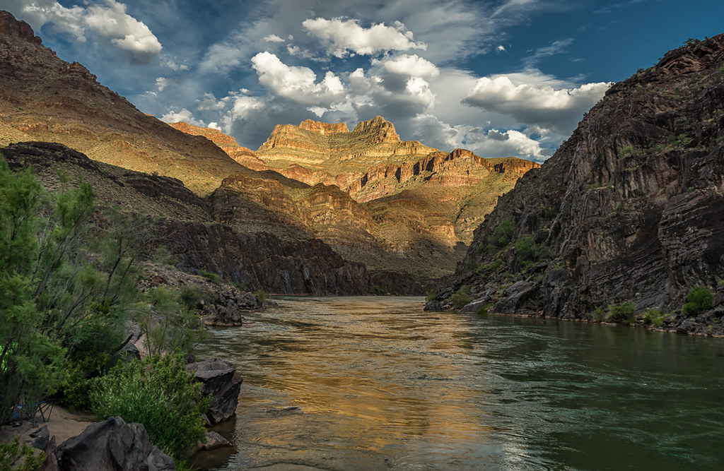
The Colorado River drops through some of the most spectacular geology on Earth, with rapids rated up to class ten on the Grand Canyon scale.
Most kayakers join commercial raft trips rather than attempting independent descents because permits are nearly impossible to obtain and the consequences of mistakes in these rapids are severe.
The full canyon trip covers 226 miles and takes two to three weeks.
Calmer sections between rapids allow paddlers to absorb the sheer scale of canyon walls rising thousands of feet overhead. Not for beginners.
San Juan Islands, Washington
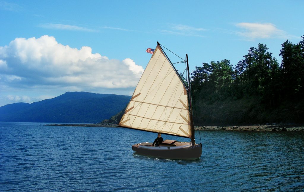
The San Juan archipelago sits in the Salish Sea between Washington State and Vancouver Island.
Over 170 islands create protected waterways ideal for multi-day kayaking expeditions, with established campsites on many islands.
Orca whales migrate through these waters regularly, and encountering a pod while kayaking ranks among North America’s most thrilling wildlife experiences.
Harbor seals, porpoises, sea lions, and bald eagles appear frequently.
The currents here can be tricky, with tidal flows reaching several knots in narrow passages.
Timing paddling with tides makes routes easier and safer.
Buffalo National River, Arkansas
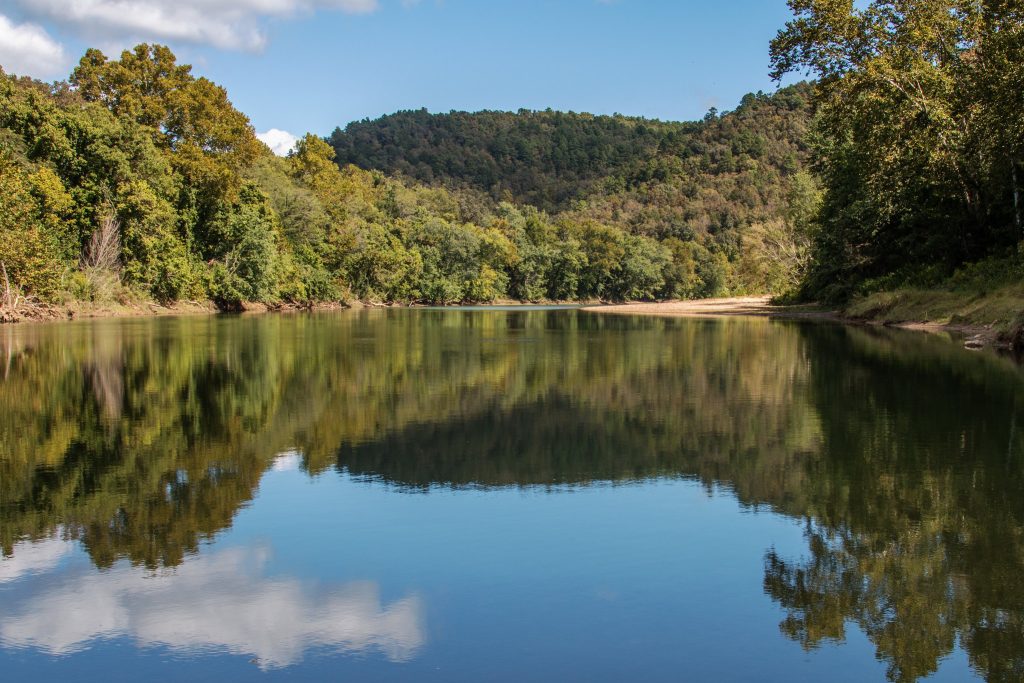
This free-flowing river cuts through the Ozark Mountains for 135 miles without a single dam.
The upper sections offer challenging whitewater during spring runoff, while middle and lower sections provide gentler float trips suitable for intermediate paddlers.
Limestone bluffs tower above the river, and the water runs clear enough to see the rocky bottom even in deeper pools.
Spring and fall provide the best conditions—summer flows can drop too low for comfortable kayaking in some sections.
The surrounding forest explodes with color in October, making autumn paddling particularly scenic.
Plus the water temperature actually feels pleasant during summer months, unlike some northern routes.
Boundary Waters Canoe Area Wilderness, Minnesota
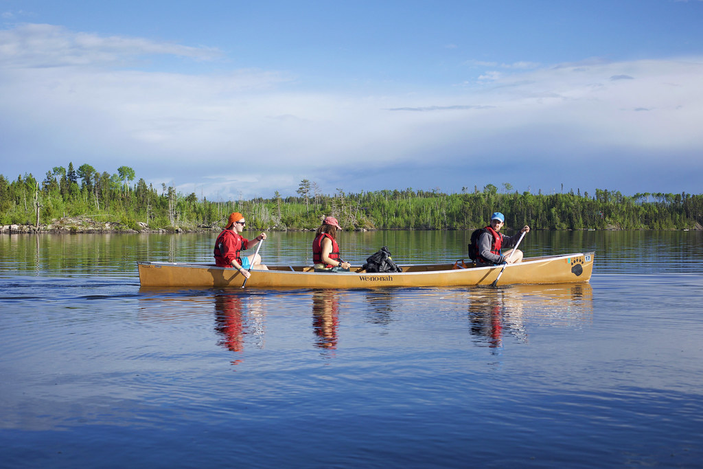
This million-acre wilderness area along the Canadian border contains over a thousand lakes connected by portage trails.
While technically a canoe area, kayakers use it extensively for expeditions lasting anywhere from a weekend to several weeks.
The portages require carrying boats and gear overland between lakes, which filters out casual visitors and maintains the area’s pristine character.
Moose wade through shallow bays, loons call across misty morning water, and campsites on rocky points offer views across island-dotted lakes.
Bears are common here, so proper food storage matters.
Could be worse than hauling a kayak over a muddy portage trail, but not by much.
Columbia River Gorge, Oregon/Washington
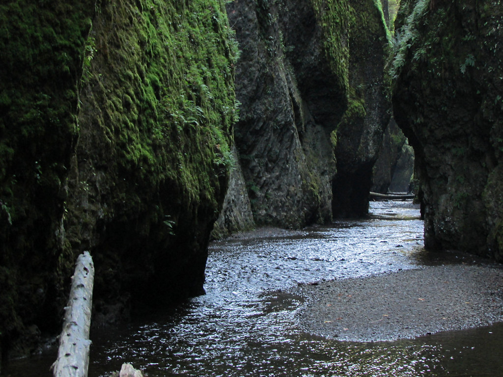
The Columbia River Gorge creates a dramatic corridor through the Cascade Range with numerous side channels, islands, and calm water sections perfect for flatwater kayaking.
The main river here is massive—more suited to powerboats—but protected areas offer excellent paddling.
Waterfalls cascade down cliff faces visible from the water, and the wind that funnels through the gorge creates consistent conditions for kiteboarding and windsurfing.
Paddlers stick to morning hours before winds intensify.
The gorge offers something for every skill level, from absolute beginners to experts seeking challenging conditions.
Nahanni River, Northwest Territories
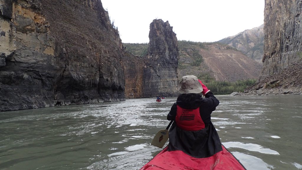
Technically crossing into Canada, but accessible primarily through connections from Alaska, the Nahanni River offers one of North America’s most remote paddling experiences.
This wild river flows through four major canyons and plunges over Virginia Falls, which drops twice the height of Niagara.
The full trip covers about 200 miles and takes two to three weeks. Grizzly bears, wolves, and caribou inhabit the surrounding wilderness.
The logistics of accessing this route are complicated and expensive, requiring float plane access to put-in points.
Most paddlers go with guide services rather than attempting independent trips.
But the isolation and pristine wilderness make the effort worthwhile for those seeking true backcountry experiences.
Pictured Rocks National Lakeshore, Michigan
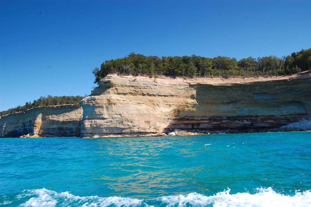
Lake Superior’s southern shore features fifteen miles of multicolored sandstone cliffs rising up to 200 feet directly from the water.
The mineral staining creates patterns of red, orange, yellow, brown, and white, giving rise to the “pictured rocks” name.
Sea caves, arches, and rock formations dot the shoreline.
Kayaking provides the only way to fully appreciate these features since they’re not visible from the top of the cliffs.
Superior’s temperament changes quickly—calm morning conditions can turn into dangerous waves by afternoon.
Local guide services understand the lake’s patterns and know when conditions are safe for paddling.
Kenai Fjords, Alaska
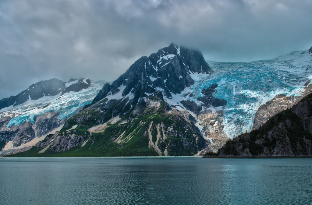
Glaciers calving into the ocean create the defining experience of paddling Kenai Fjords.
The route from Seward takes kayakers into protected fjords surrounded by hanging glaciers and steep mountain walls.
Icebergs float past kayaks, ranging from car-sized chunks to smaller pieces that clink against paddle blades.
Wildlife sightings include sea otters in kelp beds, humpback whales breaching in deeper water, and seals hauled out on ice floes.
The water temperature hovers barely above freezing, making capsizing potentially fatal without proper gear.
The sound of glaciers calving, like thunder across water, never gets old.
New River Gorge, West Virginia
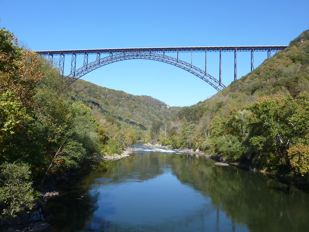
Despite its name, the New River is actually one of the oldest rivers in North America.
It cuts through the Appalachian Mountains, forming the New River Gorge, renowned for some of the best whitewater in the eastern United States.
The Lower New River features class III–V rapids, depending on water levels.
Spring brings high flows with powerful hydraulics requiring advanced skills.
Summer and fall offer more manageable levels while still providing exciting rapids.
The gorge delivers dramatic scenery, highlighted by the iconic bridge spanning 876 feet above the water.
Lake Powell, Utah/Arizona
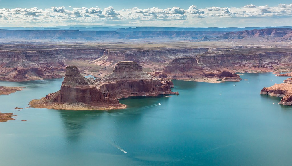
This massive reservoir behind Glen Canyon Dam floods what was once a maze of sandstone canyons.
While controversial environmentally, the lake offers unique kayaking opportunities through slot canyons and side arms accessible only by water.
Antelope Canyon and other famous formations extend below the waterline into flooded grottos and passages.
Water levels fluctuate significantly due to drought conditions and dam management.
Rainbow Bridge, one of the world’s largest natural bridges, requires a 13-mile paddle to reach.
The desert climate brings scorching summer temperatures, with ideal conditions in spring and fall.
Gauley River, West Virginia
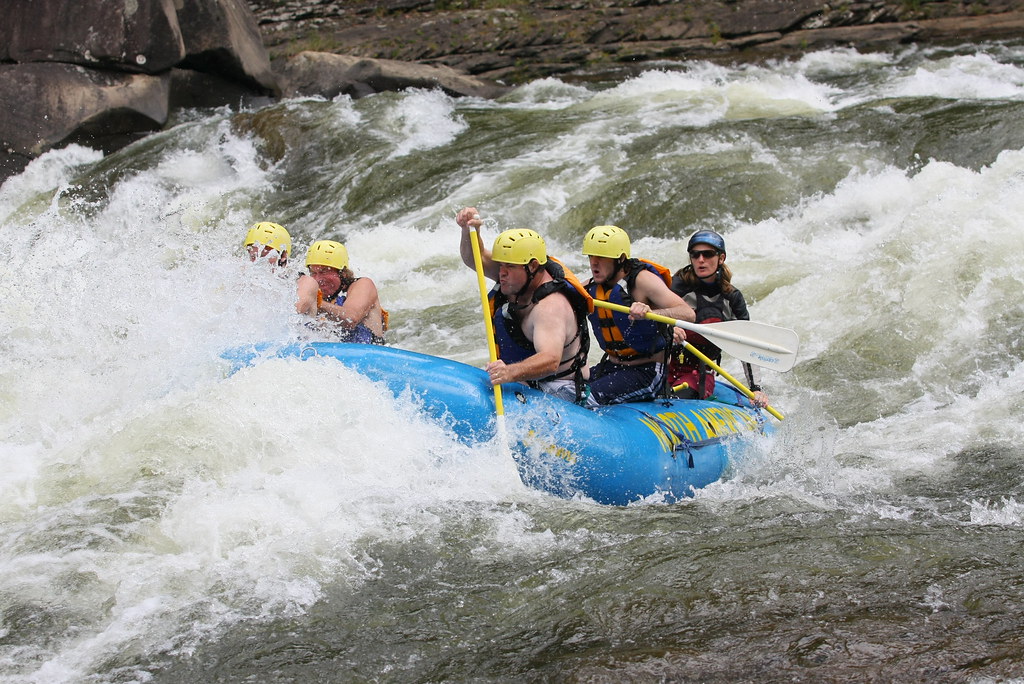
The Gauley River delivers some of the most intense whitewater kayaking in the eastern United States.
Every fall, an upstream dam releases water for six weekends, creating massive flows through class IV and V rapids.
This is strictly expert-only territory.
Rapids have iconic names like “Pillow Rock” and “Sweet’s Falls,” inspiring both excitement and fear among serious whitewater kayakers.
Hundreds of paddlers converge during release weekends, creating a festival atmosphere around some of the most challenging kayaking available.
The runs are relatively short, but the rapid density and consequences of mistakes make them unforgettable.
Glacier Bay, Alaska
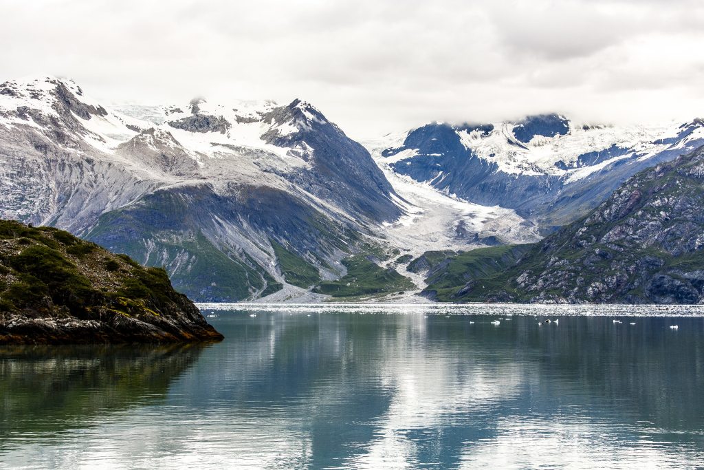
Glacier Bay National Park contains 16 active tidewater glaciers that calve directly into saltwater.
Kayaking here involves navigating around icebergs while spotting whales, seals, and bears along forested shorelines.
Permits are required and limited to preserve the wilderness character.
The paddling season runs June through August, when weather is most stable and daylight stretches late into the evening.
Conditions remain challenging, with cold water, potential storms, and hazards from floating ice.
Few places rival the raw, pristine beauty of this protected coastline.
Snake River through Hells Canyon, Idaho/Oregon
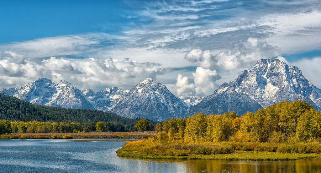
Hells Canyon forms North America’s deepest river gorge, deeper even than the Grand Canyon.
The Snake River winds through a remote canyon with class three and four whitewater interspersed with calmer stretches.
Multi-day trips typically cover about 80 miles over 4–6 days.
Bighorn sheep cling to steep canyon walls, and petroglyphs mark sites where indigenous peoples camped thousands of years ago.
Summer heat can be intense, with temperatures regularly exceeding 100°F in the canyon.
The remoteness demands commitment—once you start, finishing is the only option.
Chesapeake Bay, Maryland/Virginia
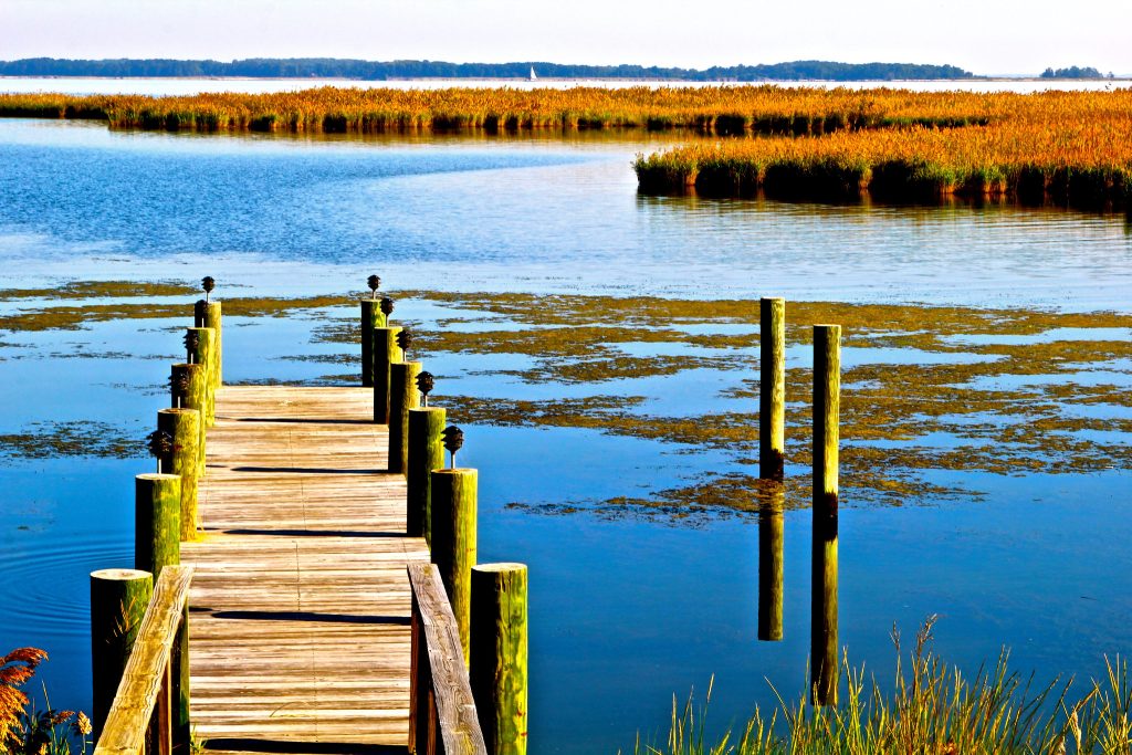
The Chesapeake Bay offers gentler paddling but is rich in history and diverse ecosystems.
Hundreds of miles of shoreline include protected coves, tidal creeks, and island chains suitable for all skill levels.
Tangier Island, located in the bay’s middle, is accessible only by boat and preserves a culture largely unchanged for centuries.
The Eastern Shore provides multi-day touring opportunities with established water trails and campsites.
Dolphins occasionally appear, and the bay is famous for blue crabs.
The flatwater environment is ideal for beginners learning paddling skills before moving on to more challenging routes.
Youghiogheny River, Pennsylvania/Maryland
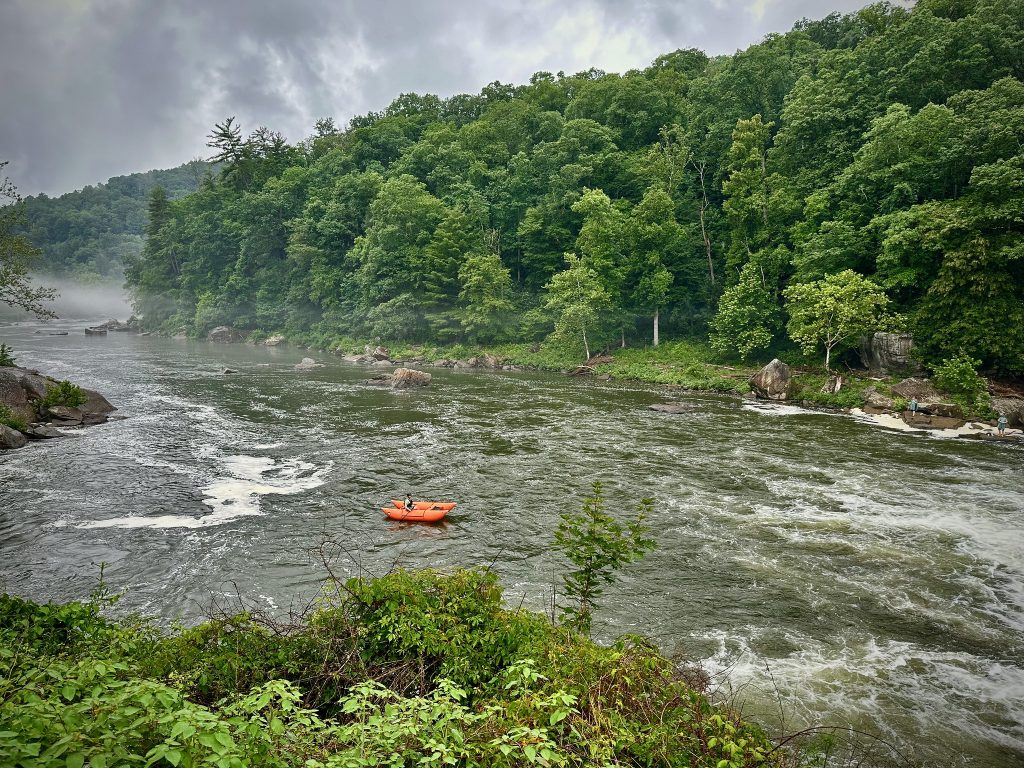
Known universally as “the Yough,” this river offers excellent whitewater progression from class two to five depending on the section.
The Lower Yough runs year-round with dam-controlled releases ensuring consistent flows.
The seven-mile lower section through Ohiopyle State Park features continuous class three and four rapids, ideal for advancing kayaking techniques.
The Middle Yough provides easier water for skill development, while the Upper Yough delivers class five intensity for experts.
Autumn colors make fall paddling especially scenic, though summer weekends can get crowded with rafters and kayakers.
Lake Tahoe, California/Nevada
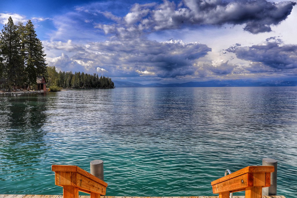
This alpine lake straddles the California-Nevada border at 6,225 feet elevation.
The water is famously clear—visibility often exceeds seventy feet—and intensely blue from its depth and clarity.
Kayaking Tahoe means paddling amid Sierra Nevada peaks and exploring boulder-strewn shorelines with hidden coves and beaches accessible only from the water.
The lake spans 191 square miles, so conditions can turn serious quickly if wind picks up.
Emerald Bay on the California side offers protected water and stunning scenery.
Summer brings warm air temperatures, though the water stays cold year-round from snowmelt and depth.
Where Paddles Meet Purpose

These routes represent only a fraction of America’s incredible kayaking opportunities, but they capture the range and diversity that makes exploring the country by kayak endlessly rewarding—each paddle stroke revealing landscapes that exist nowhere else on Earth.
More from Travel Pug

- Underrated Italian Towns That Beat the Tourist Crowds
- Las Vegas Tourist Traps to Skip
- Prettiest Towns in Every US State
- 18 passport-free countries for Americans
- Signs Your Cruise Is Not Worth The Cost
Like Travel Pug’s content? Follow us on MSN.