

Millions of hikers visit the Dolomites every year, yet the majority never leave the Instagram-famous paths. Entire mountain ranges wait in silence as throngs swarm over Tre Cime and line up at Lago di Braies. These are the paths that require greater courage, stamina, and a readiness to accept risk and uncertainty.
These strenuous Dolomites excursions will distinguish serious mountaineers from casual pedestrians.
Tullen via Günther Messner Steig
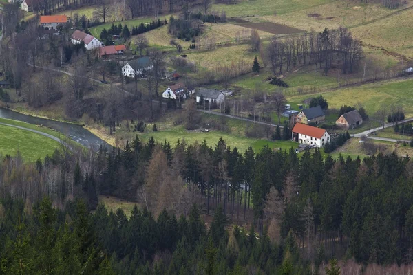
The highest summit in the Aferer Geisler Group doesn’t come easy. At 2,653 meters, Tullen requires navigating the Günther Messner Steig, a partially secured ridge traverse that most hikers skip entirely.
The route begins innocuously enough at Zannes car park in Val di Funes, winding through alpine meadows before the landscape shifts dramatically.Once past the forest, the trail follows the Oberer Herrensteig beneath the bizarre pinnacles of the Odle d’Eores.
The final push to Tullen’s summit involves an exposed, unprotected ridge where a slip means consequences. No cables here. The views stretch across the Geisler peaks and Peitlerkofel, but you’ll earn every meter of that panorama through approximately 1,200 meters of elevation gain over roughly six hours.
Sentiero Bonacossa
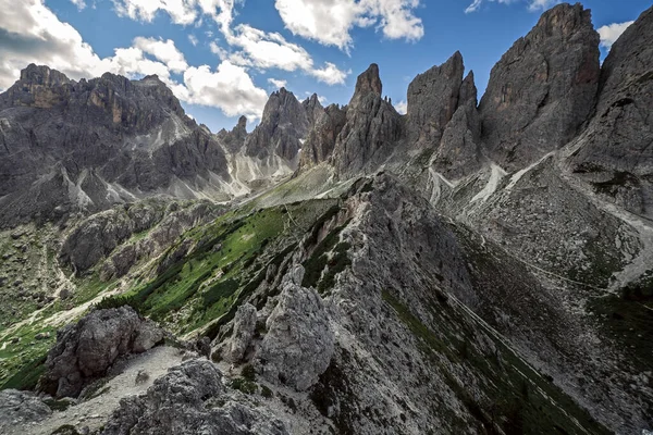
This aided trail slices through the Cadini di Misurina like a surgical cut through the mountain’s western and northern flanks. Guidebooks call it “easy,” but that’s misleading. The protection is sparse—mostly ladders in a few key sections—and between the secured passages lie steep scrambles across unstable scree.
Starting from Rifugio Col de Varda, the route crosses three major saddles: Forcella di Misurina, Forcella del Diavolo, and Forcella Rinbianco. The descent from Forcella di Misurina is particularly treacherous where rockfall has damaged much of the remaining protection.
A 40-meter near-vertical step late in the route demands ladders and steady nerves. The Cadini pinnacles—Torre del Diavolo, Castello Incantato, Ultimo Spirito—loom overhead like props from a fantasy film. Takes about seven hours. Not great for the faint-hearted.
Like Travel Pug’s content? Follow us on MSN.
Croda Rossa from Passo Stalle
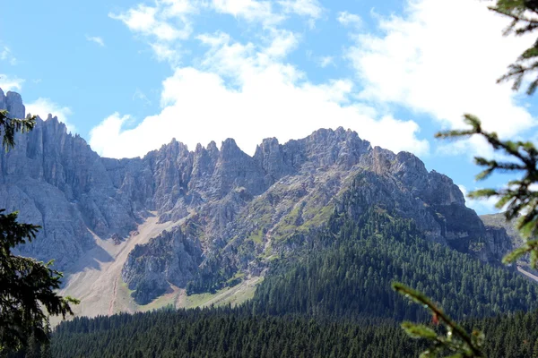
Few people bother with this 2,000-meter elevation gain monster on the Italian-Austrian border. The entire hike unfolds above treeline, meaning exposure to weather from start to finish. Six hours round trip to a summit that offers views of both the Dolomites to the south and Austrian Alps to the north, including Grossglockner.
Because the trailhead sits at 2,000 meters, altitude hits harder than expected. Cloud cover typically rolls in by early afternoon, rendering all that climbing effort pointless if you start late.
The route demands leaving before dawn and pushing hard.
Seekofel summit
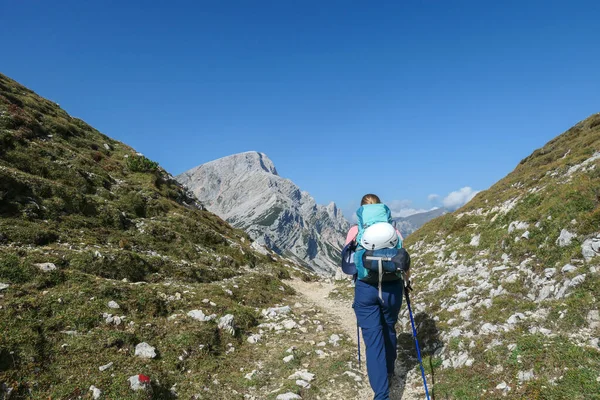
Everyone photographs this mountain reflected in Lago di Braies. Almost nobody climbs it. The ascent of Seekofel (also called Croda del Becco) involves over 1,000 meters of vertical gain and enough exposure to keep most tourists down at lake level taking selfies.
And honestly, that’s the point. While crowds choke the shoreline below, the summit offers solitude and a completely different perspective on the famous lake. The trail is unrelenting—just keeps climbing without much reprieve.
Torre dei Scarperi Circuit
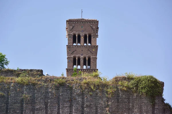
This U-shaped traverse in the Tre Cime Nature Park circles Monte Tre Scarperi through four distinct corners of the park. Starting in Campo di Dentro valley, it climbs to Rifugio Locatelli, then descends through Sassovecchio Valley before ending in Fiscalina Valley.
Both trailheads are accessible by public transport, which helps with logistics.The route covers significant ground with constant elevation changes.
.Views shift from the Three Peaks to Monte Paterno to Torre dei Scarperi itself. Because it starts and ends at different points, many hikers opt for easier circuits instead. Their loss.
Forcella Marcuoira route
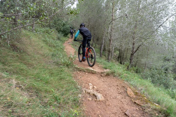
The standard Tre Cime loop is mobbed year-round. But there’s an alternative via the Forcella Marcuoira saddle that experienced alpine hikers use to avoid the masses. This route requires confidence in steep, rocky terrain without much protection. It’s technically demanding enough to filter out casual hikers.
The exposure here is real. You’re navigating fractured dolomite on narrow passages where concentration matters. Weather changes fast at altitude, and there’s nowhere to hide if conditions deteriorate.
Piz Duleda
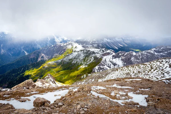
At 2,909 meters, Piz Duleda stands as one of the more adventurous peaks in the Odle Group of Val Gardena. The approach involves significant scrambling and route-finding skills that most day-hikers lack.
This isn’t a marked trail with reassuring signposts every hundred meters.The summit views justify the effort—assuming visibility cooperates.
The rock formations surrounding the peak display the classic Dolomite architecture: sheer walls, jagged spires, improbable angles. Getting up requires using your hands as much as your feet. Coming down demands even more care, as descents always do on loose rock.
Val Popena to Rifugio Popena ruins
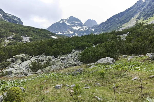
While tourists cluster around Lake Misurina buying postcards, Val Popena offers genuine tranquility just minutes away. The hike to the ruins of the old Popena refuge involves medium-difficulty terrain over approximately three hours.
Some stretches cross gravelly, exposed ground that isn’t suitable for children or inexperienced hikers.The valley feels remote despite its proximity to major tourist infrastructure.
Wildflowers carpet the meadows in summer, and the surrounding peaks—particularly Piz Popena—create natural amphitheater walls. Most visitors to Misurina never discover this place exists.
Croda Fiscalina Circuit
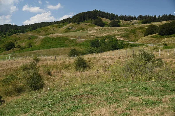
This loop around Croda Fiscalina in the Tre Cime Nature Park ranks among the most rewarding and least crowded options in the region. The trail maintains relatively high elevation throughout, crossing alpine meadows and rocky passages with continuous mountain views. Cable car assistance? None. Just legs and lungs.
The circuit takes a full day and delivers constantly changing perspectives on the surrounding peaks. In late afternoon light, when the sun hits the dolomite faces at acute angles, the rocks glow amber and rose. If you time it right.
Which requires planning and luck.
Hochalpenkopf Peak from Lago di Braies
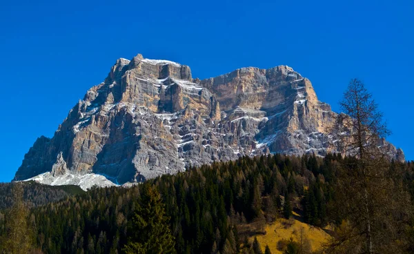
Starting from the region’s most photographed lake, this route immediately diverges from the crowds doing the easy lakeside stroll. The ascent to Hochalpenkopf involves sustained climbing and exposure that most Braies visitors won’t consider. The summit provides panoramic views across the Fanes-Senes-Braies Nature Park.
The trail requires:
- Strong cardiovascular fitness for the elevation gain
- Comfort with exposed sections
- Proper mountain boots (not sneakers)
- Early start to avoid afternoon weather
From the top, Lago di Braies looks like a turquoise gem far below. Worth every burning quad muscle.
Tofana di Rozes Circuit
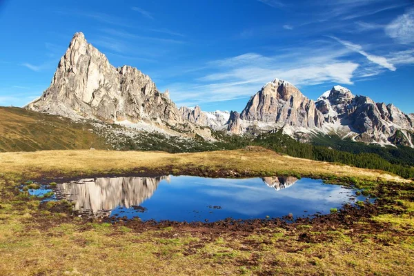
This challenging loop near Cortina d’Ampezzo takes hikers through wild, less-traveled terrain in the Tofane mountain group. The circuit involves technical sections, significant elevation changes, and route-finding that keeps most people on easier Cortina trails.
Expect a long day—six to eight hours depending on pace and conditions.The Tofane peaks are massive, imposing presences.
This circuit gets you intimate with their lower flanks and hidden valleys. The rock here feels older, more weathered than other Dolomite formations. Maybe that’s imagination talking, but the geology does differ subtly from the iconic pale towers elsewhere in the range.
Monte Castellaz
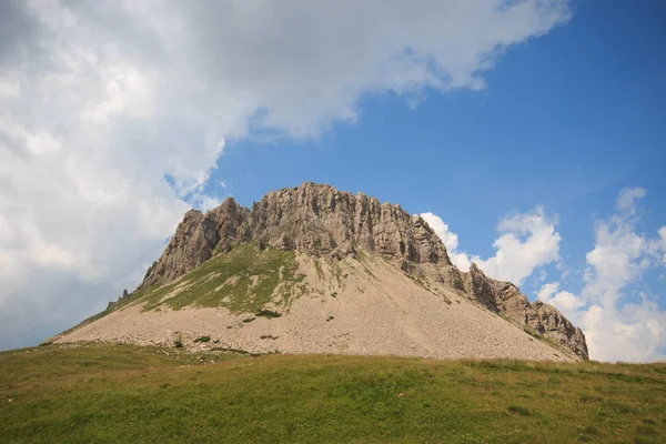
Located in the Pale di San Martino group, Monte Castellaz offers technical climbing on an adventurous route that sees minimal traffic. The Pale di San Martino range sits on the western edge of the Dolomites and receives fewer visitors than the central areas around Cortina.
This works in favor of solitude-seekers.The ascent demands scrambling ability and comfort with exposure.
Routes here aren’t manicured or maintained to the same standard as more popular areas. Rockfall is a legitimate concern. Still, for those with proper alpine skills, Castellaz provides an excellent objective in a stunning, underappreciated massif.
Pala di San Martino Circuit
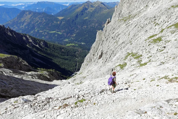
This full-day circuit through the Pale di San Martino requires serious fitness and mountain experience. The terrain varies from alpine meadows to rocky passages to exposed ridges.
Total distance and elevation gain add up to a substantial effort that casual hikers won’t attempt.The Pale di San Martino feels more remote than the eastern Dolomites.
Fewer refugios, fewer trail markers, more self-reliance required. The mountains here have a different character—broader, more plateau-like in sections, then suddenly vertical. Navigation skills matter.
Armentara meadows traverse
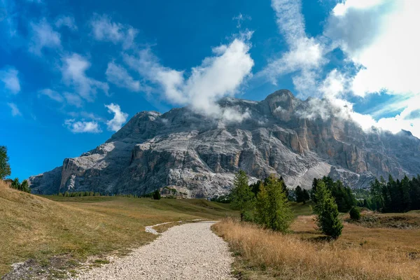
On the western edge of Fanes-Senes-Braies Nature Park in Alta Badia, the Armentara plateau offers a gentler experience than most entries on this list. But here’s the catch: the descent might prove difficult for those with knee issues. The trail continuously drops across rolling pastures beneath the arresting rock faces of Sasso di Santa Croce.
Starting from La Crusc church (reached via two chairlifts), the route follows trail 15 to Armentara, then continues on trail 7a all the way down to Badia. That’s over 1.5 hours of descending, which sounds easy until your knees start protesting.
Hay huts dot the landscape. The smell of mountain grass hangs in the air. It’s pastoral and beautiful, but those knees will remember.
Piz Boè
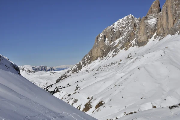
Considered one of the easiest 3,000-meter summits in the Dolomites doesn’t mean it’s actually easy. Just easier than other giants. The route begins at Passo Pordoi with a cable car to Sass Pordoi, then a steep, strenuous push to Piz Boè at 3,152 meters.
The 430 meters of elevation gain from the cable car station packs more punch than the numbers suggest.At the summit, the 360-degree panorama encompasses the entire Sella Group and beyond.
The highest peak in the Sella massif rewards those willing to handle altitude, exposure, and the thin air that makes every step more laborious.
Worth the effort
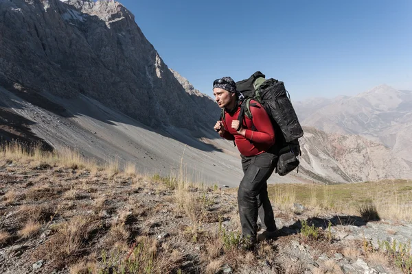
The demands of these paths are higher than those that most hikers bring to the Dolomites. But that’s exactly why, even during peak season, they’re rather vacant.
The best experiences in the mountains are reserved for those who are prepared to work harder, begin earlier, and value real difficulty over convenient scenery.
More from Travel Pug

- Underrated Italian Towns That Beat the Tourist Crowds
- Las Vegas Tourist Traps to Skip
- Prettiest Towns in Every US State
- 18 passport-free countries for Americans
- Signs Your Cruise Is Not Worth The Cost
Like Travel Pug’s content? Follow us on MSN.