

The world’s map looks neat and orderly from a distance—clean lines separating countries, everything in its proper place. But get closer, and the reality becomes wonderfully strange.
Borders twist through houses, split restaurants down the middle, and force travelers into elaborate detours that seem designed by someone with a peculiar sense of humor. These aren’t just lines on paper; they’re living reminders of history’s accidents, diplomatic compromises, and the stubborn refusal of geography to cooperate with human ambition.
Haskell Free Library and Opera House
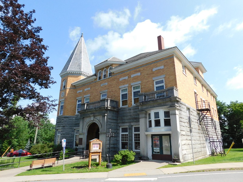
This library splits the United States and Canada right down the middle. The building sits on both sides of the border, which means checking out a book technically involves international travel.
The reading room sits in Canada. The entrance sits in the United States.
Patrons cross an international border just to return their novels, and the whole thing operates under a special agreement that predates modern border security. No passports required for library cards.
Korean Demilitarized Zone Joint Security Area
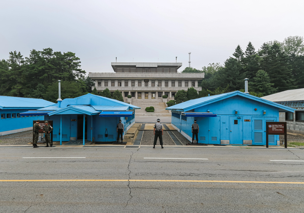
The most militarized border on earth features a conference room where peace talks happen (when they occur). Tourists can walk from South Korea into North Korea by stepping around a table, making it possibly the world’s shortest international trip—and definitely the most supervised.
But here’s what makes it particularly surreal: the soldiers on both sides spend their days staring at each other from a few feet away, maintaining a tension so thick you could almost cut it . And yet, tour groups show up daily to take photos of what amounts to the world’s most serious standoff, which creates this bizarre atmosphere where mortal enemies and vacation selfies occupy the same space.
The whole thing operates on rules so specific that stepping six inches in the wrong direction could spark an international incident—or at least a very uncomfortable conversation with people who don’t appear to have much of a sense of humor about these things.
Baarle-Nassau and Baarle-Hertog
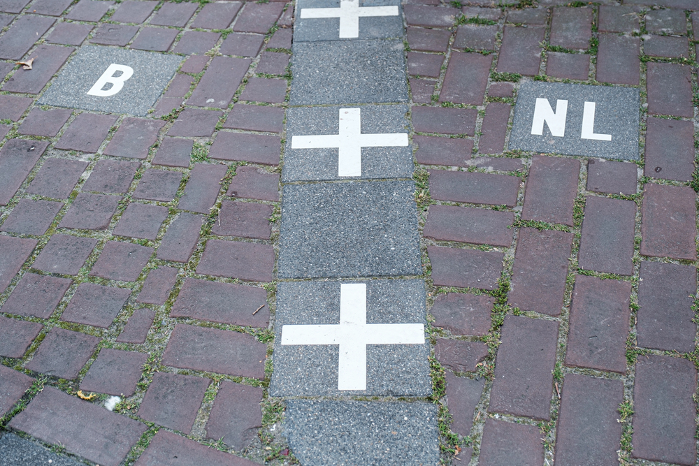
Walking through this Dutch town requires crossing the Belgian border approximately thirty times. Some houses sit in both countries simultaneously, which creates complications for everything from mail delivery to tax collection.
The border runs through restaurants, shops, and living rooms. White crosses in the pavement mark where one country ends and another begins.
Residents might eat breakfast in the Netherlands and lunch in Belgium without leaving their neighborhood.
Point Roberts, Washington
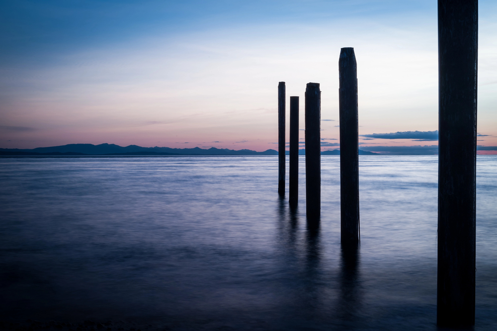
This American town can only be reached by driving through Canada. Geography created this puzzle when the 49th parallel became the border, leaving a small piece of Washington State dangling below the line like a geographic afterthought.
Residents need passports to buy groceries in their own country. Their mail gets delivered through Canada.
Children take school buses across two international borders to attend American schools. The whole situation feels like someone drew the map without checking their work.
Derby Line and Stanstead
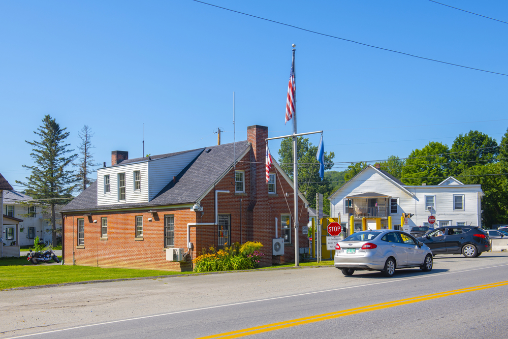
The border between Vermont and Quebec runs straight through the middle of town, creating situations that border patrol agents probably didn’t anticipate when they signed up for the job. The library straddles both countries—you can check out books in Canada and return them in the United States without anyone batting an eye, assuming your library card is more current than your passport.
But it gets stranger: families live on one side of the street and work on the other, which means commuting to work involves international travel that takes about thirty seconds on foot (and significantly longer if you get stopped for questions about where you’ve been and why). So neighbors chat across national boundaries while hanging laundry, and the local theater company puts on shows where the audience sits in one country and the stage occupies another, making every performance a cross-border cultural exchange whether anyone intended it or not.
The whole arrangement works on the honor system and a fair amount of bureaucratic flexibility that seems to acknowledge how ridiculous the alternative would be.
Bir Tawil
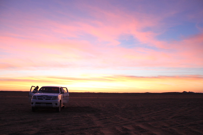
Nobody wants this patch of desert between Egypt and Sudan. Both countries claim the more valuable territory next door and reject ownership of Bir Tawil, creating the world’s only unclaimed land.
Travelers who make it here find themselves in a legal nowhere zone. No government, no laws, no official recognition of its existence.
It’s roughly the size of London, but London has considerably more going for it.
Northwest Angle, Minnesota
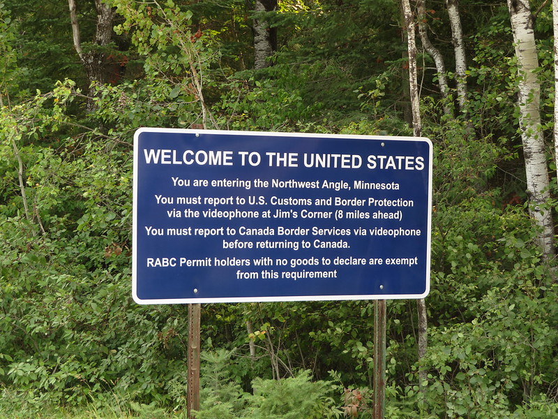
This piece of Minnesota can only be reached by boat, plane, or driving through Canada twice. A surveying error in 1783 created this geographic orphan when diplomats used the wrong map to draw borders.
Residents deal with the logistics of living in America while being surrounded entirely by Canada and water. Getting pizza delivered requires international cooperation.
The school bus crosses the Canadian border four times on a normal day.
Diomede Islands

These two islands sit three miles apart in the Bering Strait. One belongs to Alaska, the other to Russia.
The international date line runs between them, creating a 21-hour time difference despite the short distance.
Residents can see their neighbors across the water, but live almost a full day apart in time. During winter, the strait freezes solid, and walking between countries becomes technically possible—though immigration officials on both sides have strong opinions about unauthorized border crossings on foot.
Cooch Behar Enclaves

Until 2015, this area contained 162 pieces of India completely surrounded by Bangladesh, plus 51 pieces of Bangladesh completely surrounded by India. Some enclaves contained counter-enclaves, creating a geographic puzzle that defied common sense.
Residents lived in one country while being surrounded by another, making trips to their own government offices international expeditions. The situation got resolved through the largest peaceful exchange of territory since World War II, which probably came as a relief to postal workers who’d been trying to figure out mail delivery for decades.
Friendship Bridge

This bridge connecting Brazil and Paraguay divides more than just countries—it splits time zones. Travelers cross from one side to the other and lose or gain an hour depending on which direction they’re headed.
The bridge handles significant commercial traffic between South America’s largest economies. Truck drivers regularly time-travel while hauling cargo, which creates scheduling complications that someone probably should have anticipated when they built the thing.
Hala’ib Triangle

Egypt and Sudan both claim this desert region, but neither country seems particularly motivated to settle the dispute. The triangle sits empty while both governments insist it belongs to them.
The area contains nomadic tribes who probably have more practical claim to the land than either government. They cross borders that exist mainly on paper while following grazing patterns that predate the countries arguing over jurisdiction.
Campione d’Italia
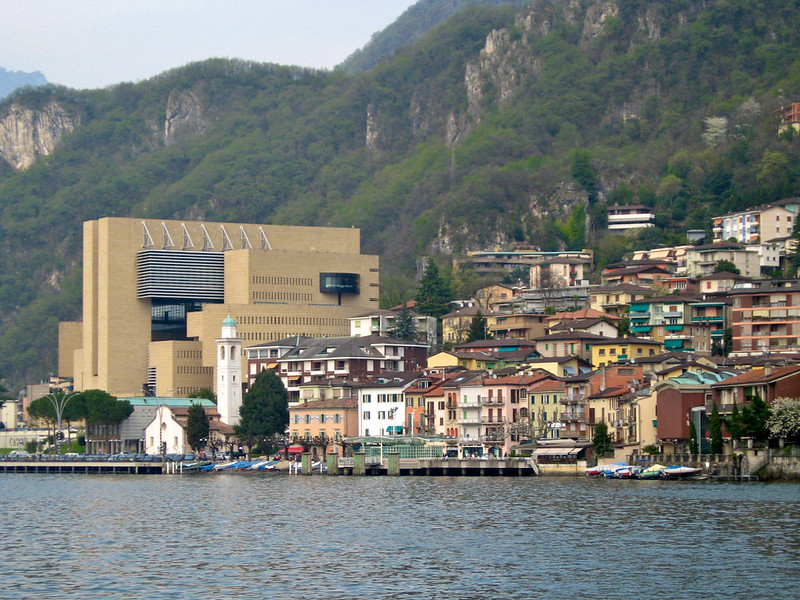
This Italian town sits completely surrounded by Switzerland but uses Swiss currency, postal services, and phone systems. Residents live in Italy while depending on Switzerland for nearly everything practical.
The arrangement creates tax advantages that residents appreciate and complications that everyone else finds bewildering. Travelers need to pass through Swiss customs to reach Italian territory, making every trip to town an international expedition for what should be domestic travel.
Where lines become adventures
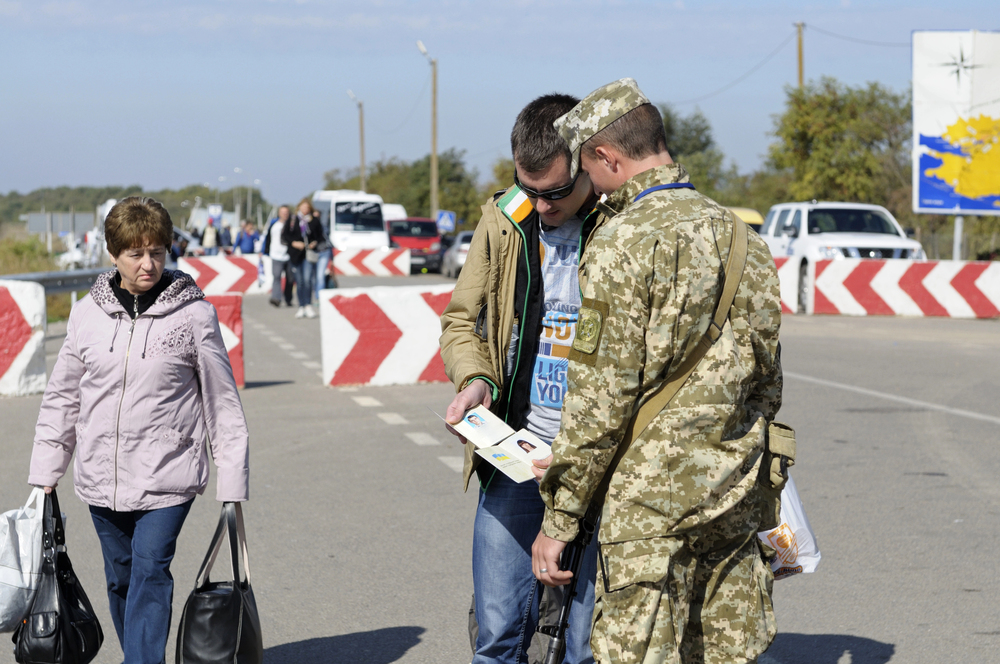
These borders remind us that the world wasn’t designed by committee—it was shaped by accident, compromise, and the occasional surveying mistake that seemed like a good idea at the time. Crossing them requires more than a passport; it demands a willingness to embrace the beautiful absurdity of human geography.
Every stamp in your passport tells a story, but these stamps tell stories that nobody quite intended to write.
More from Travel Pug
- Underrated Italian Towns That Beat the Tourist Crowds
- Las Vegas Tourist Traps to Skip
- Prettiest Towns in Every US State
- 18 passport-free countries for Americans
- Signs Your Cruise Is Not Worth The Cost
Like Travel Pug’s content? Follow us on MSN.