

Islands seem like they should be simple. Water on all sides, clearly defined boundaries, one flag flying over the whole thing.
Yet some of the world’s most peculiar borders wind through islands, creating territorial puzzles that cartographers probably curse under their breath. These aren’t clean lines drawn by treaties — they’re accidents of history, stubborn political compromises, and geographic oddities that somehow stuck around long enough to become permanent.
Cyprus

The island splits right down the middle like a broken dinner plate. The Republic of Cyprus controls the south, while the Turkish Republic of Northern Cyprus claims the north — though most of the world refuses to acknowledge that second part exists.
A United Nations buffer zone cuts between them, complete with peacekeepers and abandoned buildings that have been slowly crumbling since 1974.
The capital city of Nicosia gets the strangest treatment of all. It’s the last divided capital in Europe, with a green line (literally painted green in some places) running through neighborhoods, separating families who used to share Sunday dinners.
Hispaniola

Haiti and the Dominican Republic couldn’t be more different if they tried, and sometimes it feels like they are trying. The western third speaks French and Creole, while the eastern two-thirds speaks Spanish.
The border between them tells the story of colonial powers who never quite figured out how to share.
The contrast hits you immediately at the border crossings. The Haitian side often appears dustier, more crowded, with different currencies and different languages floating through the air.
Cross the line, and the road conditions change, the architecture shifts, even the music sounds different. It’s like stepping between two different worlds that happen to share the same piece of land.
Ireland

The border between Ireland and Northern Ireland refuses to behave sensibly. It winds through the middle of towns, cuts across farms, and occasionally runs right through people’s houses — meaning some residents technically live in two countries at once, depending on which room they’re standing in.
The border exists because history got complicated: when Ireland gained independence in 1922, six northern counties opted to stay with Britain. So now you have the Republic of Ireland (independent) sharing the island with Northern Ireland (part of the United Kingdom), creating a situation that’s been alternately tense, peaceful, and politically exhausting for a century.
Brexit made it even more interesting, turning what had become an invisible line back into something people actually have to think about.
Borneo
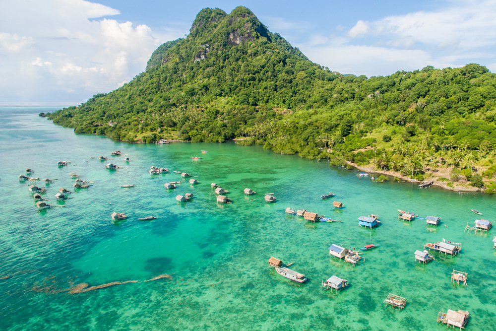
Three countries carve up this massive island like they’re sharing an enormous pizza that nobody can quite agree on how to slice. Malaysia gets the northern sections of Sabah and Sarawak, Brunei wedges itself into a tiny slice along the coast, and Indonesia claims the southern bulk called Kalimantan.
Brunei creates the weirdest situation. It’s split into two separate pieces, with Malaysian territory sitting between them like filling in a sandwich.
Getting from one part of Brunei to the other means crossing through Malaysia, which turns a simple domestic trip into an international journey requiring passports and border formalities.
New Guinea
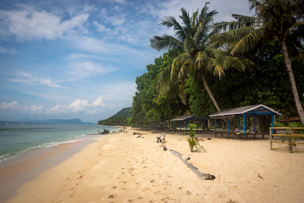
The eastern half belongs to Papua New Guinea, while the western half — called West Papua or Papua — belongs to Indonesia. The border runs roughly down the middle, though “roughly” is used loosely here since the line was drawn by people who had never actually walked through those mountains and jungles.
This split happened because different colonial powers claimed different ends of the island, and when independence movements started up, they moved at different speeds. Papua New Guinea broke away from Australia in 1975, while the western side had already been absorbed into Indonesia decades earlier.
The cultural differences across this border run deep — different languages, different governments, different relationships with the outside world.
Tierra del Fuego
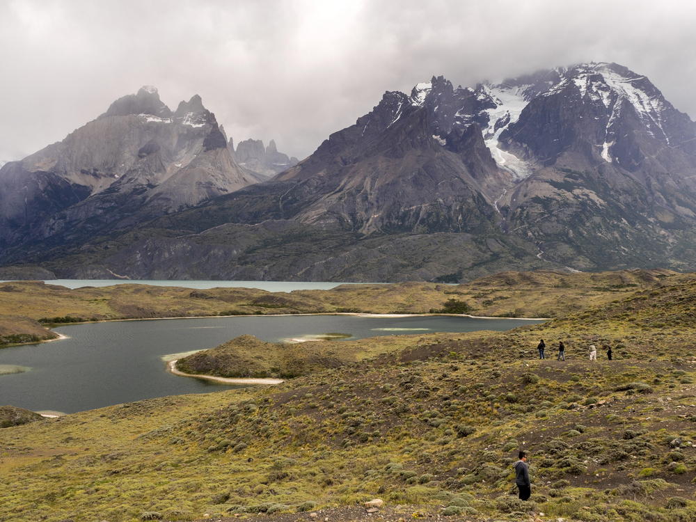
At the bottom of South America, this island gets split between Chile and Argentina in a way that actually makes some geographic sense, which is refreshing after all the arbitrary lines drawn elsewhere. Chile takes the western and southern portions, while Argentina gets the eastern chunk, including the city of Ushuaia that likes to call itself the southernmost city in the world.
The border follows natural features — rivers, mountain ranges — rather than straight lines drawn on maps by people who had never seen the place. Both countries seem reasonably content with this arrangement, probably because there’s enough wind and cold down there to keep anyone from getting too worked up about territorial disputes.
Saint Martin/Sint Maarten
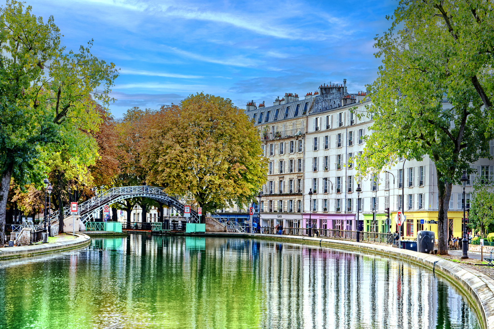
This tiny Caribbean island managed to get itself split between France and the Netherlands, creating the smallest international border in the world at just 6.2 miles long. The French side calls itself Saint Martin, while the Dutch side goes by Sint Maarten, and somehow both sides have made this arrangement work for over 350 years.
Legend claims the border got drawn when a Frenchman and a Dutchman started walking in opposite directions from the same point, with each country getting the territory their representative could cover in a day. The Frenchman supposedly walked faster (or the Dutchman got distracted by rum), giving France the larger portion.
Whether that story is true hardly matters — it’s the kind of tale that perfectly captures the casual absurdity of the whole situation.
Usedom
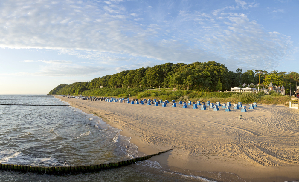
Germany and Poland split this Baltic Sea island like neighbors sharing a backyard, with Germany getting the western two-thirds and Poland claiming the eastern portion. The border runs straight through the resort town of Świnoujście/Swinemünde, where you can literally walk from one country to another while getting lunch.
During the Cold War, this border meant something serious — families separated, guards watching, the whole tense standoff between East and West playing out on a beach resort island. These days, the crossing is so casual that tourists often wander back and forth without realizing they’re international travelers.
The only real difference is which currency the ice cream vendors prefer.
Timor

East Timor (Timor-Leste) occupies the eastern half of this island, while West Timor belongs to Indonesia. But East Timor also gets an exclave called Oecusse-Ambeno on the northwestern coast, completely surrounded by Indonesian territory, just to make things interesting.
The split reflects colonial history — Portugal controlled the eastern portions while the Dutch claimed the west. When Indonesia gained independence, it eventually absorbed West Timor, but East Timor’s path to independence took much longer and involved considerably more conflict.
Getting from the main part of East Timor to Oecusse-Ambeno requires crossing through Indonesia, making domestic travel an international affair.
Märket
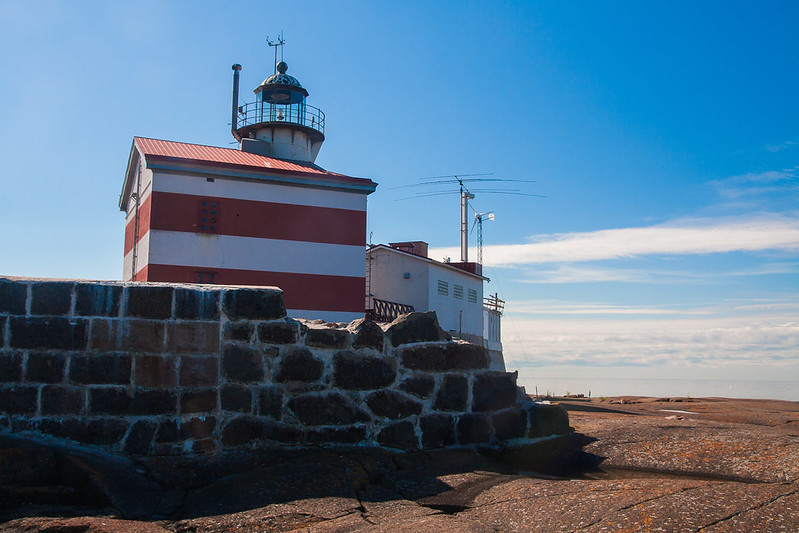
This tiny rock in the Baltic Sea between Sweden and Finland hosts one of the world’s most bureaucratically ridiculous borders. The island is so small you can walk across it in a few minutes, but the international boundary is in an irregular zigzag pattern, all because someone built a lighthouse on the wrong side of the original border.
When Finland built the lighthouse in 1885, they accidentally placed it on the Swedish side of the island. Rather than move the lighthouse or accept that Sweden now owned it, diplomats spent decades drawing increasingly complicated border adjustments to ensure the lighthouse ended up on Finnish soil.
The result is a border that makes several sharp turns just to accommodate one building on an island that barely qualifies as land.
Market Reef

This barely-above-water rock pile between Finland and Sweden manages to support its own amateur radio station, which may be the most optimistic use of questionable real estate in the Baltic Sea. The reef is so small and so frequently underwater that calling it an island requires generous interpretation, but Finland claims it anyway.
Sweden doesn’t particularly contest this claim, probably because owning a semi-submerged rock that disappears during storms isn’t worth diplomatic effort. The main residents are seabirds and the occasional ham radio enthusiasts who show up to broadcast from one of the world’s most precarious sovereign territories.
It’s the kind of place that exists mainly to give geographers something to argue about.
Hans Island
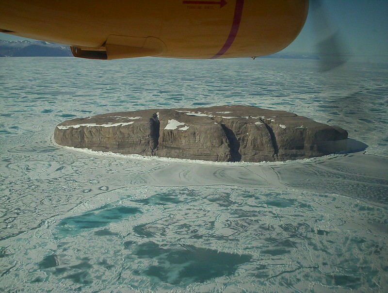
Canada and Denmark spent decades in the world’s most polite territorial dispute over this uninhabited Arctic rock between Greenland and Ellesmere Island. The “Whisky War” involved each country’s officials periodically visiting the island to plant their flag and leave a bottle of their national liquor — Canadian whisky or Danish schnapps — for the other side to find.
In 2022, they finally decided to split the island down the middle, creating a land border between Canada and Denmark. The agreement ended one of the friendliest international disputes in modern history, though it also eliminated one of geography’s most charming footnotes.
Both countries can now claim they settled their differences through decades of competitive gift-giving.
When geography meets politics

Islands with multiple nations reveal something stubborn about human nature. Water should simplify things — natural boundaries, clear edges, obvious divisions.
Instead, these places become laboratories for the strange compromises that happen when political ambition meets geographic reality. Some of these borders work smoothly, others create decades of diplomatic headaches, and a few exist mainly to give mapmakers job security.
But they all prove that even surrounded by water, humans will find ways to make simple things complicated.
More from Travel Pug
- Underrated Italian Towns That Beat the Tourist Crowds
- Las Vegas Tourist Traps to Skip
- Prettiest Towns in Every US State
- 18 passport-free countries for Americans
- Signs Your Cruise Is Not Worth The Cost
Like Travel Pug’s content? Follow us on MSN.